2024 World Cruise, Cruising, Travelogues

Leg 8: Africa

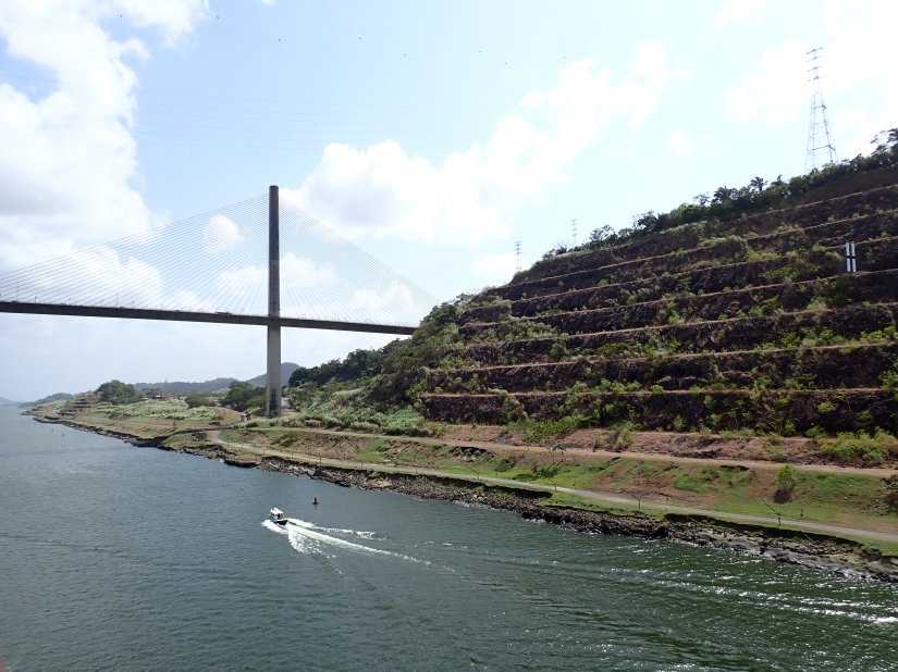
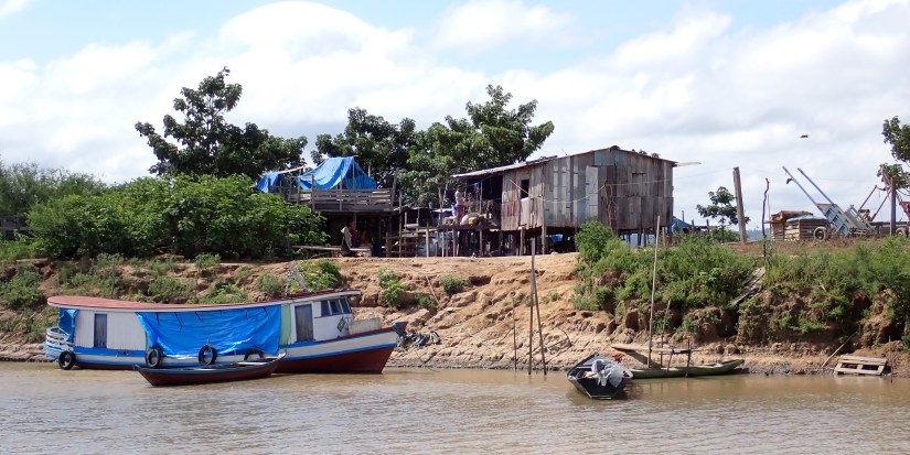
The Red Sea disruption has rerouted the flow of worlds maritime traffic around South Africa, and Zuiderdam joins the ranks.  Cargo, tankers, supply ships of every kind; it’s become a crowded route, and ports have become hectic.  And each one seems to be vying for precious space on docks and within harbors.  In the realm of passenger vessels alone, some ports we’ve visited stated they normally receive only 5 cruise ships a month, but now are receiving 30.  It’s provided an unexpected financial boom for locals.

The original itinerary was to cruise The Mediterranean via the Red Sea. However, the revised itinerary naturally takes us around South Africa.

Our revised route brings us back to a few African ports from last year’s cruise. For reference, I covered some interesting background to this vast country in a previous post, which can be viewed here: https://lifeinnauticalmiles.com/2023/04/20/2023-m-s-zuiderdam-leg-6-africa/

Our scheduled ports as we round South Africa and The Cape of Good Hope

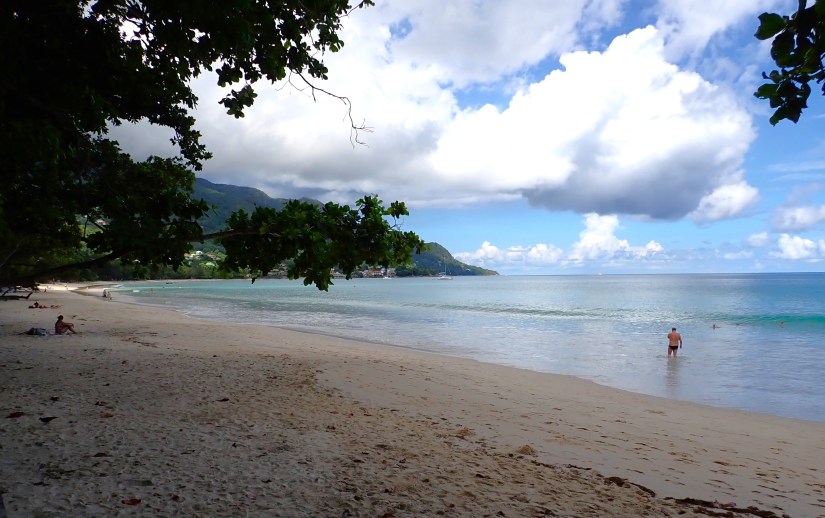
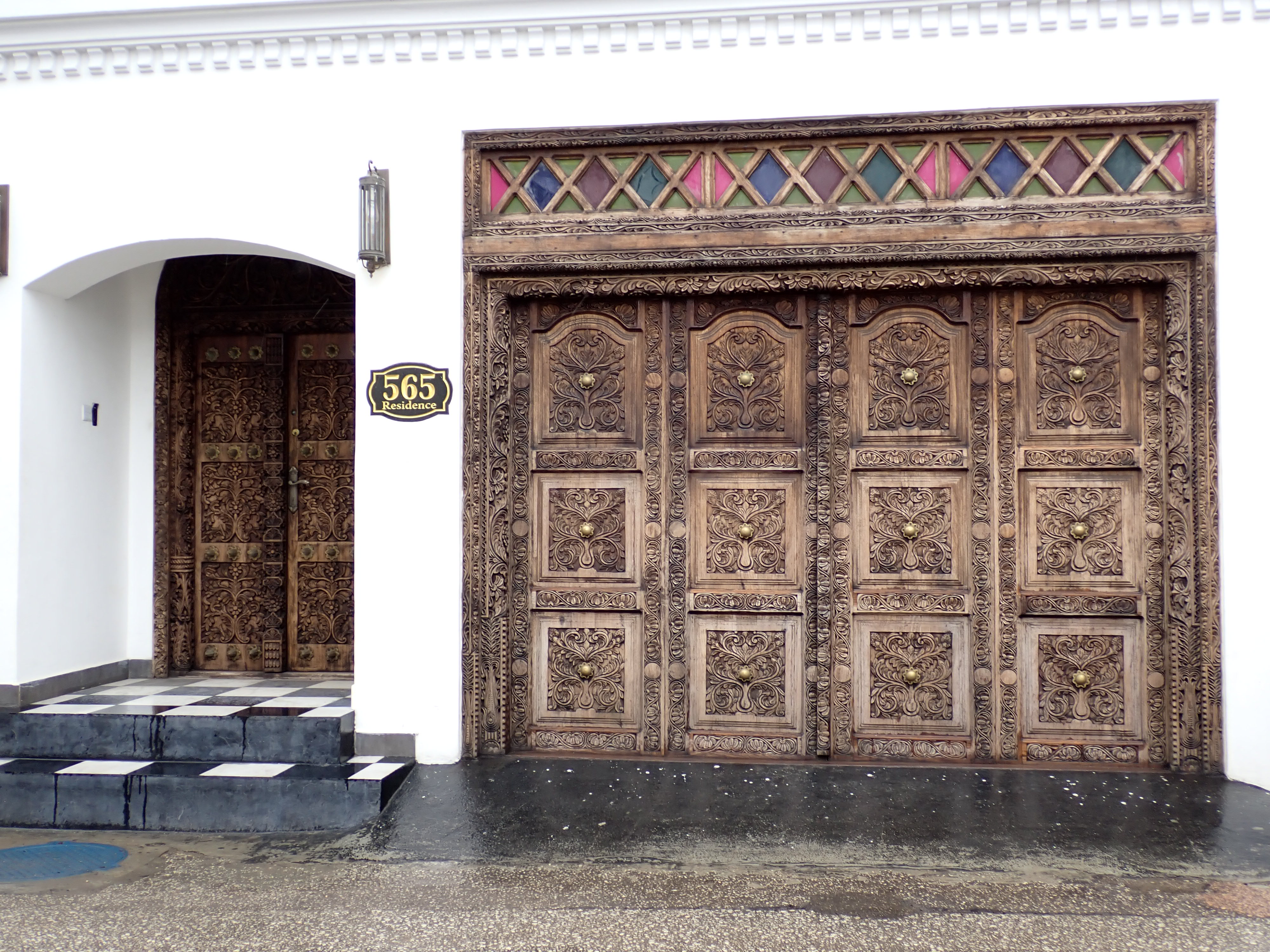
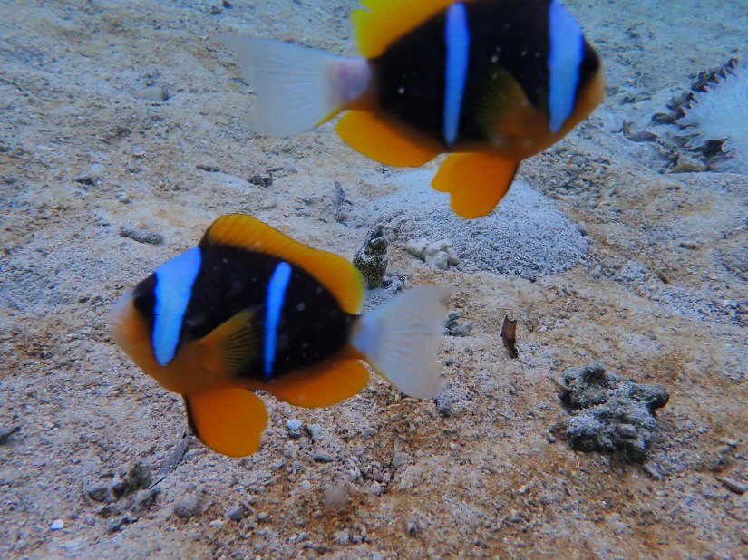
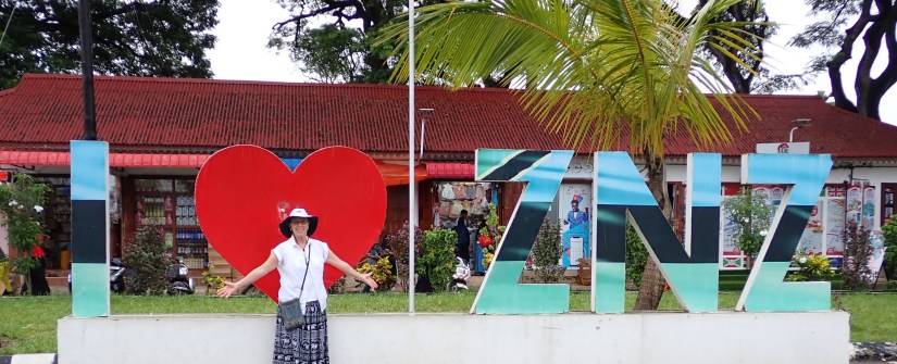
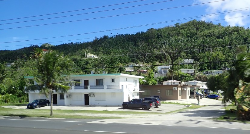
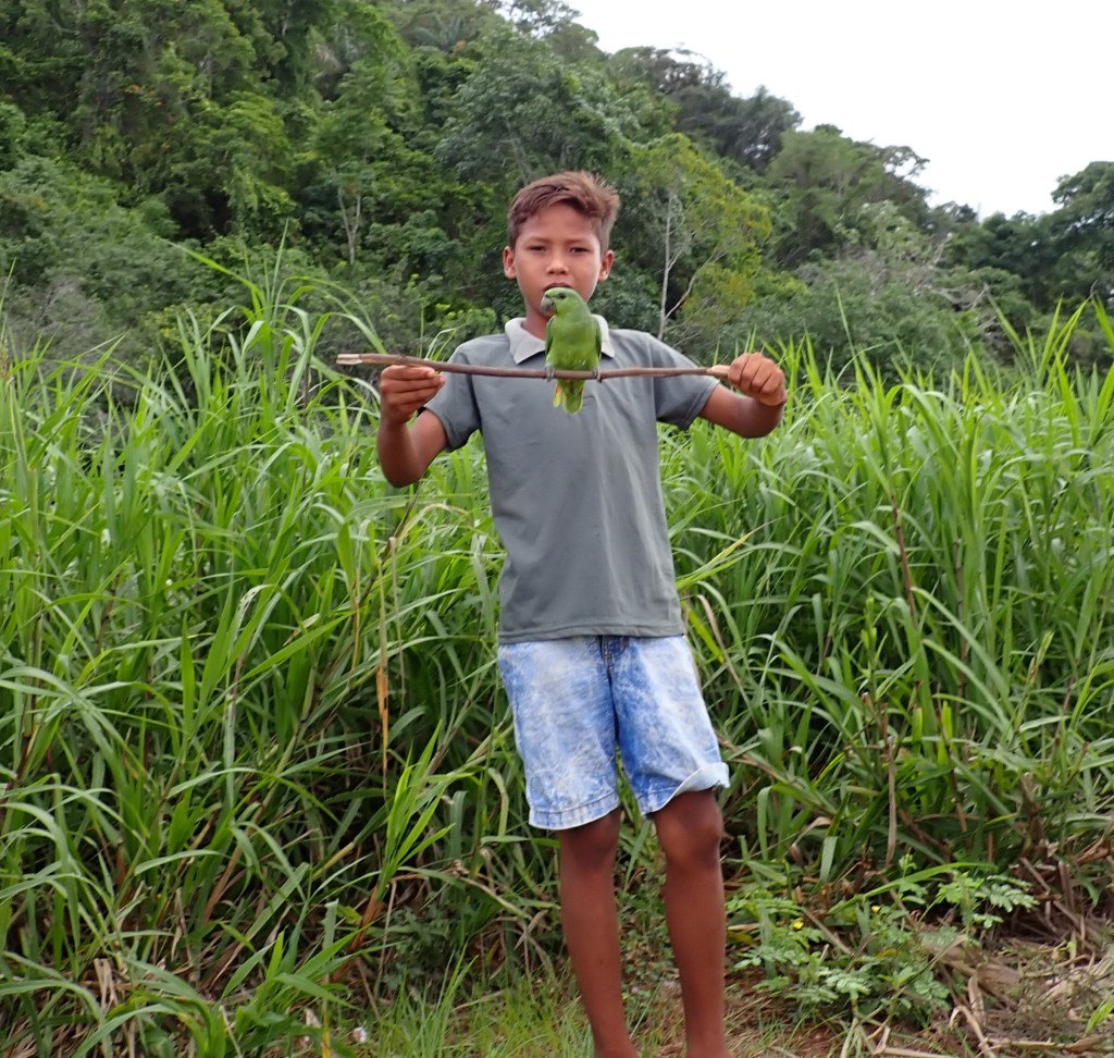
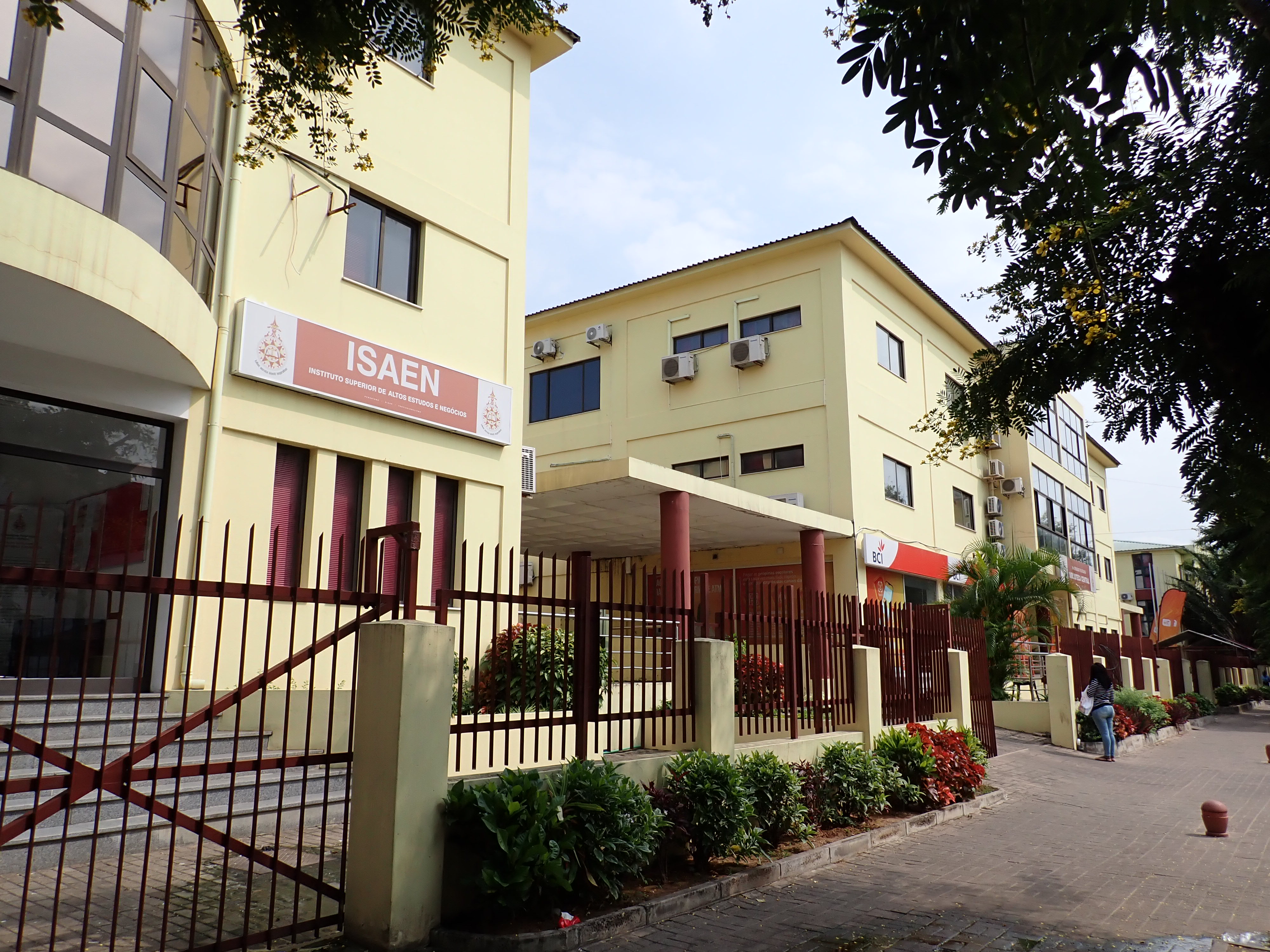
When revisiting any destination, it’s fun to seek out new places and experiences.  And Africa offers many!    We departed Zanzibar 3 sea days and 1,405 nautical miles ago and have made our way south along the eastern coast, where we will revisit Maputo, Mozambique.

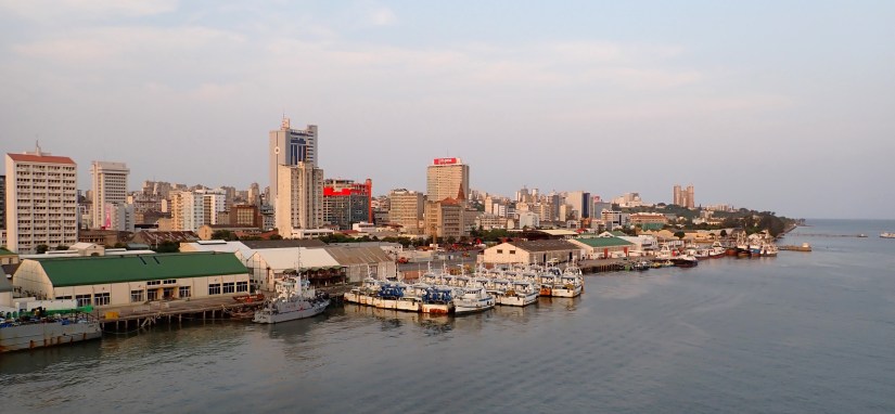
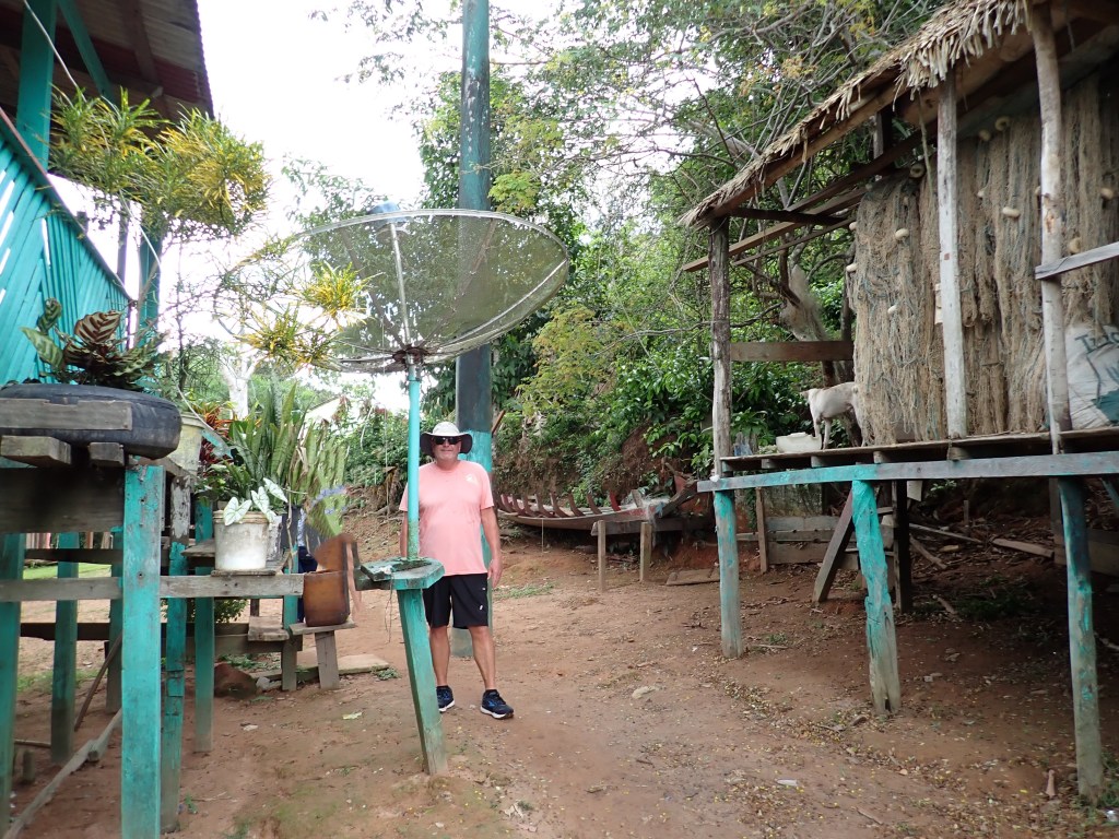
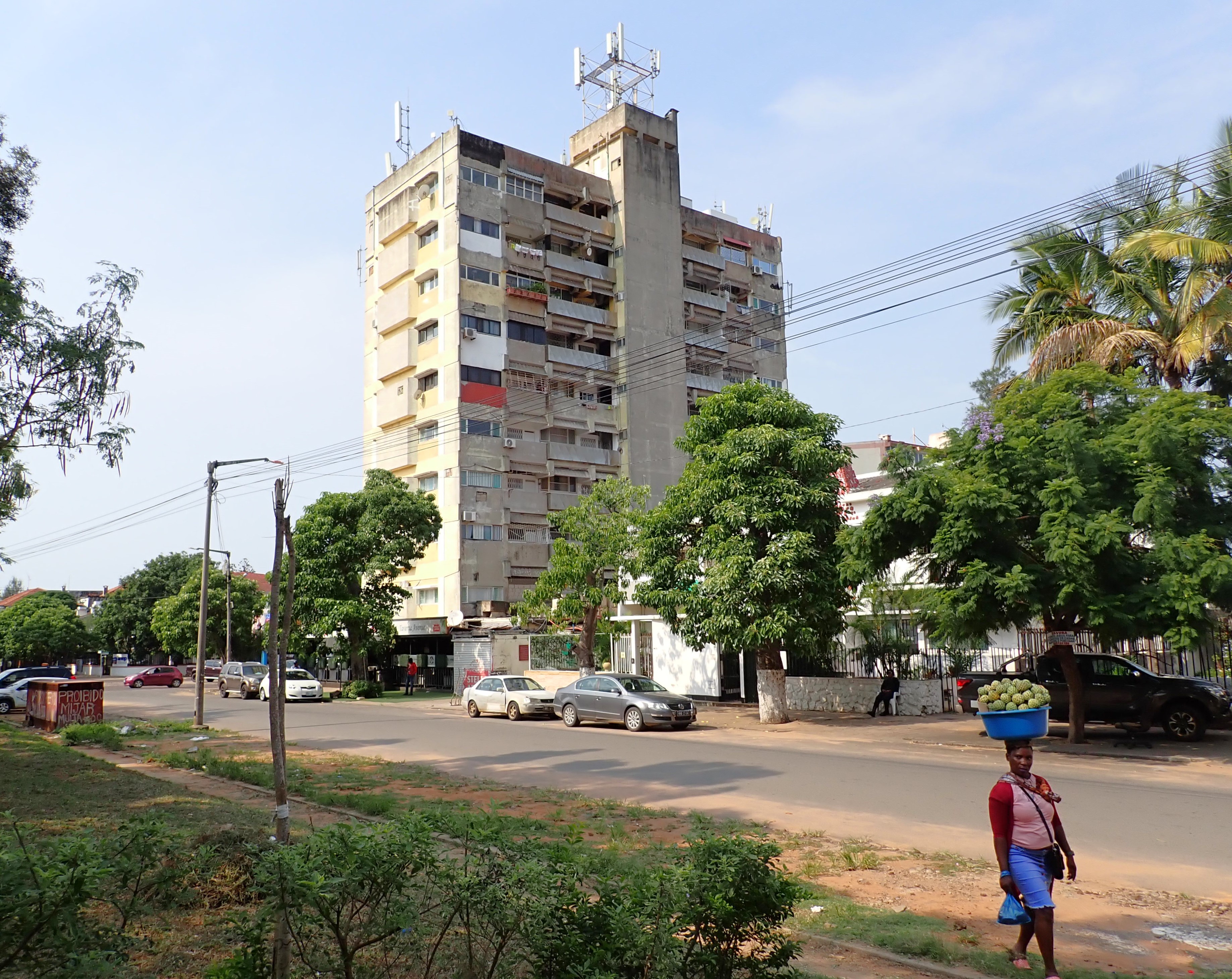
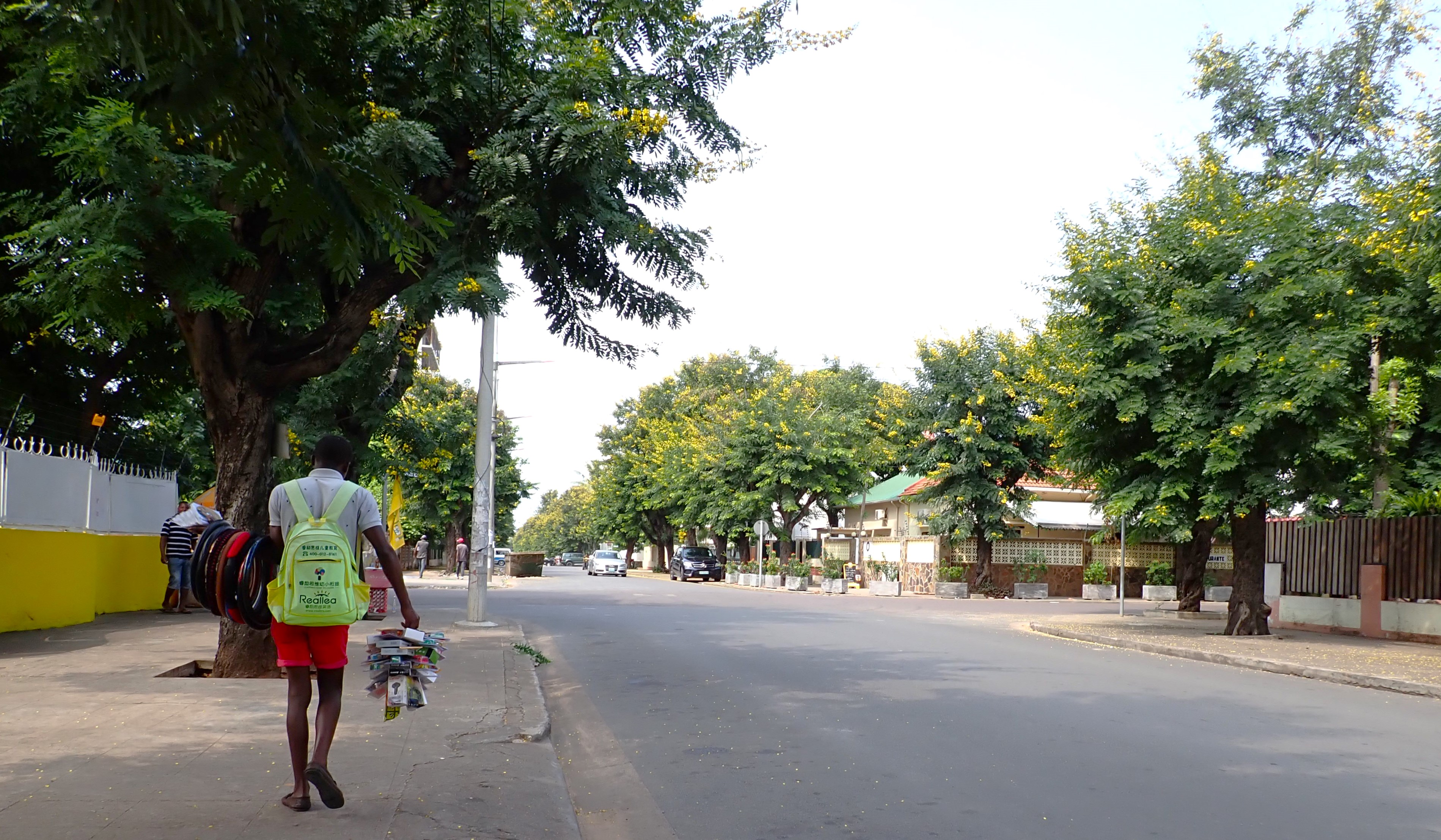
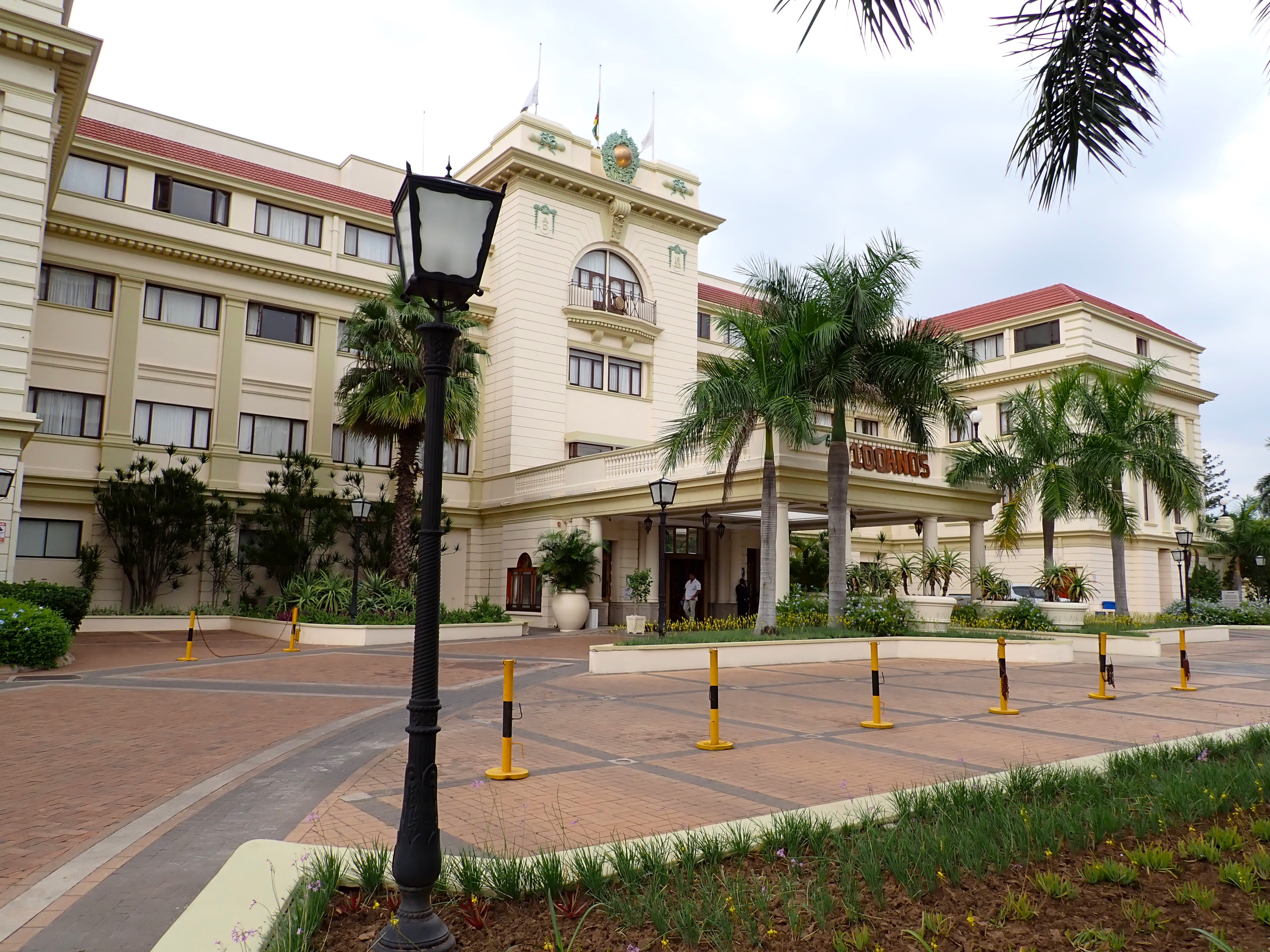
Last year, we spent our time exploring the gritty downtown of this bustling harbor city.  This time, we wandered over to where the hospital, a compact university campus and the Serena Hotel reside amongst shaded residential streets and broad commerce avenues. 

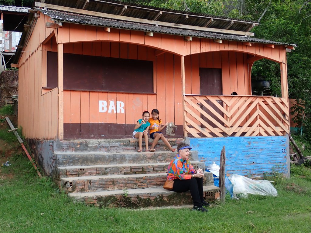
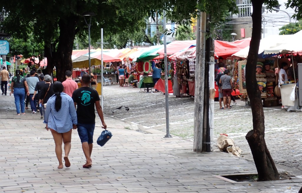
Our stroll came to an end at the FEIMA market within a pleasant park and children’s playground. 

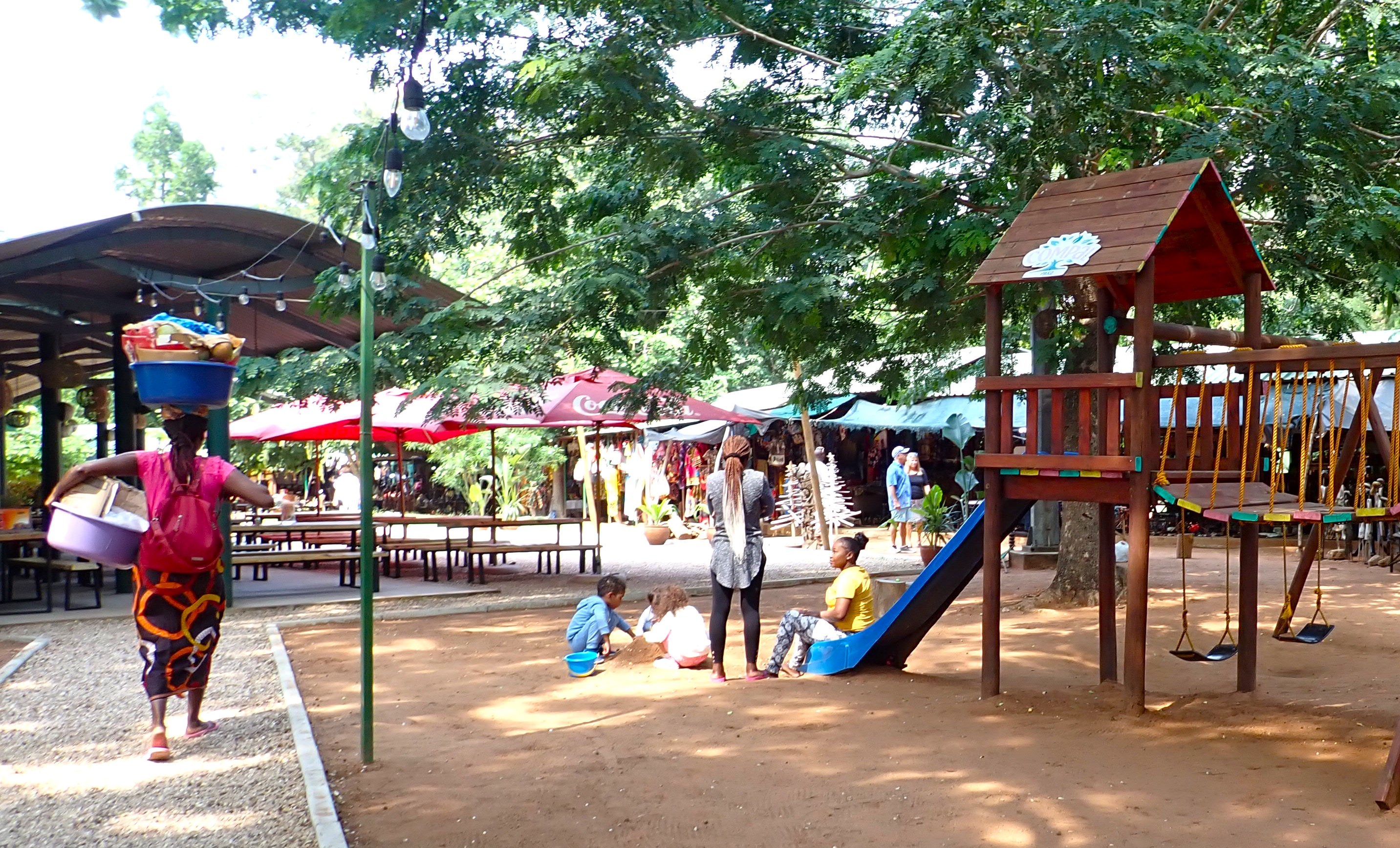
Vendors creatively display their handicrafts and artwork, and there were several outdoor cafes.  We enjoyed the peaceful atmosphere and snacked on pizza and beer beneath the trees.     

Good night, Maputo!

Another 335 nautical miles in her wake, Zuiderdam pulls alongside the newly completed Nelson Mandela Cruise Terminal in Durban.  At a cost of $16 million, it is their pride and joy. 

The orange-clad Nelson Mandela Cruise Terminal just opened a few months prior to our arrival.

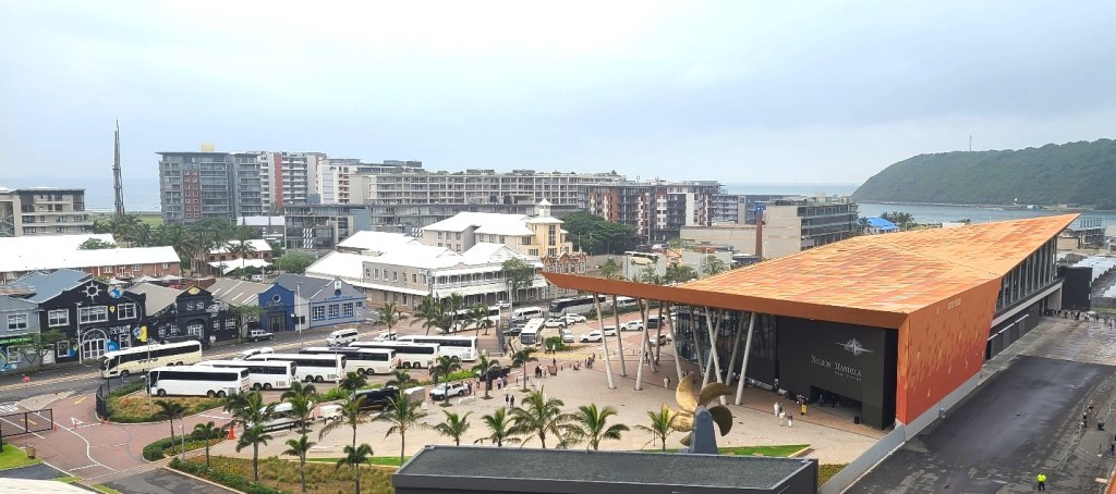
It’s our second visit to this coastal city, so we were curious to see what lies beyond this time around.  We are soon on our way inland, towards a private game reserve for a half-day bush drive.

Urban areas gave way to green sugar cane fields, and where eucalyptus and bamboo stands mixed with hardwoods and pine trees.  The modern highway led us through a scenic area known as Thousand Hills, and through the lush Giba Gorge, until we reached the rolling grasslands.

Along the way, our Zulu guide shares some interesting background of her life here, where the tribal culture is family first.  Whoever the breadwinner of the family is, also supports parents who no longer work.  Within the villages, Zulu men can marry as many wives as they wish depending on how much money and many cows he has.  Each wife will cost him 11 cows.  Marriage proposals may begin as early as 15yrs old.  Weddings can last over 3 days, with 500 people in attendance. Brides to-be go through training on how to speak, dress, act when married.  In a Zulu man’s eyes, respect equals love.

Food is reasonably priced in South Africa.  The area is plentiful with crop farms like sugarcane, macadamia nuts, banana, citrus, avocado, beets, beans, carrots, peppers and potatoes.  Livestock too, including massive chicken farms.

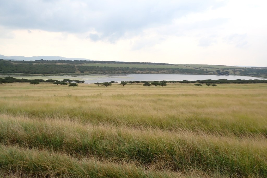
It may have only been an hour’s drive from Durban, but we feel a million miles away as we pull into the Tala Private Game Reserve, a 7500-acre wildlife conservancy located in the KwaZulu-Natal Hills. http://www.tala.co.za/conservation

It’s an overcast, mid 70-degree day; perfect for a game drive.   We meet our tracker, board a 16-person open-air safari vehicle and head into the bush.   

We pass through thickets of indigenous acacia that alternate with vast grasslands and an occasional oasis of wetland.  As our vehicle bounces through densely wooded narrow lanes, we are careful to dodge branches whipping inside as we go by.  The fragrance of the bruised wild sage surrounds us. 

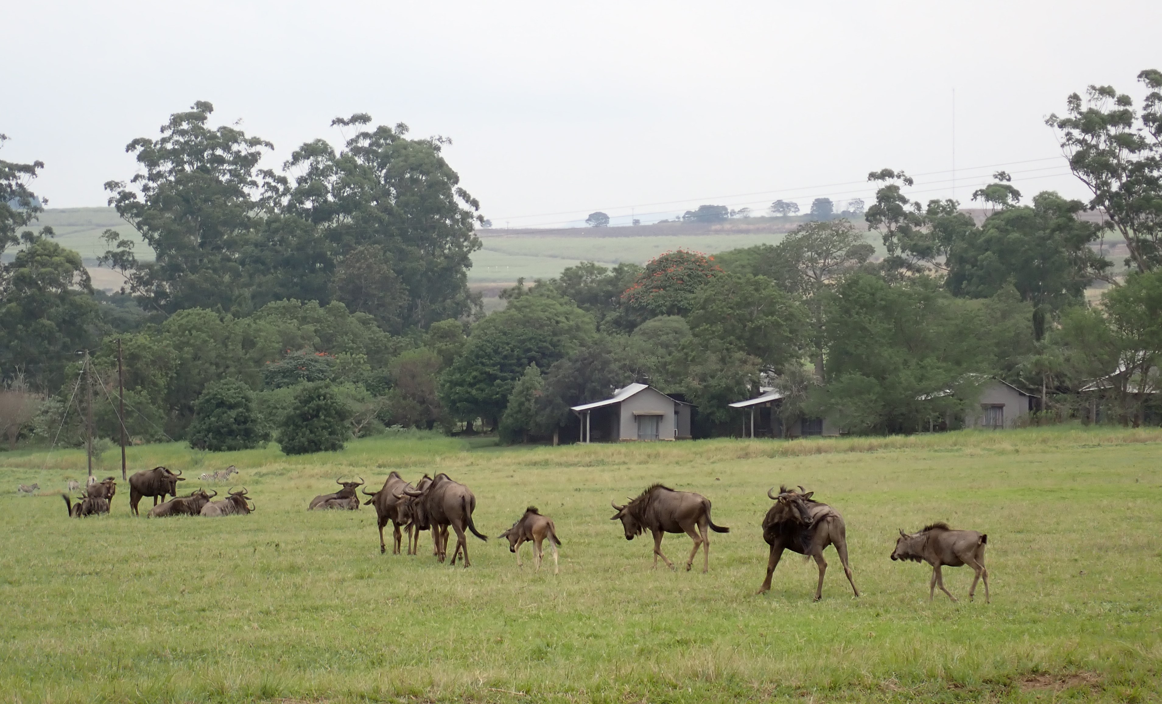
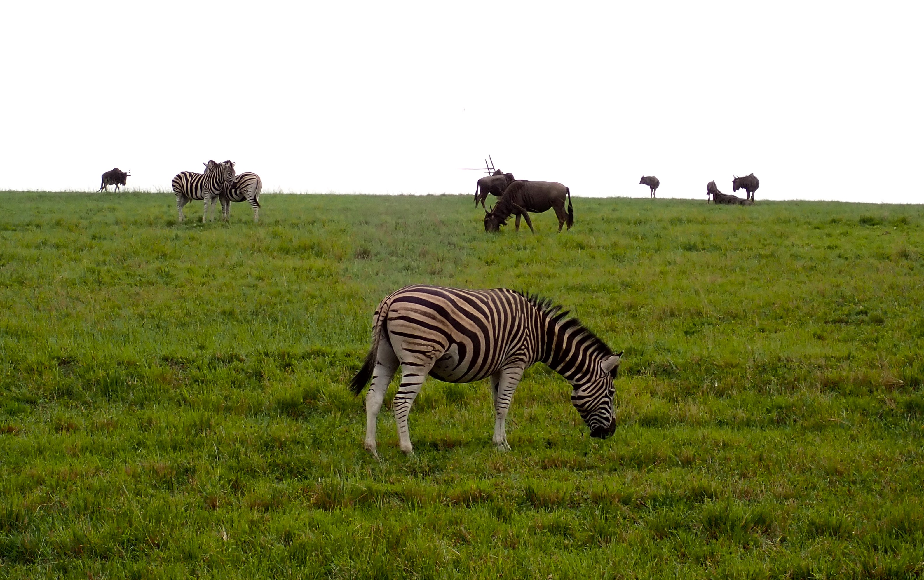
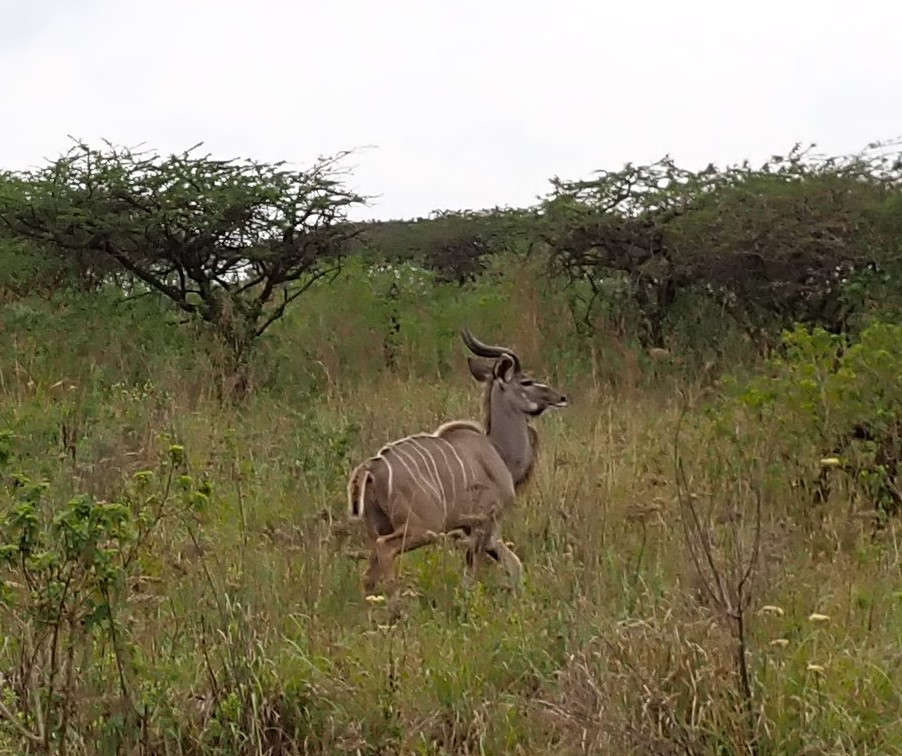
In the grasslands, we found grazing kudu, impala, nyala, wildebeest, zebras and ostrich.  Among the dense thickets, we spied a few monkeys.  Near the water oasis, flocks of African geese, ducks, cormorant and even a pair of eagles.  

As we came around a hidden corner, we were awed by the 8-9 giraffes in the clearing.  We learned that a group of giraffes may be referred to as a “journey” or “tower” of giraffes. 

But our most exciting find was a mother rhino and her 8-day old baby, grazing by themselves!    

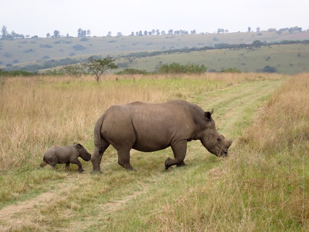
Later, we came upon the rest of the rhino herd who sauntered only a few feet from our vehicle.  So close that we could hear them tearing and chewing their mouthfuls of grass. 

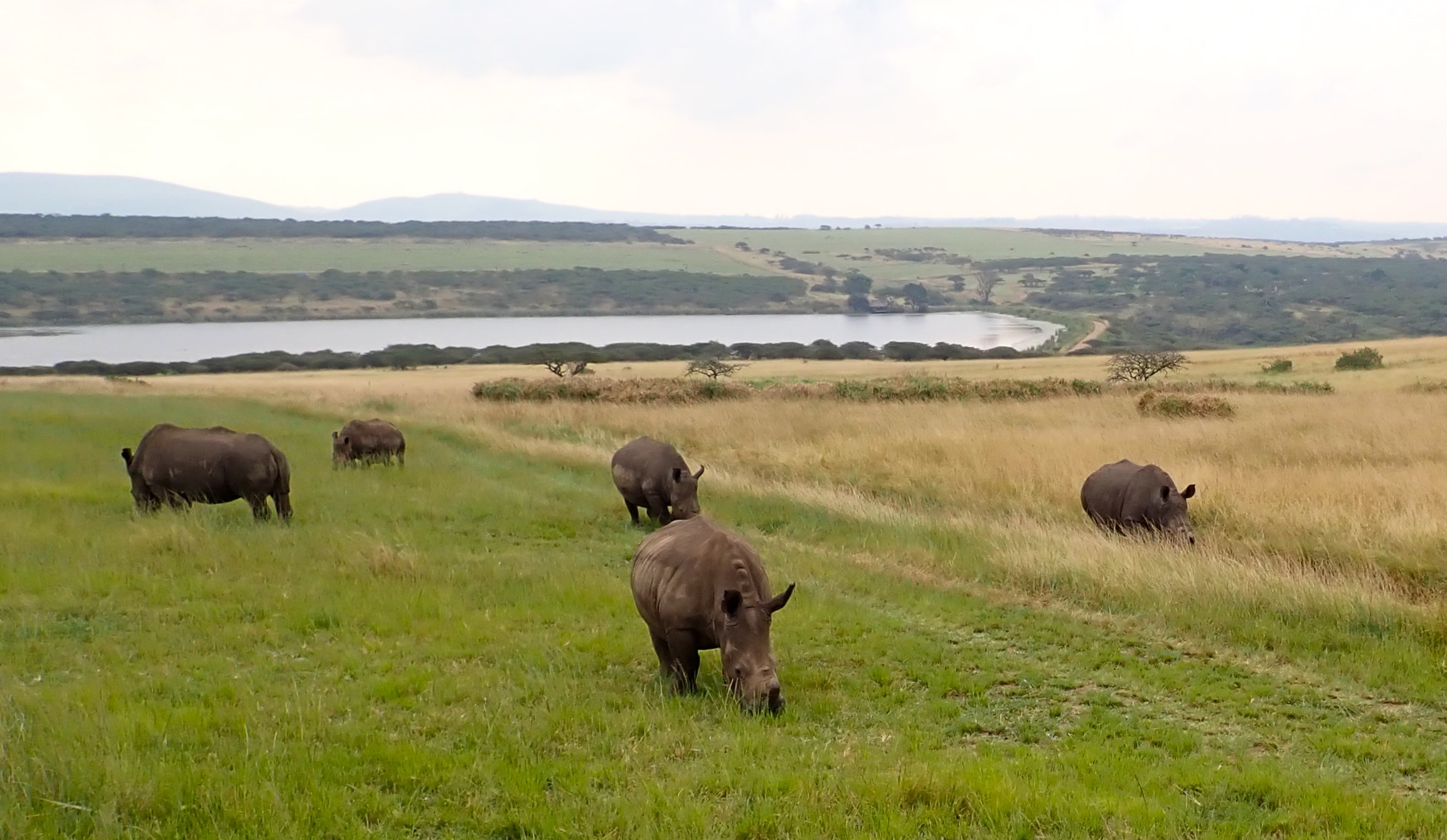
Seeing (hearing and smelling!) all these magnificent animals in their natural environment was an exciting experience we’ll never forget! 

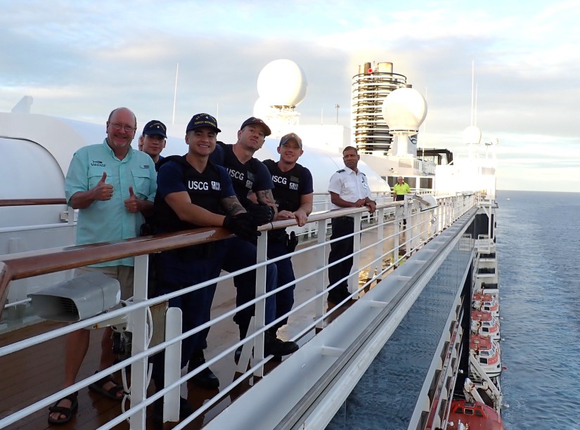
We returned to Durban in time for Zuiderdam’s late afternoon, but non-typical departure. I’ll explain. It is often compulsory by local harbor authorities that a ship have one of their local pilots aboard to assist in local knowledge and navigation.   Time and time again in various ports, we watch as a small pilot boat pulls alongside the shadow of our great hull.  Then the single and brave pilot appears and steadies himself on his tiny deck, calculating the right time to make his precarious leap, grabbing a feeble looking ladder and scrambling up and into Zuiderdam’s side cargo door before being escorted to the ships bridge. 

But Durban’s port has limited protection from often tumultuous seas, which are no match for a small pilot boat.  Their solution to this problem is that the pilot is flown to the ship by helicopter and lowered by cable onto our aft deck.  (Que the “Mission Impossible” music!)  

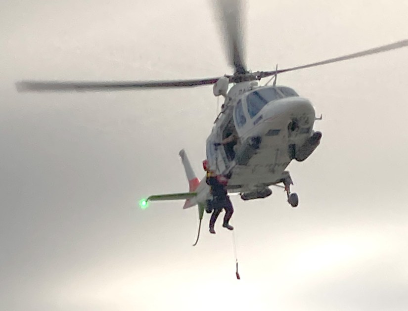
Naturally, most passengers were still asleep at 4am during the arrival procedure. However, the departure procedure provided some thrill to the Sail-Away and much excited chatter over Happy Hour!   

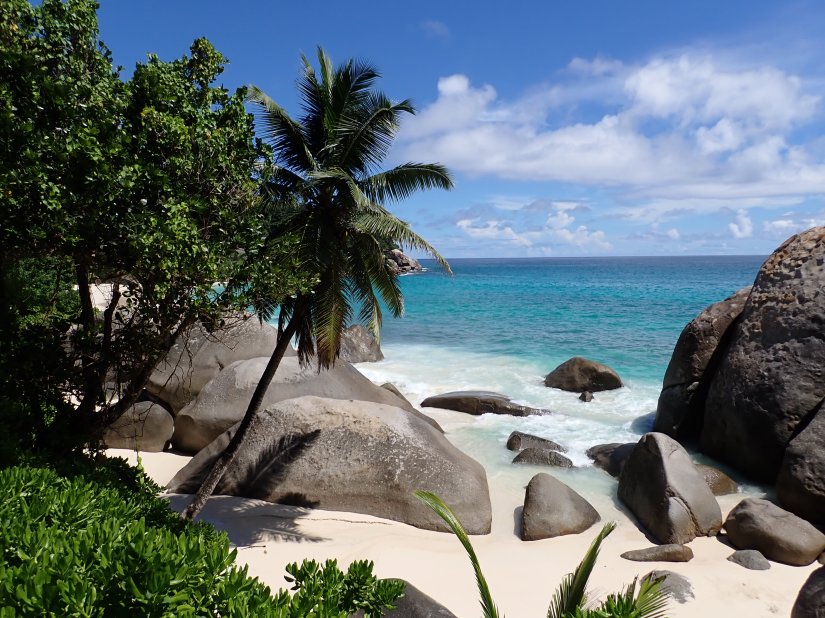
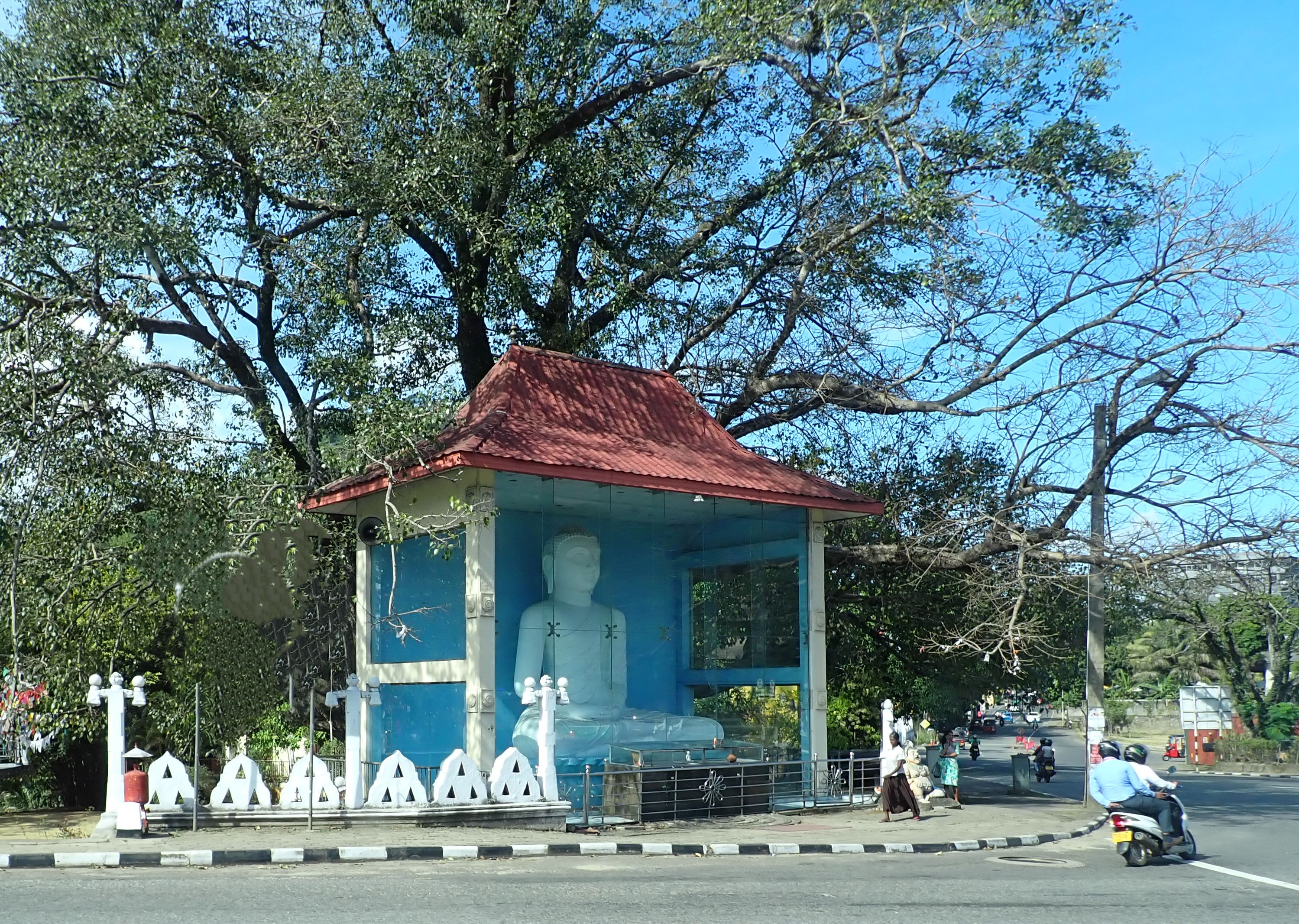
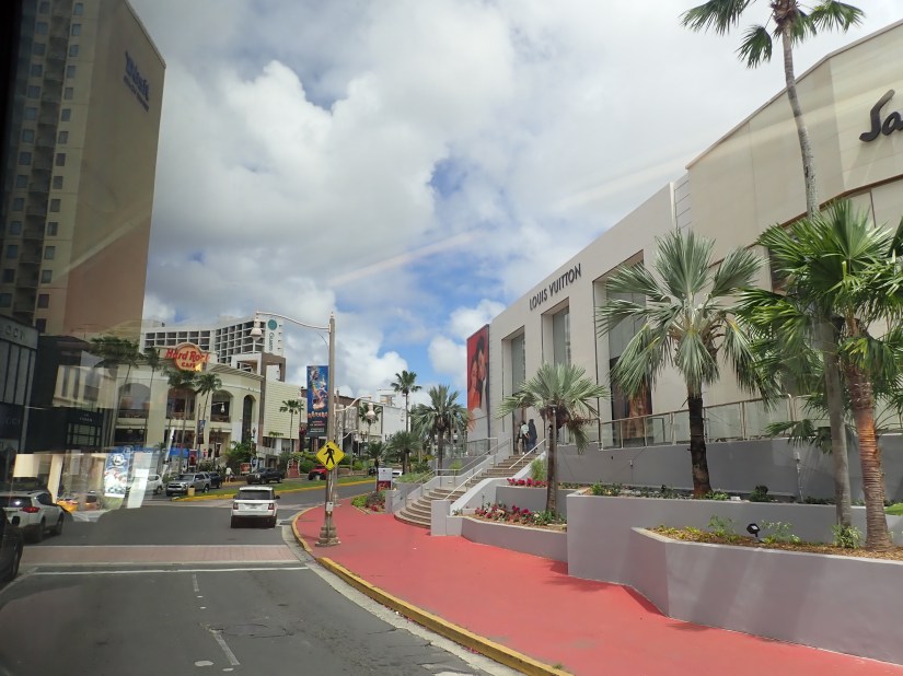
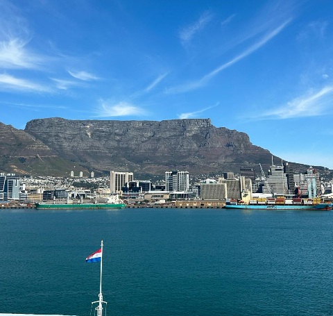
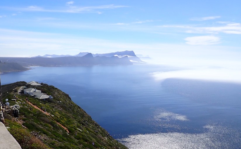
Onwards to Cape Town, South Africa, where we are lucky to be spending three days to explore!   It’s the oldest city in South Africa and therefore known as the mother city, with a population of 5.4 million in 9 provinces, with 11 languages spoken.  It’s also said to be one of the most beautiful ports to sail into, with stunning Table Mountain to guide you. That is, if you could see more than 100 feet past the bow or stern!  

The Fog

A dense fog had closed the harbor to any traffic and delayed our arrival by several hours. Being autumn here, the cold air meets the warm surface water overnight and results in this commonplace occurrence.   Once the fog lifted, we eventually docked by 1pm.    

Table Mountain finally comes into view once the fog lifted.

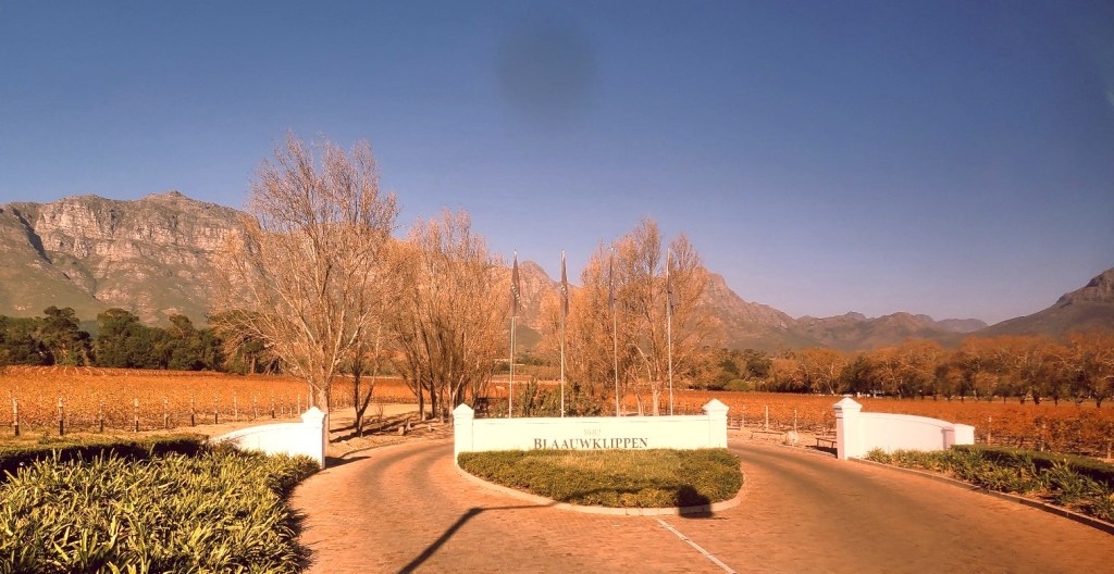
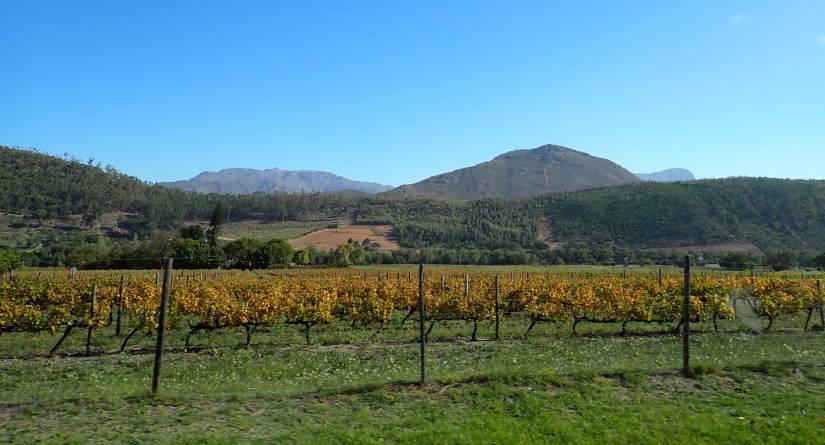
Aside from Table Mountain and the Cape of Good Hope, South Africa is also known for its world-class vineyards.  Wine is big business here: 16 wine regions and 6,400 wine farms, most which are found in the Cape Province in its fertile valley of the Eerste River.  Their Fall harvesting is accomplished between February through April.  So, our timing couldn’t be better to learn more about their varietals! 

The Simon Mountains in the winelands.

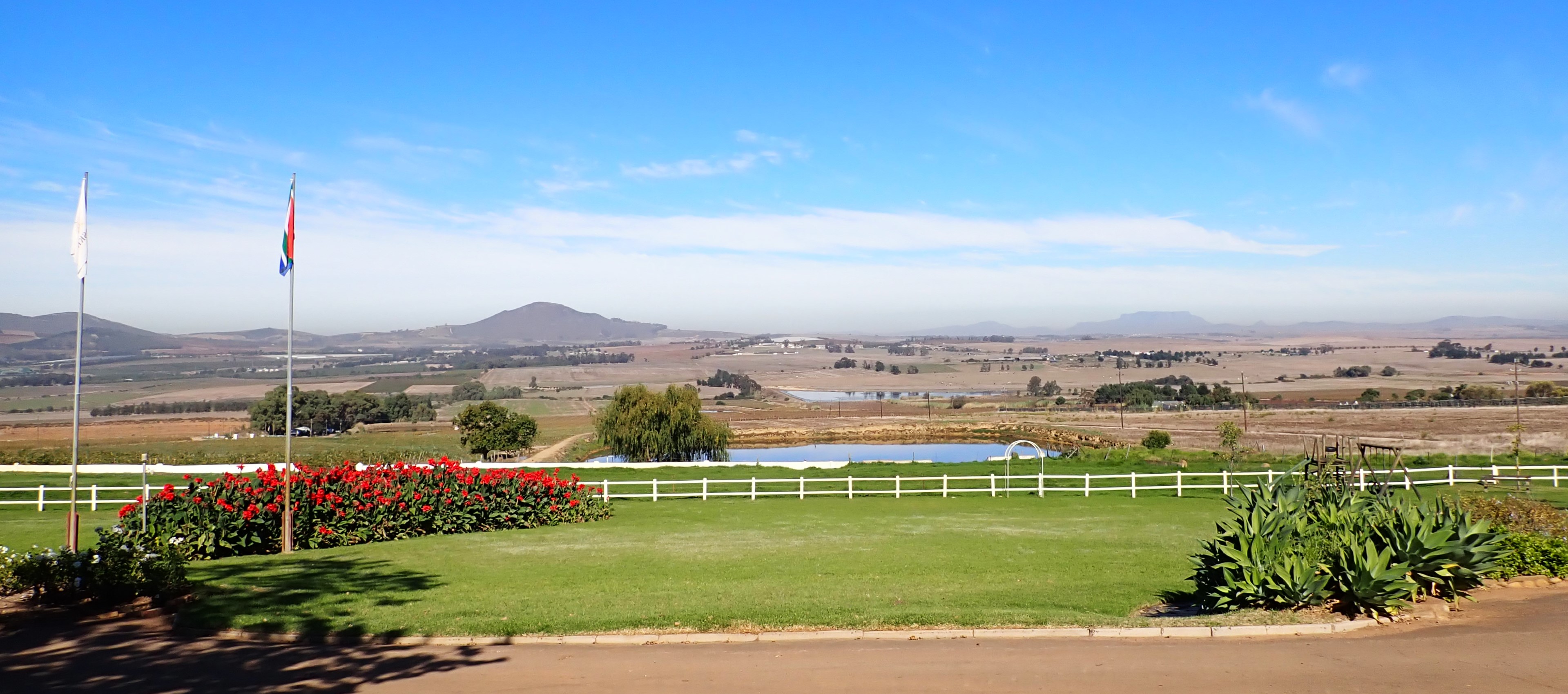
A 31-mile drive brings us to the charming town of Stellenbosch, founded in 1680.  The Dutch-style architecture gives this university town a storybook appearance, with its oak-shaded streets lined with quaint art galleries, coffee shops, restaurants, wine bars and boutiques.

The abundance of oaks here are the result of founder Mr. Stellen, who encouraged citizens to plant the trees, intending them for oak barrels.  Unfortunately, this climate produced trees with porous and brittle wood; inadequate to contain wine. 

Stellenbosch Church

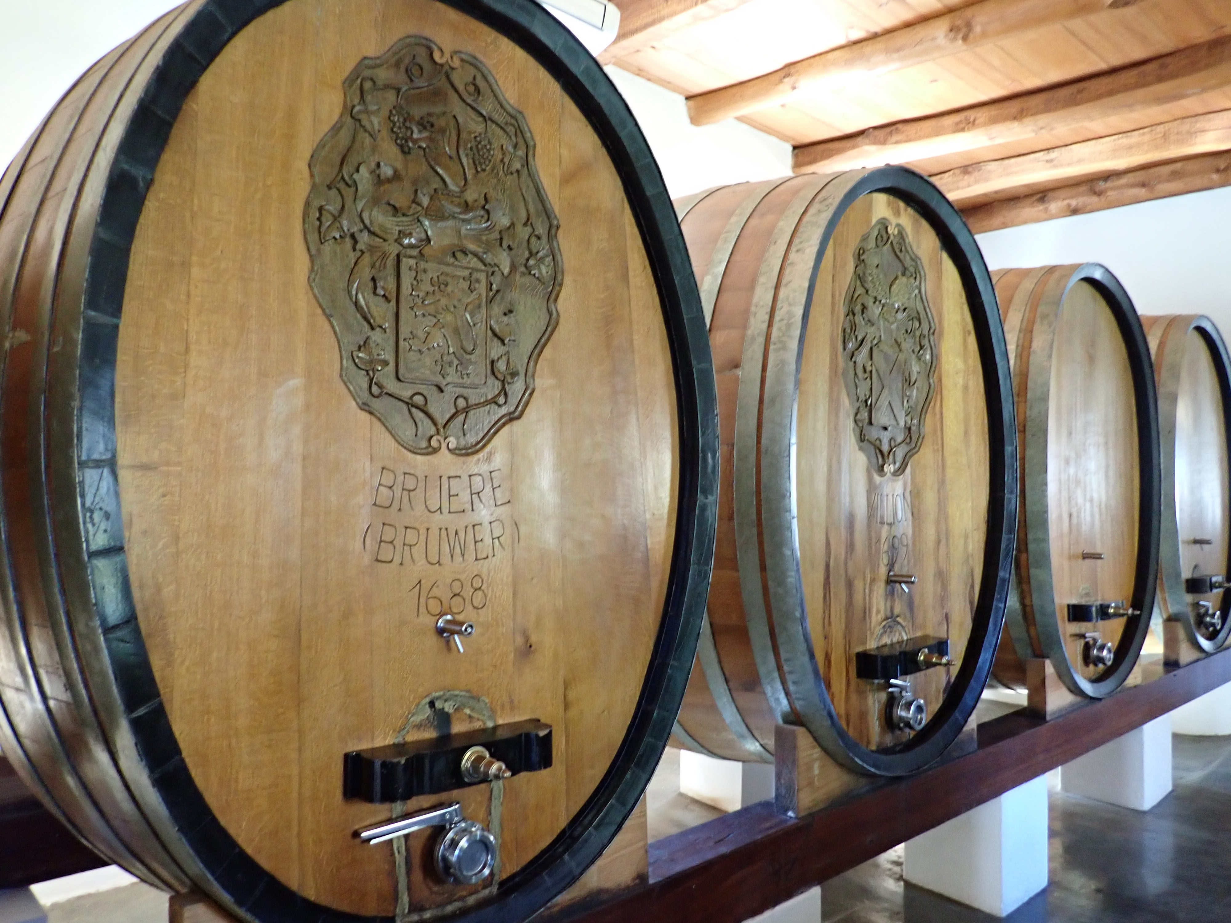
We visit Blaauwklippen Vineyards https://www.blaauwklippen.com/ founded in 1682, to learn more about their operation, as well as South African’s signature grape variety, Pinotage.  Its creation came about in 1924 and is a cross between Pinot Noir and Hermitage.

Our short afternoon in Stellenbosch was long on autumn scenery and delicious sips.  It was a wonderful introduction to South Africa’s wine country.

Cape Town Day 2: The next day, a couple of friends joined us for a private 8-hour tour that would take us to the renowned Cape of Good Hope and Cape Point.   For us sailors, visiting this revered Cape is a pilgrimage to seek at least once in a lifetime.  Today is the day.

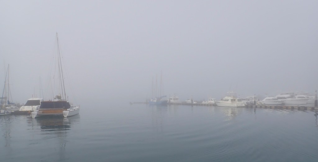
As we begin, David, our local tour guide, provides us with his suggested route towards the Cape, with stops along the way at many of the highlights he feels we would enjoy.  Despite the reoccurring morning fog, our route starts south along the scenic coastal road, winding through upscale beachside resort towns.  

Just beyond, our first stop is the ferry dock where we board a harbor boat and chug to nearby Duiker Island to see the seals. 

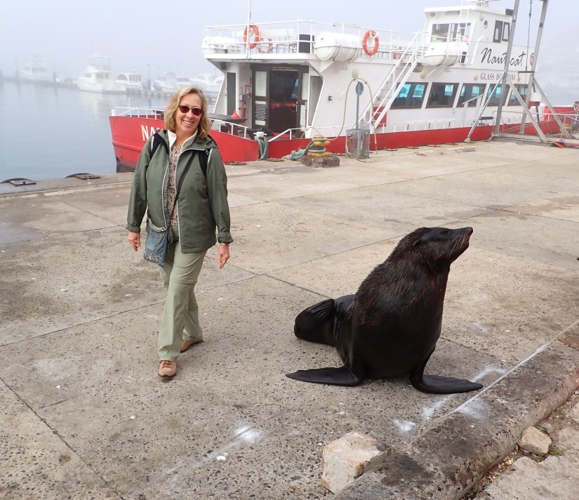
The fog lends a spooky ambiance as the rocky islet appears through the mist, just off False Bay. 

As we near, the morning stillness is broken by hundreds of seals barking as they lounge on the broad rocks.  Others dart and leap through calm water.  

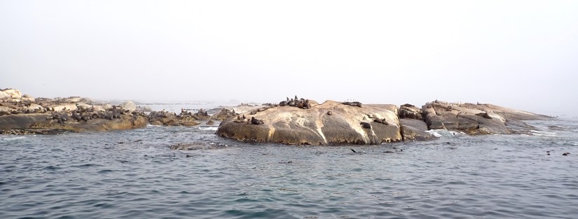
The bilge level of the stout vessel features glass viewing ports where one can view the kelp fields we are crossing over.

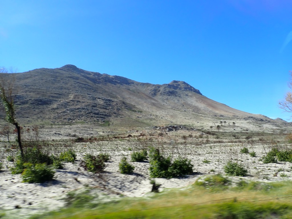
Reunited with David back ashore, the landscape of our drive changes to salt-tolerant scrub bushes and tufts of grassy patches hanging on desperately to the windblown gravel and rock. 

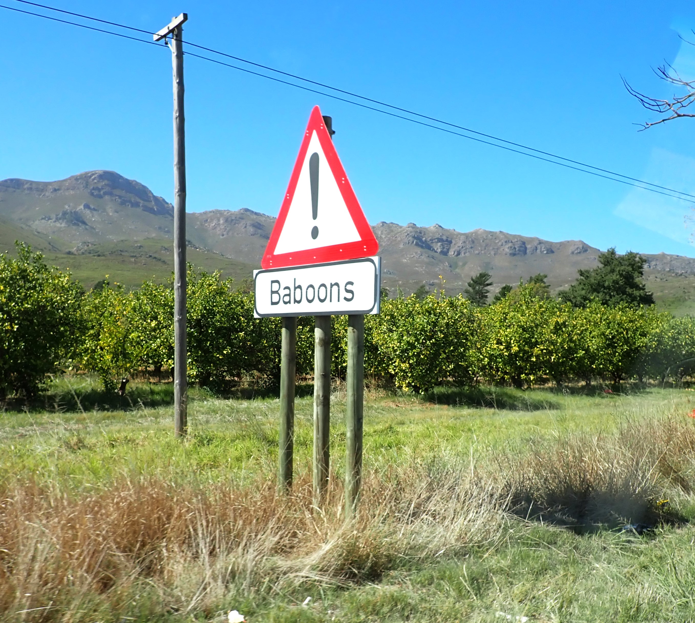
Cars with sightseers are pulled over to the berm to photograph the ostriches and baboons who roam freely.

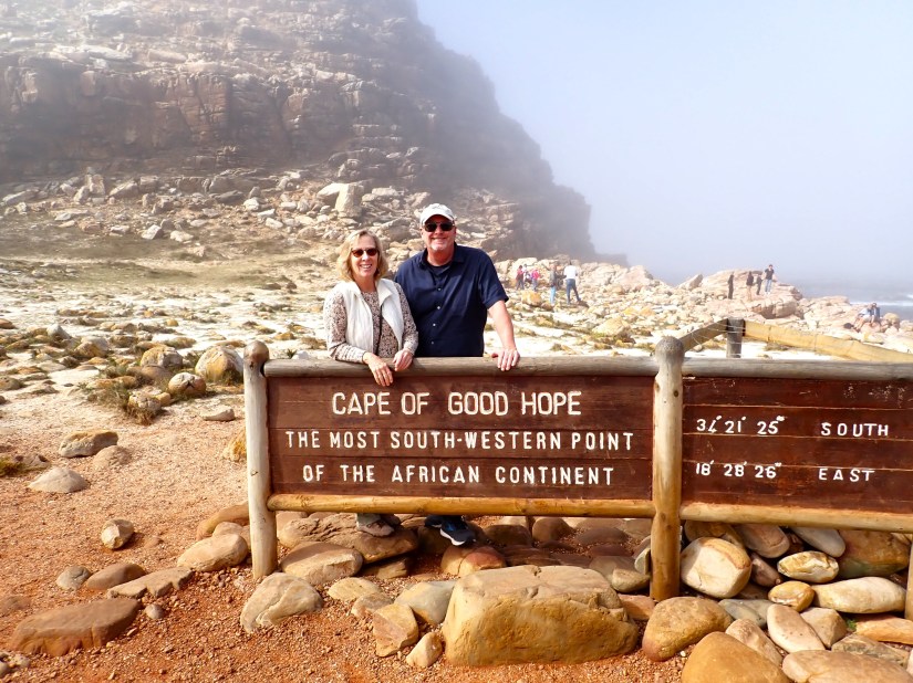
Entering the Cape of Good Hope National Park, the road winds for several miles to the official signage declaring that you have reached the most southwestern point of the African continent.  However, David explains that it’s a bit of a misnomer, as he is about to take us to Cape Point, the truly qualified southernmost point.

We climbed up to the Cape Point Lighthouse to look over the rocky cliffs that plunge into the sea. 

This is where the Indian Ocean meets the Atlantic waters in a breathtaking seascape.

From there, we proceed up the east coast until we reach Boulders Beach to find the residing South African penguins. 

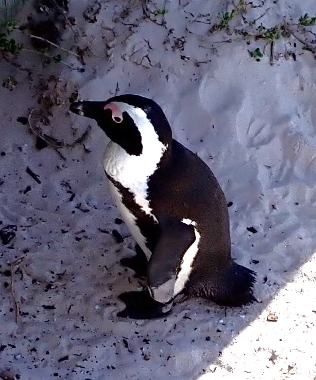
The granite boulders protect their habitat from wind and waves. 

Our last stop was the Constancia Winery for a beautiful view of Table Mountains backside in the glowing afternoon light. 

We truly enjoyed the expansive 8-hour circle route of South Africa that revealed the diverse nature of this beautiful area.

Adjacent to our ship, the evening lights and Ferris Wheel of the vibrant V&A waterfront beckoned us for a short visit after this long day. 

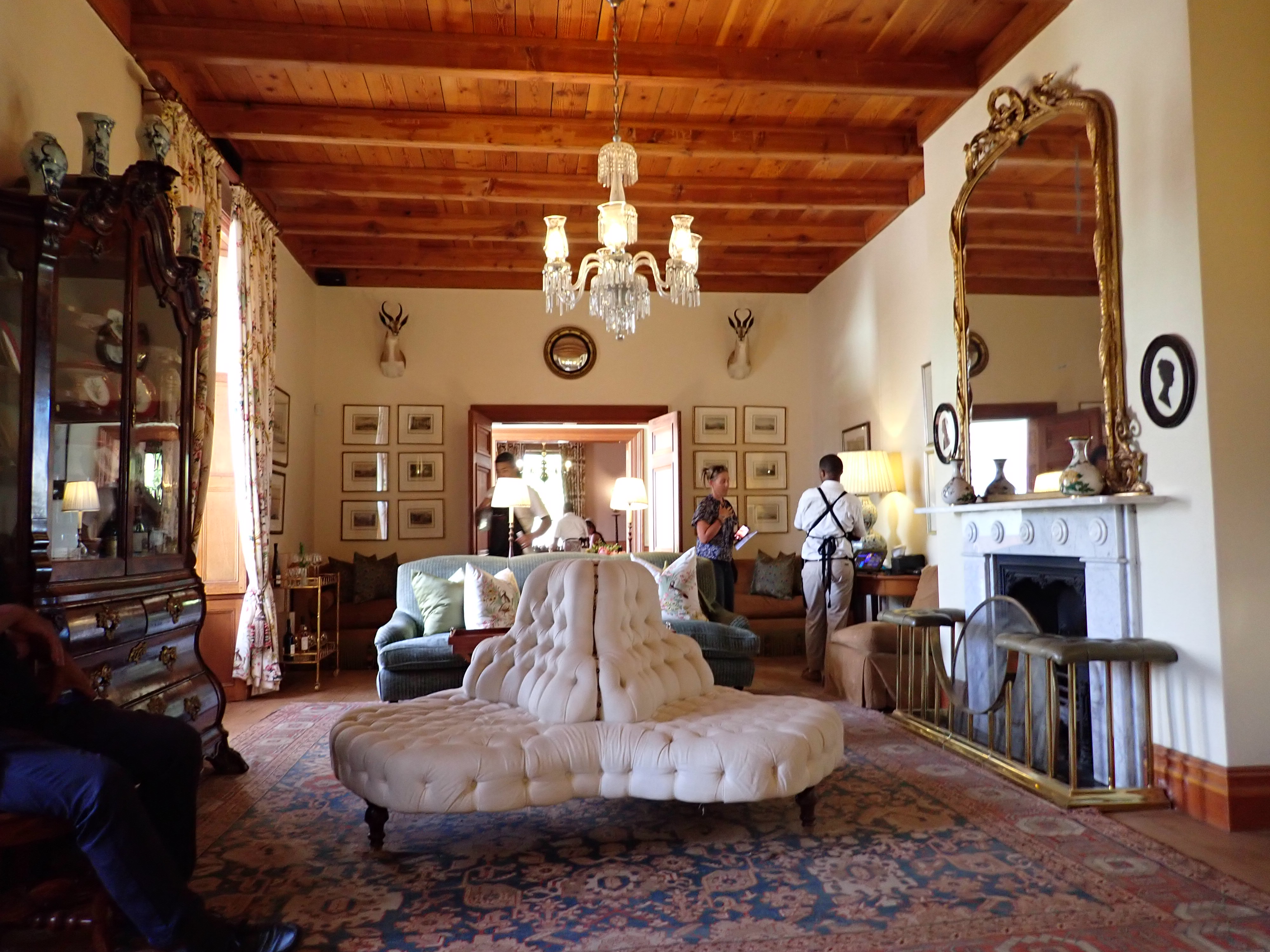
Cape Town Day 3: Locals told us that our visit would not be complete without traveling 50 miles to the Western Cape and its storied Franschhoek region.   Mountainous with pristine natural and architectural beauty, it’s become known as the ‘food and wine capital’ of South Africa.  Cozy B&B’s, shopping boutiques, upscale restaurants and wineries help make this a destination.

We booked a private tour via Viator and a couple from the ship joined us.  Our driver, Esuadore, was born in Paarl, where we would begin our tour.   The Fairview is a working farm, known for its wine and cheese making. 

The Fairview goats have their own turret!

Landskroon Wine Estate is situated along the southwestern slopes of Paarl Mountain, with stunning views over their vineyards looking towards Table Mountain.

Picturesque with historic charm, LeMott Wine Estate is part of the Rupert Family.  With a museum and hiking trails, this estate offers much more than wine.

Perched on Franschhoek Pass, Haute Cabriere’s romantic wine cellar and upscale restaurant begs one to linger.

And while most all of the area vineyards have breathtaking properties and heritage dating back to the 1600’s, perhaps the most opulent estate was Anthonij Rupert, and its vintage tasting room. 

Returning back into Cape Town, we passed by the Victor Verster Prison where Nelson Mandela spent the last part of his imprisonment for campaigning against apartheid.  He was released in February 1990 and his statue commemorates his walk to freedom. 

Three days is simply not enough time to experience the modern, cosmopolitan city of Cape Town and its surroundings!  We will always look forward to our next visit and never-ending list of things to do there. 

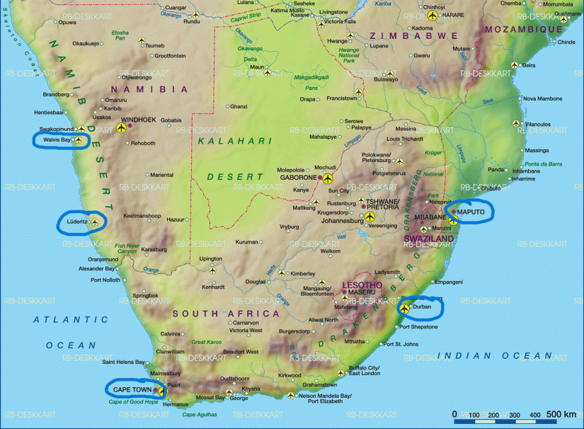
We’ve turned the corner now and begin heading north, up the west coast of the African continent.  The Republic of Namibia lies about 500 miles north of Cape Town.   With 30 different languages spoken amongst 2.26 million people, Namibia is a land of contrasts where golden desert sands and blue ocean compete for attention.  We will visit two ports:  Luderitz and Walvis Bay.

Ludertiz, Namibia   It is our second visit to this strange, but endearing town that looks like an old, abandoned Western movie set in Germany.  In 1884, a small enclave of German prospectors arrived during the diamond rush and carved a town out of rock and rubble.  Today, there are about 16,000 residents that remain in Luderitz. 

We strolled through a tidy, but almost deserted town on a Sunday.  If it weren’t for our ship’s visitors, there might not have been a sole on the streets. 

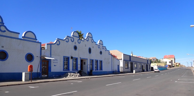
Their colorful buildings seem like a valid attempt to brighten the dusty, rocky landscape.

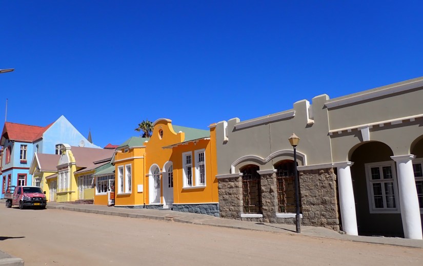
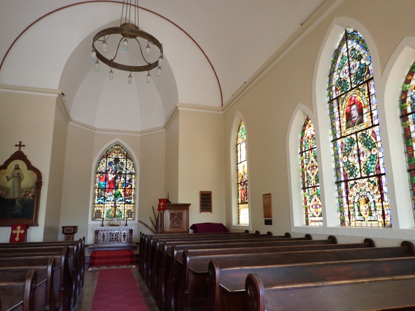
The German Evangelical Lutheran Church, built in 1912 stands atop Diamond Hill.  Known as ‘Felsenkirche’ or Church on the Rocks.   

Despite its tiny museum, it held tons of treasures revealing the towns colorful past; from tribal relics and whaling history to photos of the large diamonds that had been discovered in the immediate and surrounding areas.  When we compared the town photo taken in 1924 to our visit today, not much has changed! (Unfortunately, photography was not allowed in the museum.)

Departing Luderitz, we see the fog awaiting us just offshore

Zuiderdam makes her 260-mile overnight passage towards Walvis Bay through darkness and fog; her horn sounding every two minutes.  Captain Friso is quite happy to complete a successful docking in near zero visibility at 6am.  Kudos to the Captain for landing a big ship on a postage-stamp-of-a-dock! 

We are happy to be revisiting Walvis Bay, Namibia, as we found it to be such a pleasant surprise last year.  A small town of only 5,200, yet big on hospitality.  It was nice to reconnect with our friend Theo, at their humble yacht club along the waterfront for an hour or so. 

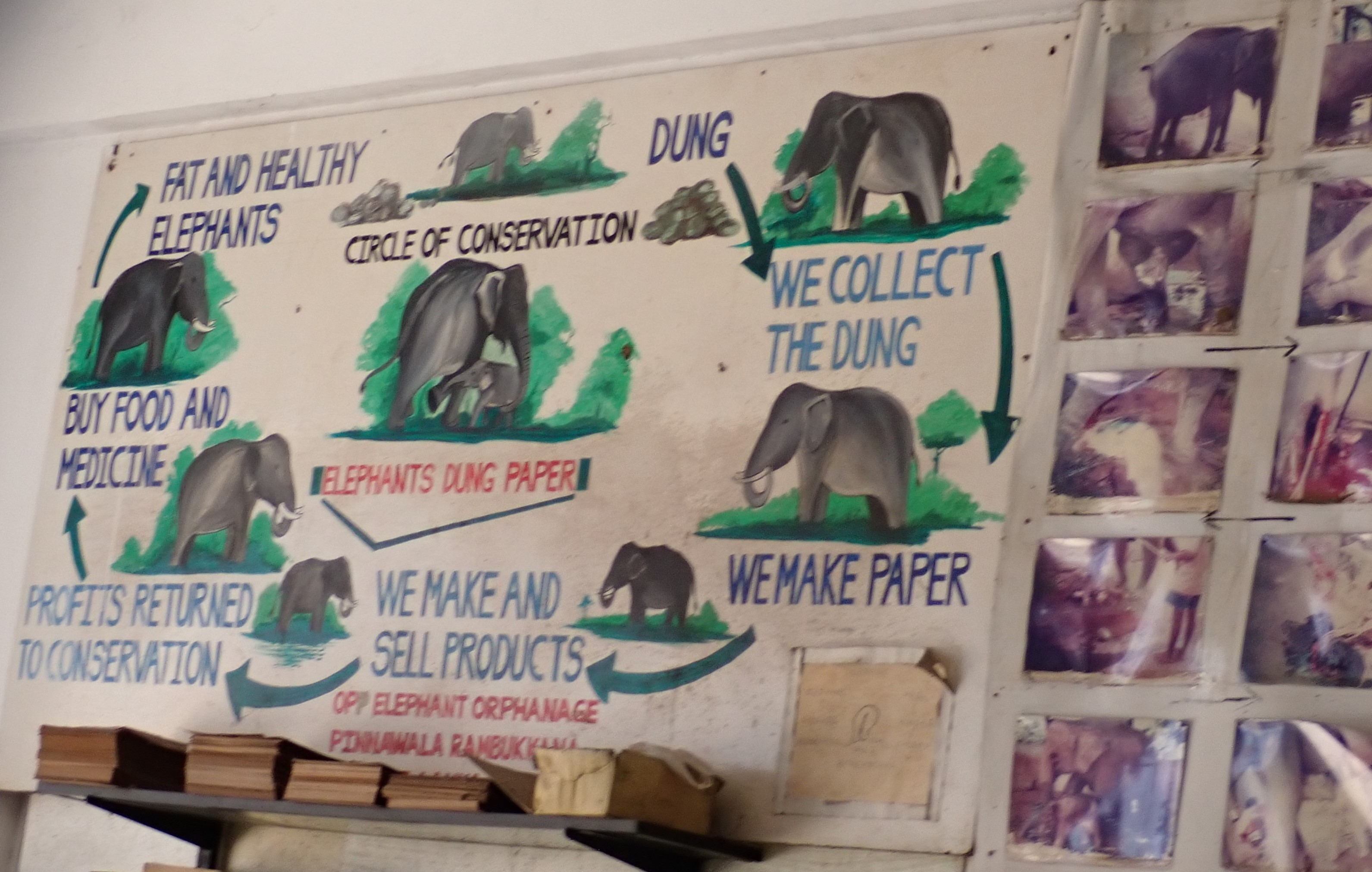
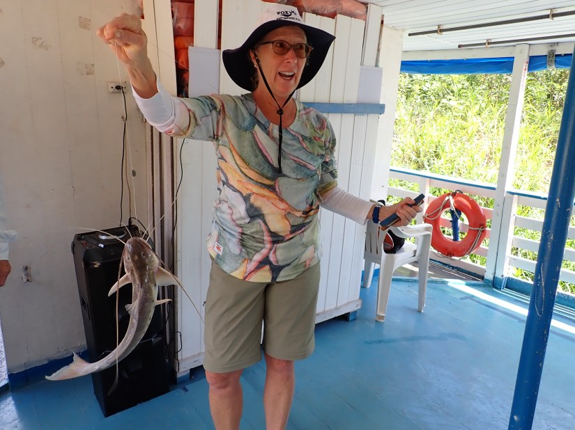
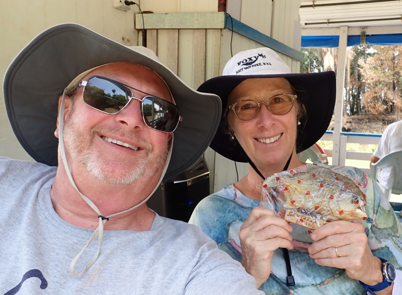
But the main attraction of today’s visit was a 4×4 dunes tour of Sandwich Harbor, arranged by shipmate friends.  Six of us met with our guides Robbie and Ernst, who loaded us up in two of their well-equipped trucks that took us off-road 31 miles south.  Within minutes, we left suburbia and the trucks tires transitioned from biting dirt, to mud, salt and eventually sand.  Lots of towering sand.

But salt, you wonder?  We first passed through their salt fields, where 400,000 tons of salt are produced annually.  The off-flowing water rests in canals along the fields and turns pink while waiting for evaporation.  The harvested salt is exported and used for non-dietary uses, like salting roads, etc. 

Beyond the salt fields, we found their haven for migratory birds and flocks of flamingos.  And a seal basking in the sun who quickly took to the sea upon our approach.  The entire area was raw, unspoiled and wild.  And only accessible at low tide.

Flamingos in the lifting fog

We also glimpsed the occasional springbok and oryx, fleeing the sound of our vehicle. 

Look closely to find the two oryx on the run

The isolation of the sunbaked Namib Desert. Surreal landscapes and vistas of sand as far as the eye could see. 

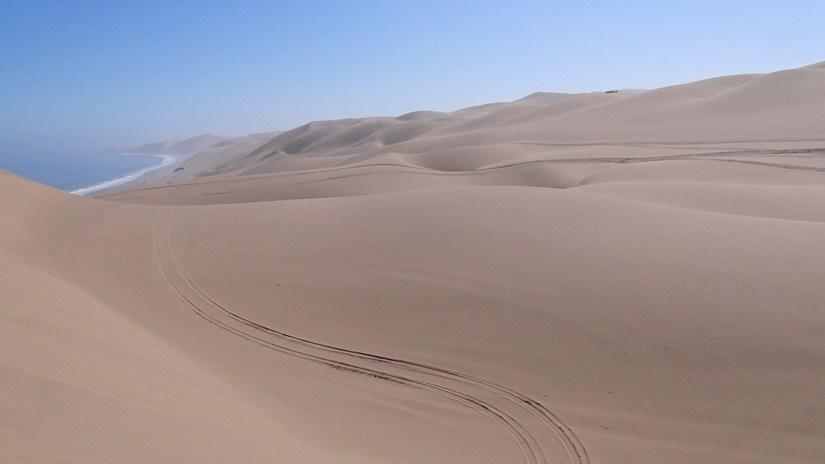
As the elevations rose, we found ourselves amongst dunes that tumble down into the ocean below.  Our guides rev their engines, and we zoom up 300 ft dunes, cresting momentarily with zero gravity, before plummeting down the soft and shifting sands of the other side.  Again and again.  It was exhilarating adrenaline rush!   

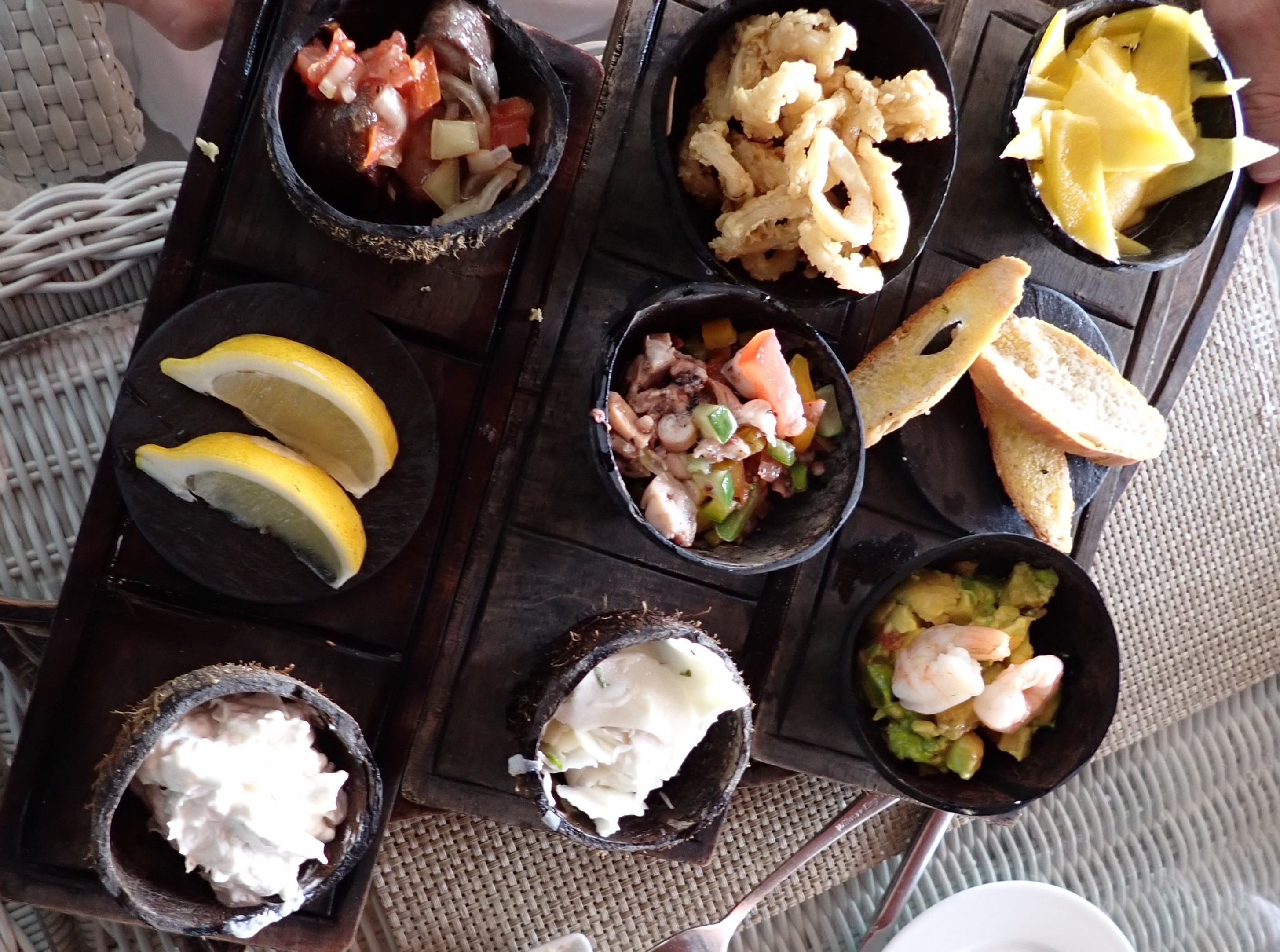
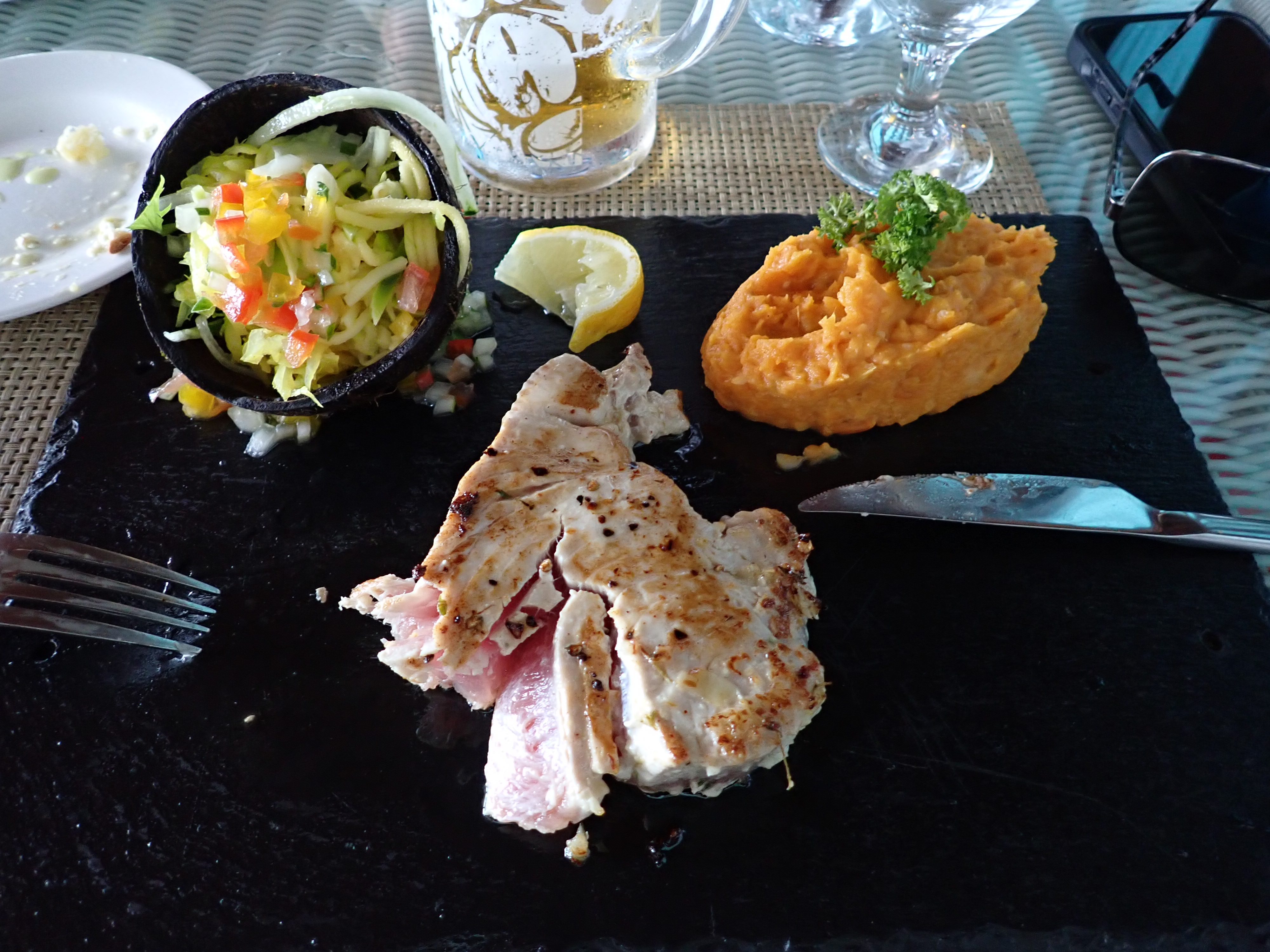
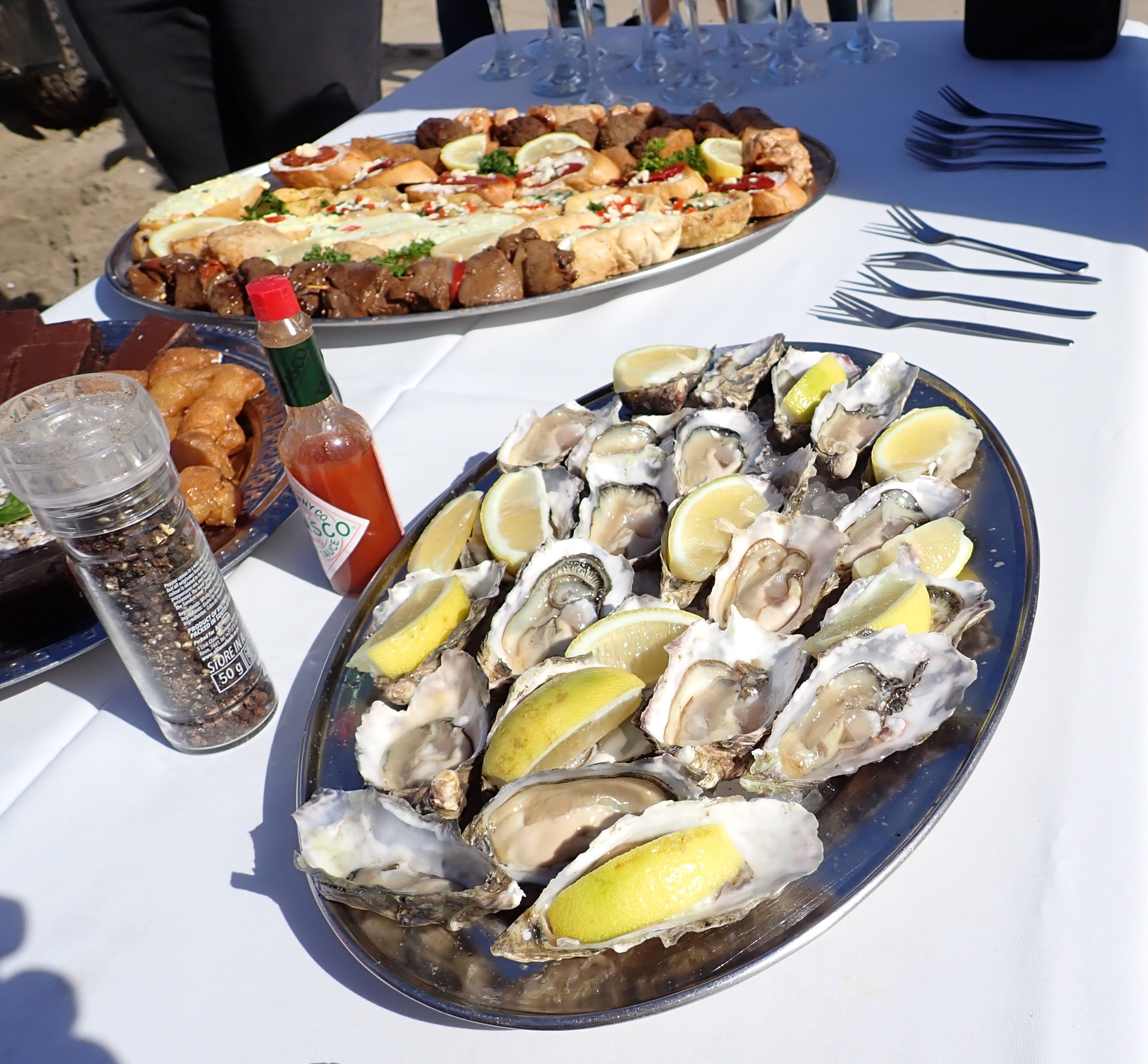
Taking a break down at the shoreline, our guides quickly set up an impressive beachside lunch buffet, featuring fresh-from-the-sea raw oysters, grilled oryx, chicken, fish, egg salad, quiche, brownies, dates, “Afrikan Twists” (a cross between a donut and baklava) champagne, beer, soft drinks and water.    The entire experience was thrilling beyond compare.  

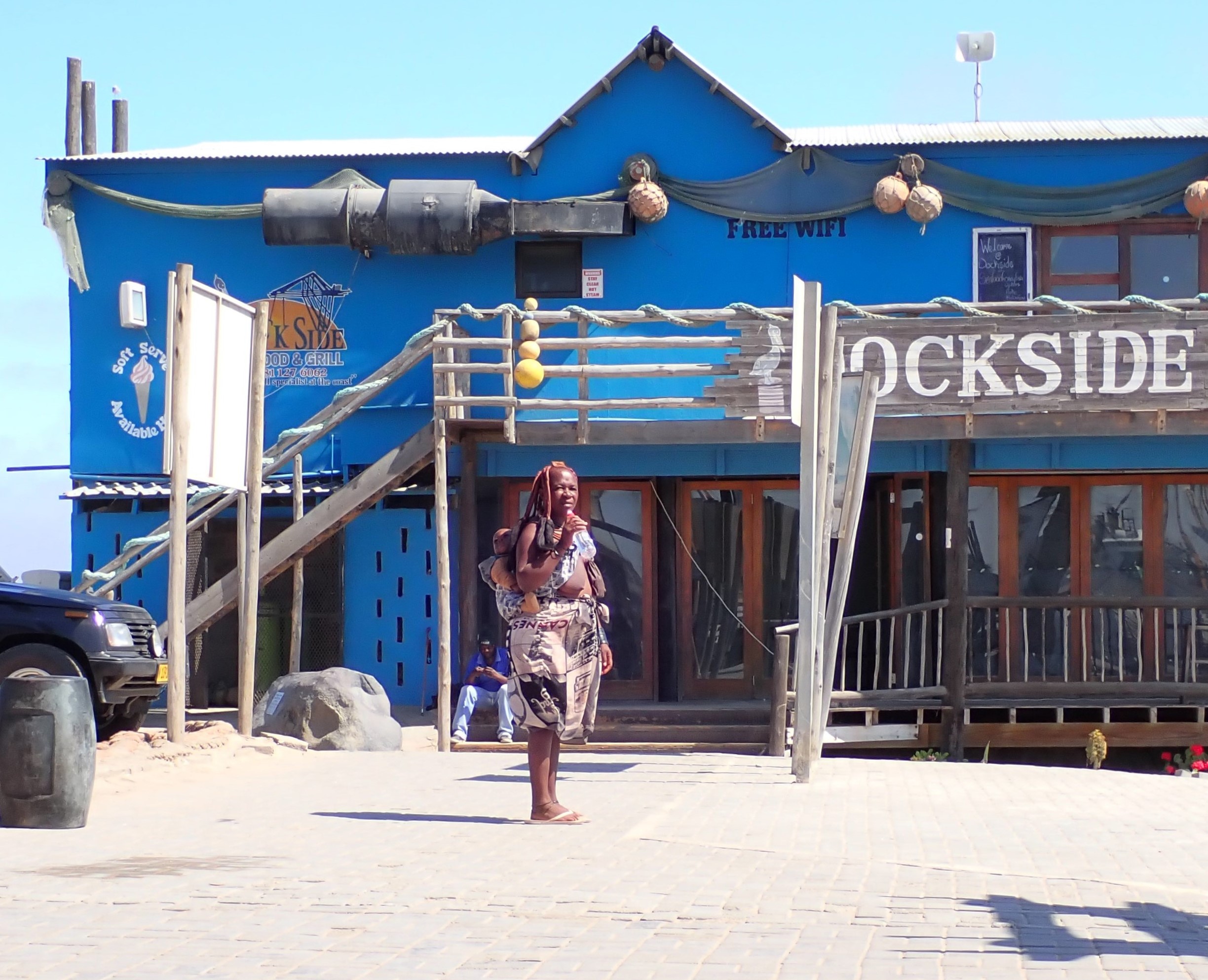
With aftermath stories bubbling up within us, the six of us sought the waterfront to unwind before returning to the ship.   The bare-breasted women of the Humba tribe gained a great deal of attention as they plied their trinkets to the tourists.

Walvis Bay, and particularly Sandwich Harbor is a place worth (re)visiting! For more info and photos of the stunning dunes, visit: https://www.sandwich-harbour.com/

From Namibia, we sail 1,600 miles to a ‘place’ that doesn’t materially exist….Null Island.  Why all the excitement about a nothing-to-see place in open ocean?  It is where the prime meridian and the equator meet. Better known to mariners as zero degrees latitude and zero degrees longitude. The Captain sees this as the rare opportunity to position the ship in each quadrant: bow in the northern hemisphere, stern in the southern hemisphere.  And port side of the ship in western; starboard side in eastern.  Quite an accomplishment!

A rare GPS display

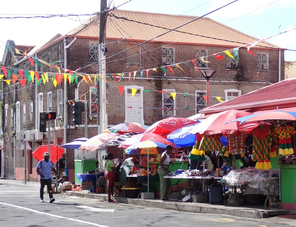
Another 1,923 nautical miles northwest brings us to the industrial and commercial port of Takoradi  Ghana.  Over 2 million people support fishing, cocoa processing, timber and plywood, shipbuilding, and oil-related activities.  

This Takoradi tugboat welcomed and surprised us into the harbor with an exuberant spin, while blaring “The Star-Spangled Banner” from its crackling speakers!

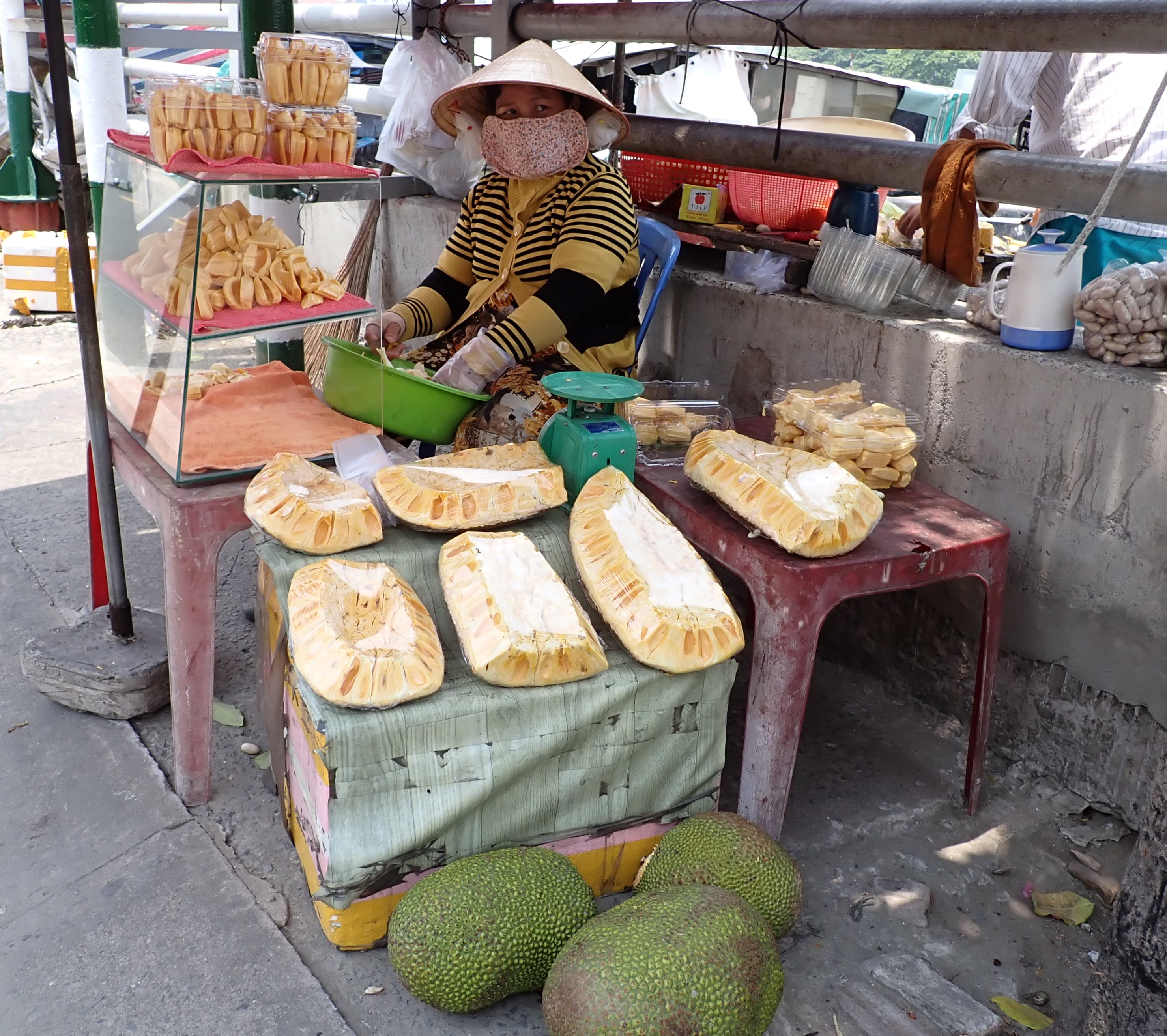
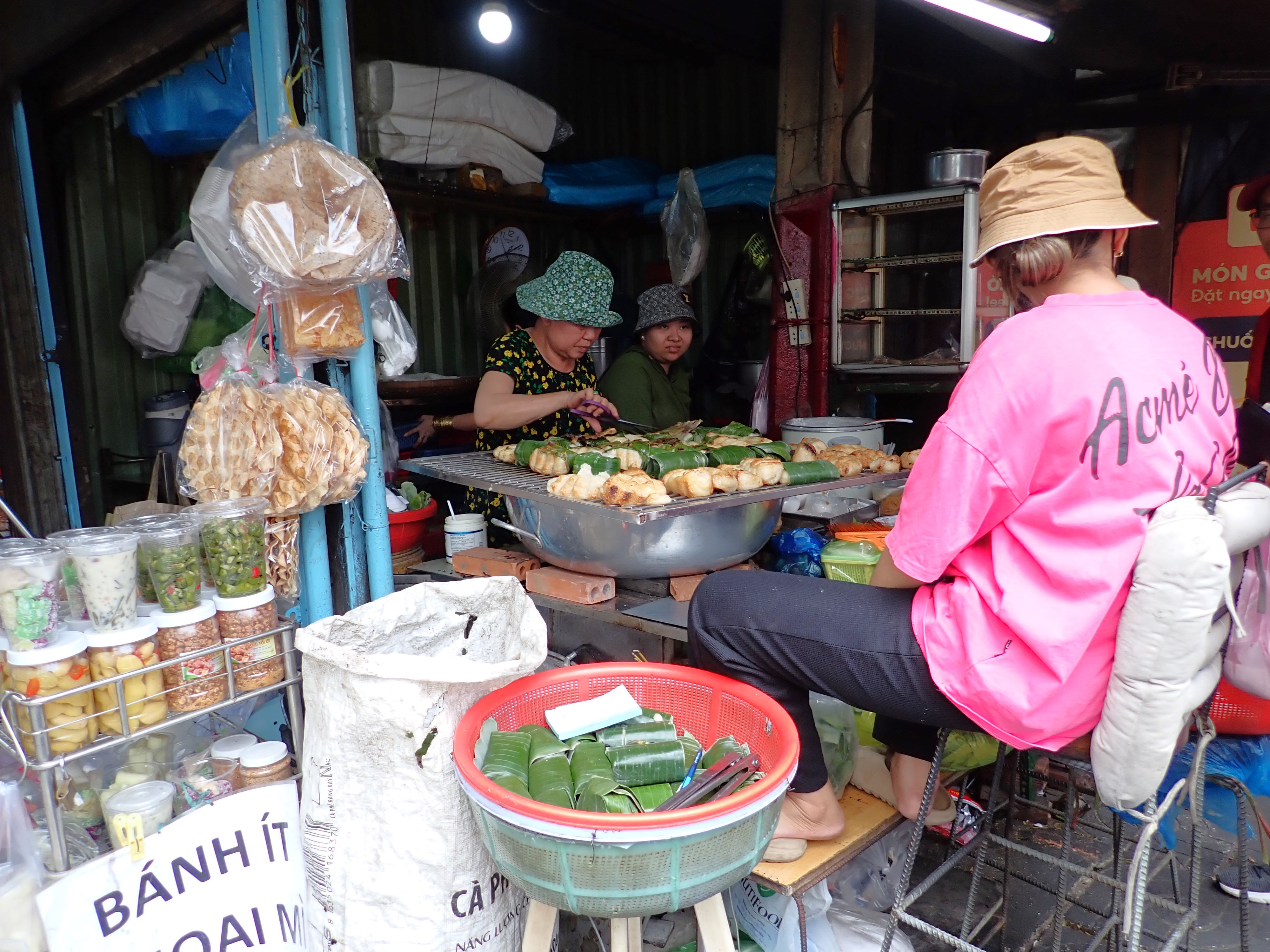
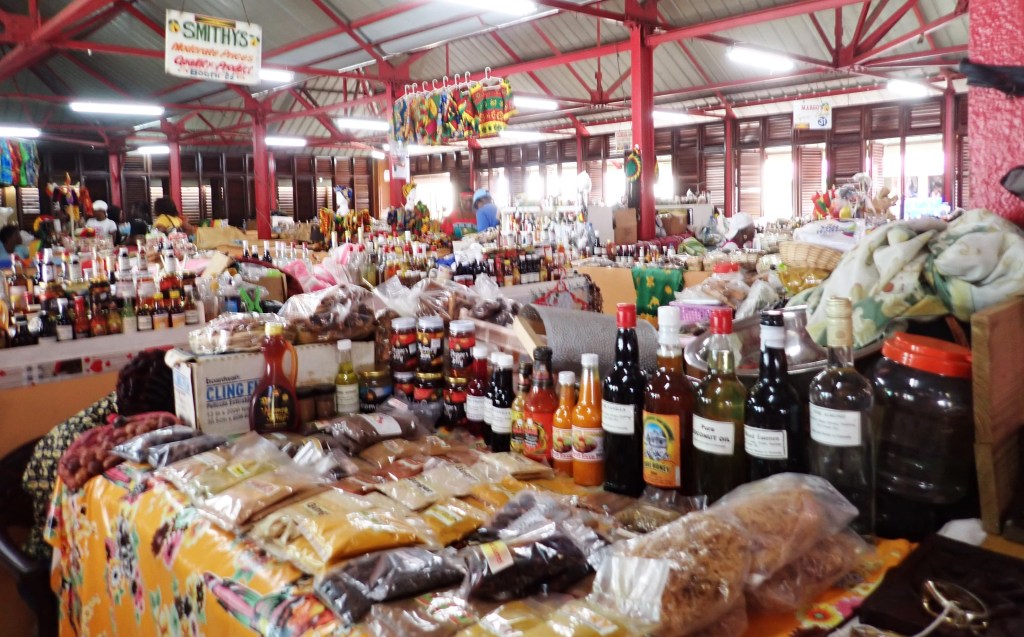
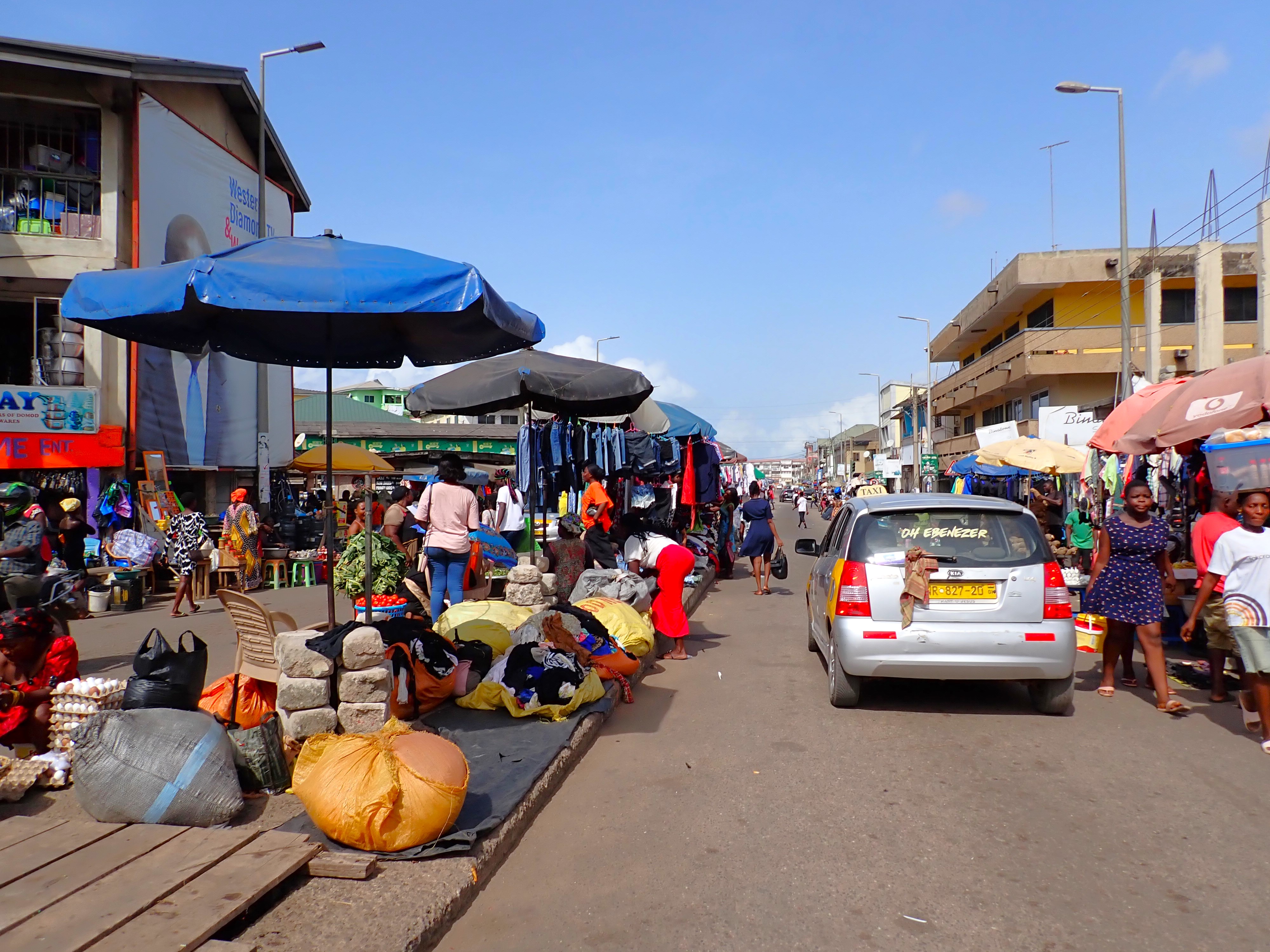
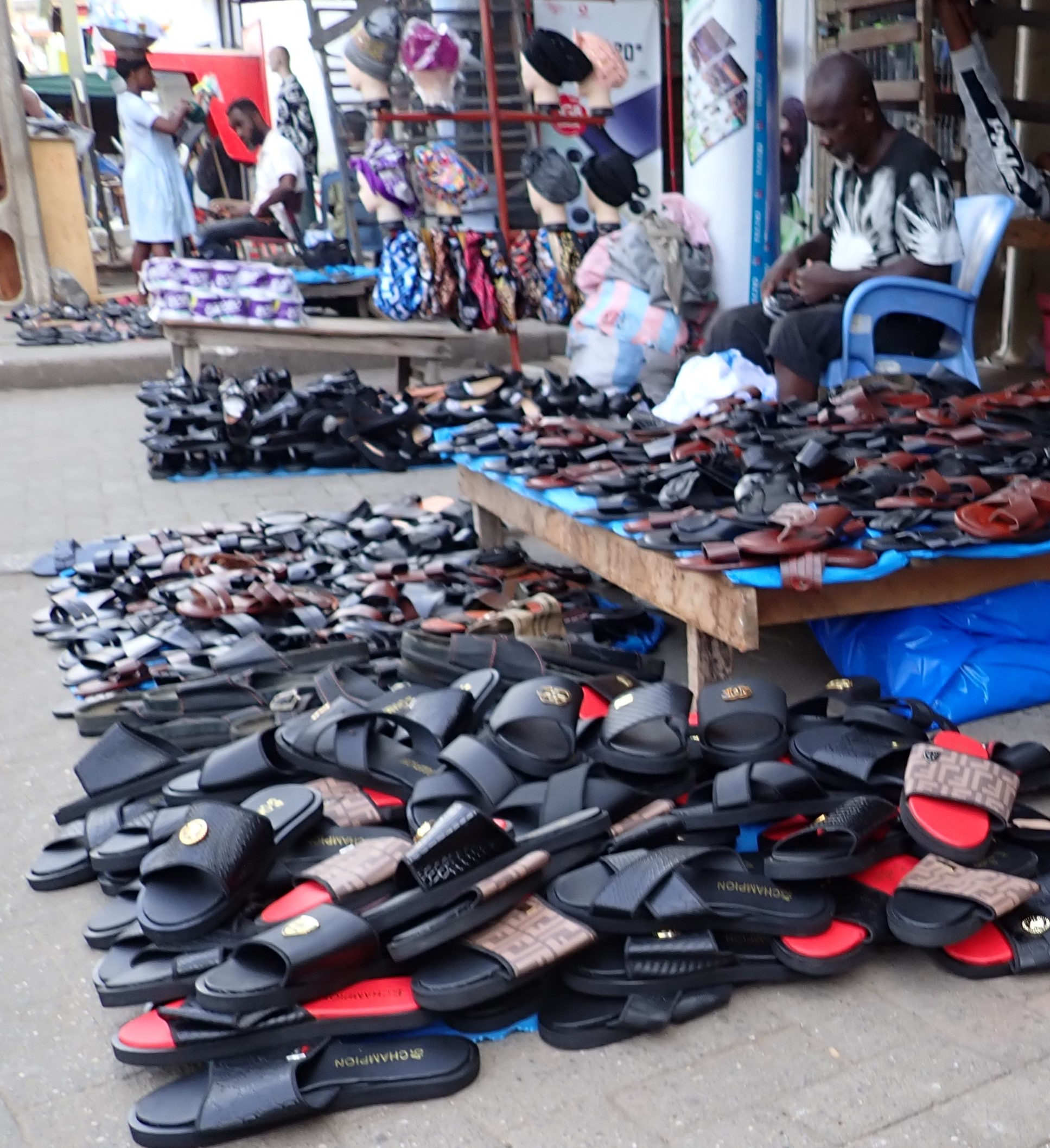
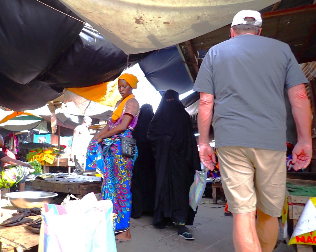
Without any notable attractions in Takoradi, we visit their colorful Circular Market on a bustling Saturday in 100-degree heat.  We find friendly locals with easy smiles and conversations full of curiosity about where we are from.   

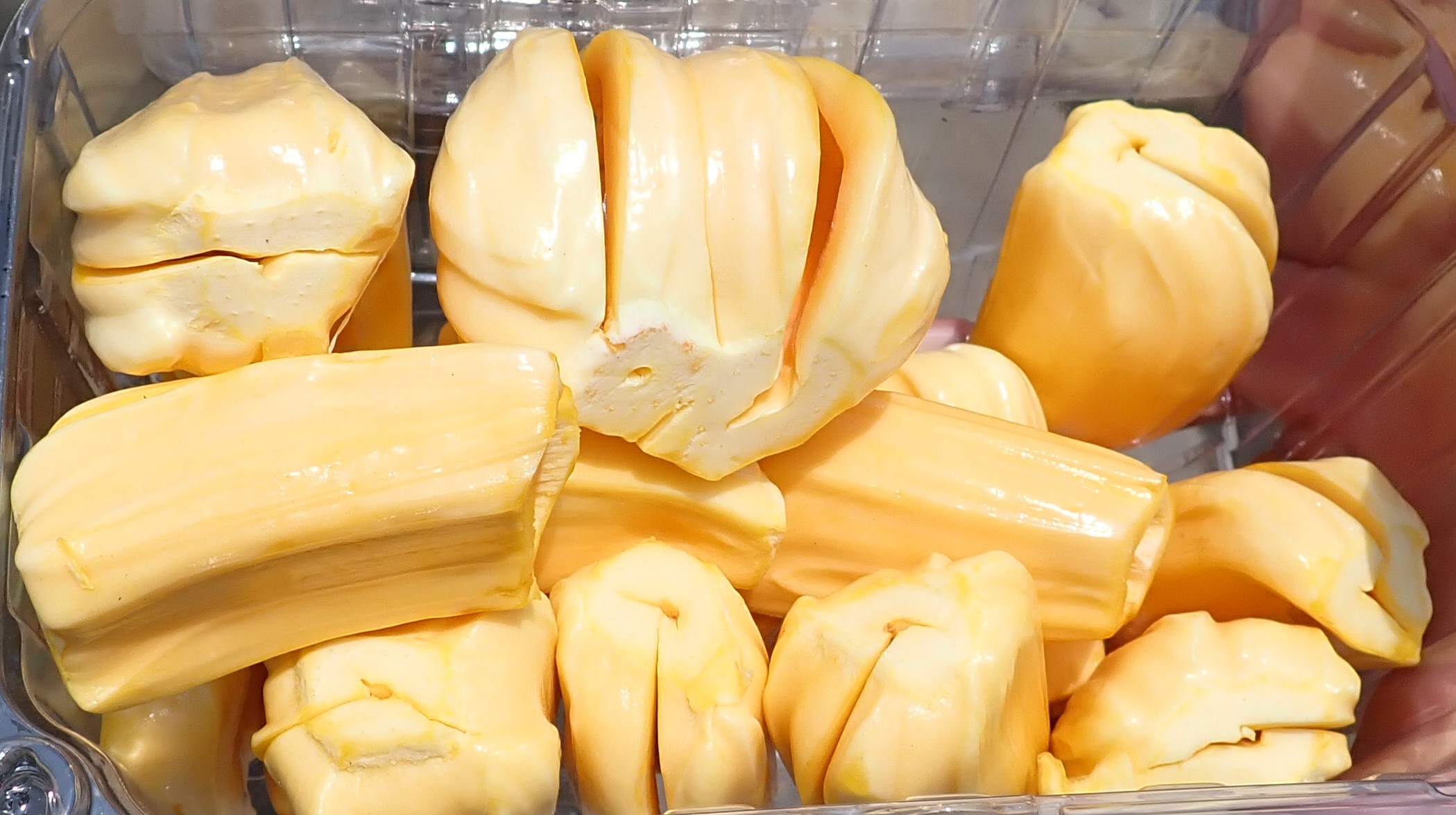
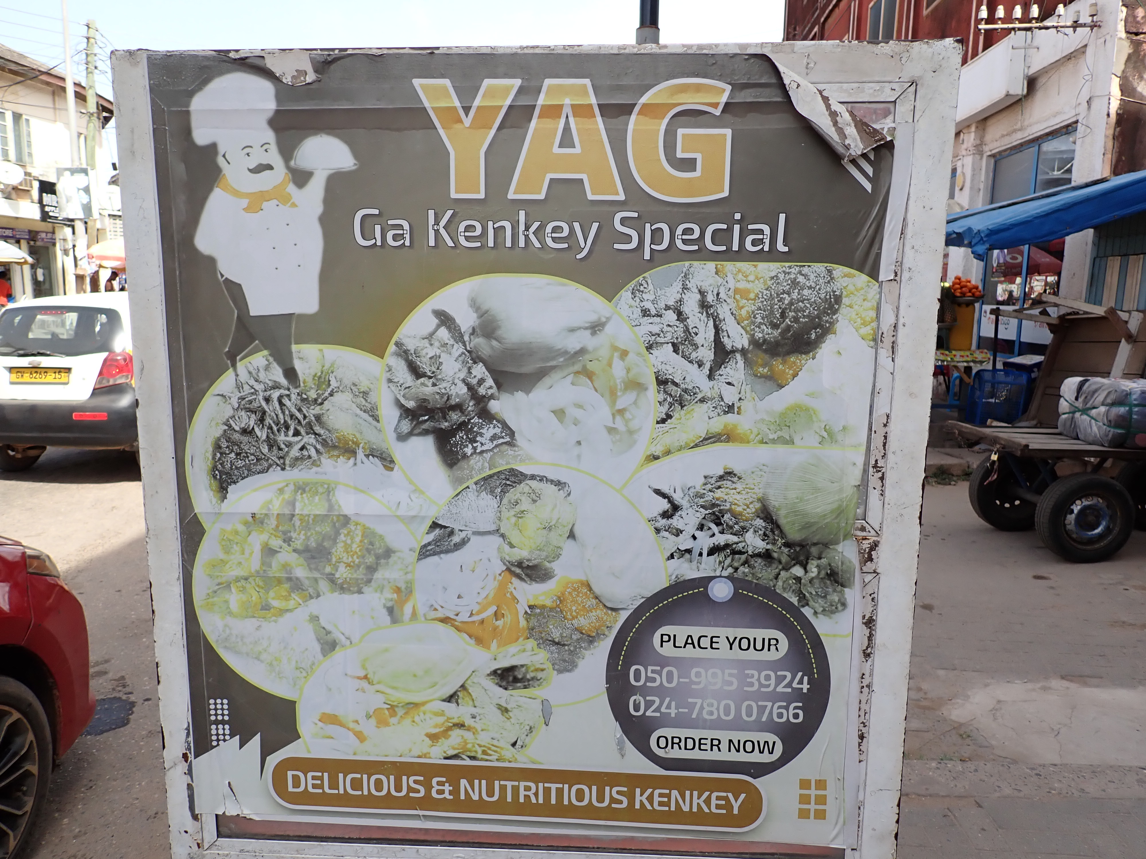
“Kenkey” is a traditional Ghanaian dish made from fermented white corn.  Fante Kenkey is wrapped in corn husks and stacked vertically as a popular street food.

You’ll find ANYthing and EVERYthing displayed under the hot sun: fresh fish and veggies, shoes, coconuts, tupperware, baskets, hardware, etc.

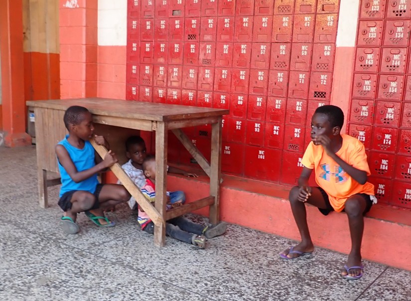
And kids are kids no matter where in the world you are, like this trio playing ‘fort’ in the local open-aired post office.

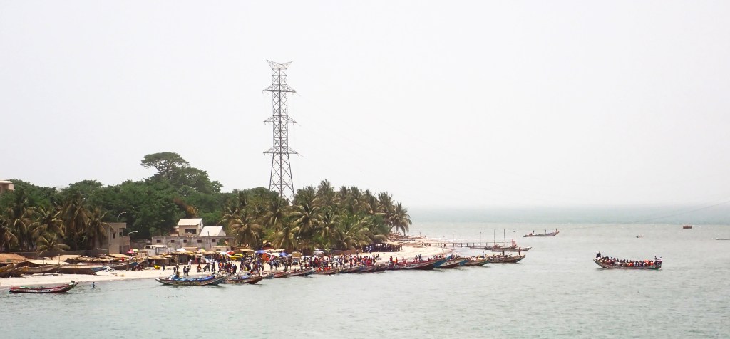
Departing Ghana, Zuiderdam covers 1,318 nautical miles over three sea days to reach The Gambia, the smallest and narrowest country in continental Africa. It is entirely surrounded by Senegal, except for its Atlantic coast.

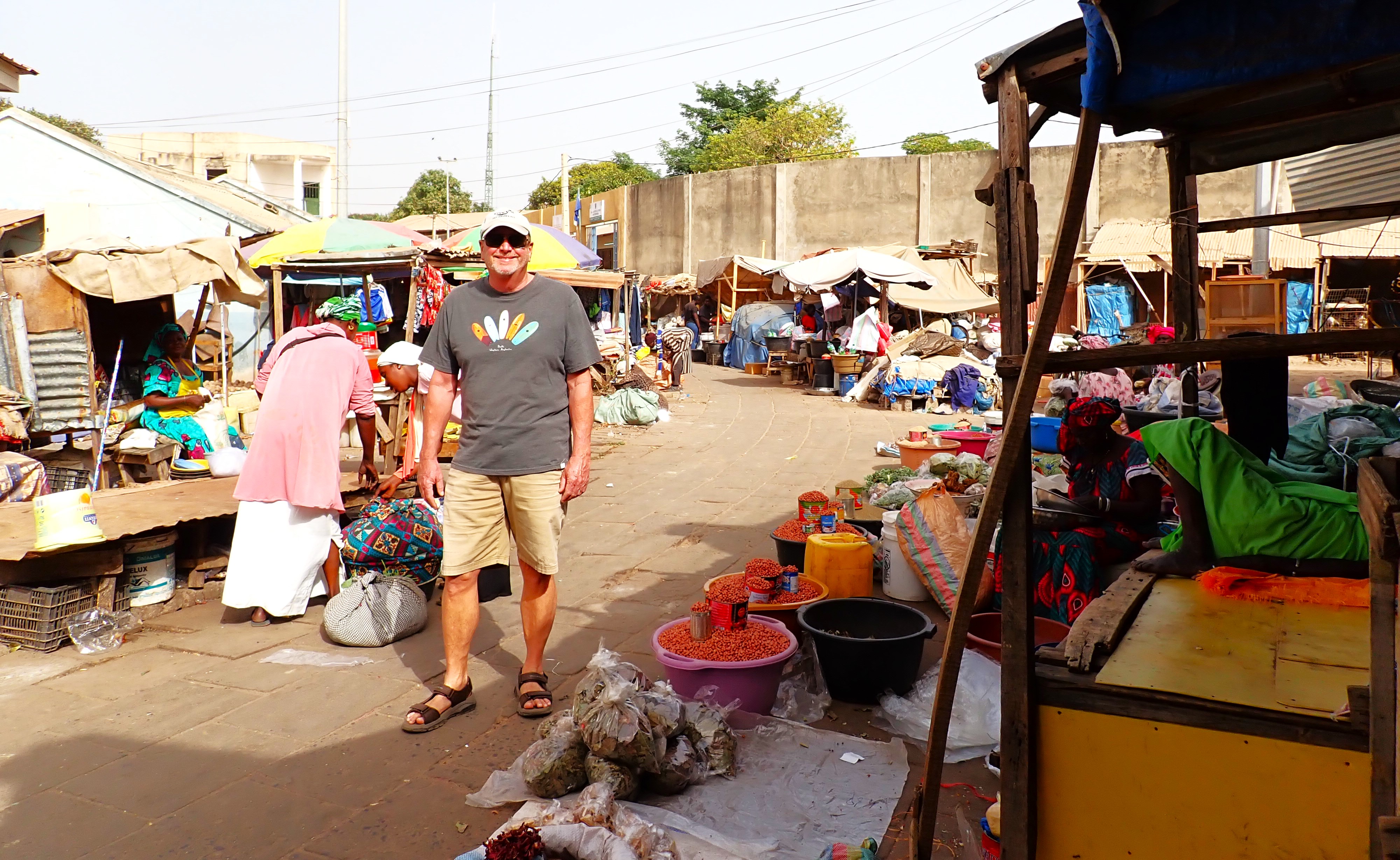
Banjul is the capital of The Gambia, and despite it being amongst the poorest ports we’ve visited, the locals were friendly and welcoming. The haze of Sahara dust hangs in the heavy, 106-degree air as we meander the streets lined with faded colonial buildings. 

Today is May Day, and their holiday celebrations include a large track meet and cookout in their athletic field.  All the federal departments (police, fire departments, etc.) were participating.   

We found a few interesting attractions that offered a glimpse into the culture and history of this small nation.   Such as Arch 22, a massive 118-foot-tall gateway that was built to commemorate the military coup of 1994. It offers views of the city and small museum.

Albert Market was founded in the mid-19th century, and is the main hub for frenzied buying, bartering, and bargaining. You’ll find everything from local crafts to fresh fruits and spices.

After a 5-mile walkabout in sweltering heat, we retreated back to the ship.  Only to find that the locals had set up the original “Pier One” shopping just outside our gangway.  

From our stern, we could see the ferry terminal and its chaotic assembly of locals in overloaded watercraft of every kind.  It’s a wonder they remain afloat.

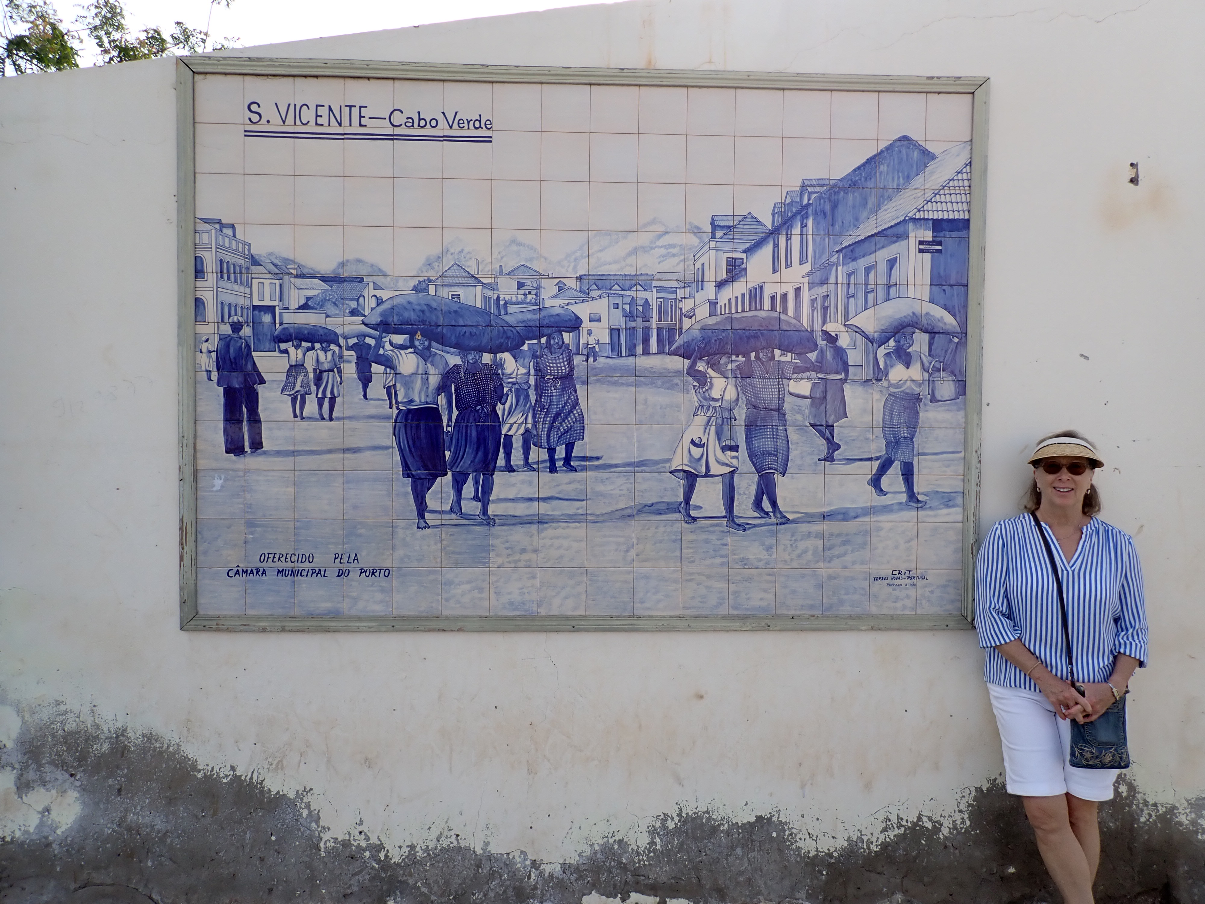
We leave the continent of Africa in our wake, now heading due west to the archipelago country of the Cape Verde Islands in the central Atlantic Ocean.  Our port of call is Mindelo, a city beautifully situated in a large bay surrounded by hills and mountains on the island of Sao Vicente.  

Our morning approach to Mindelo

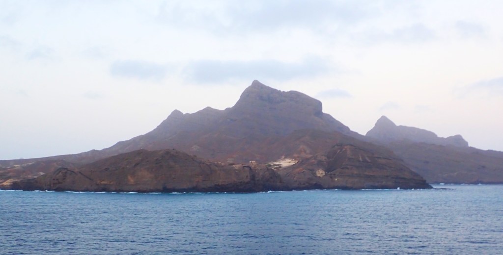
Perhaps the other 11 islands are “verde”, but we found a desert-like landscape, stark against the blue Atlantic waters. 

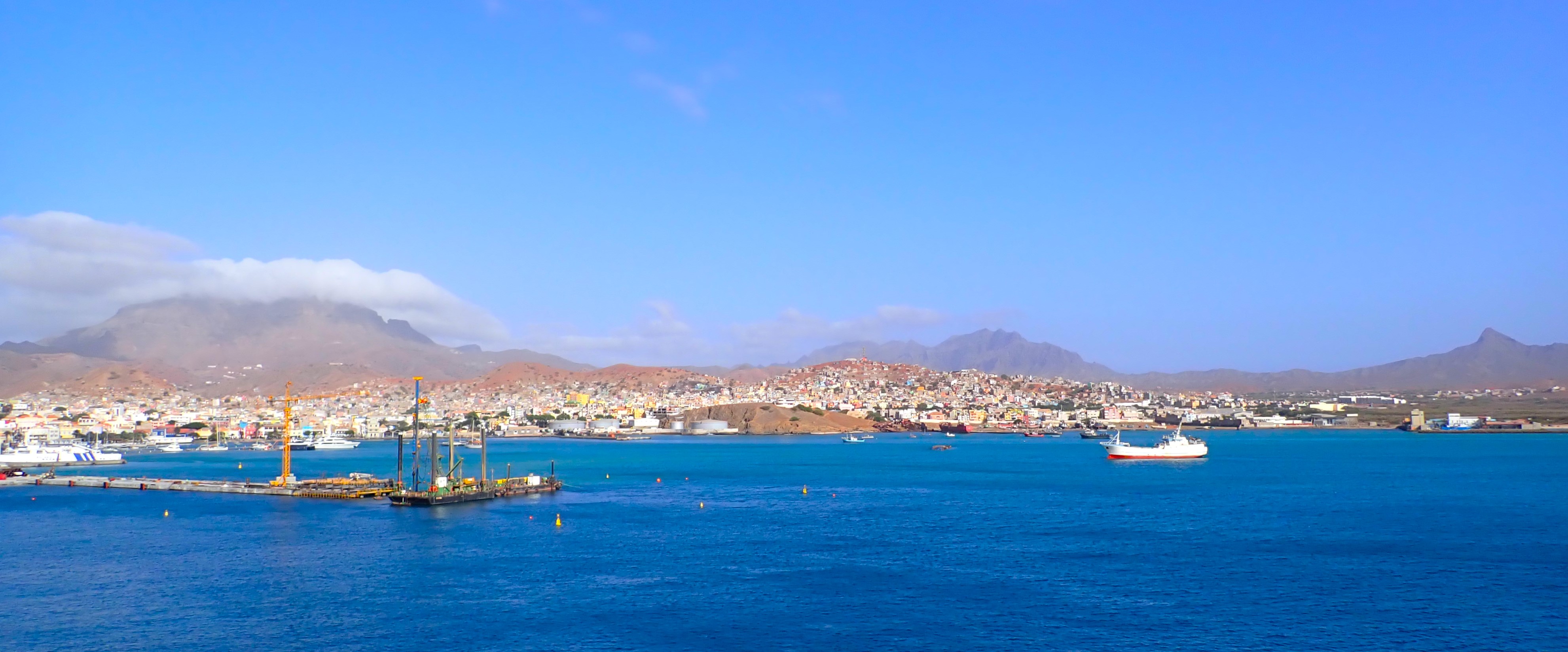
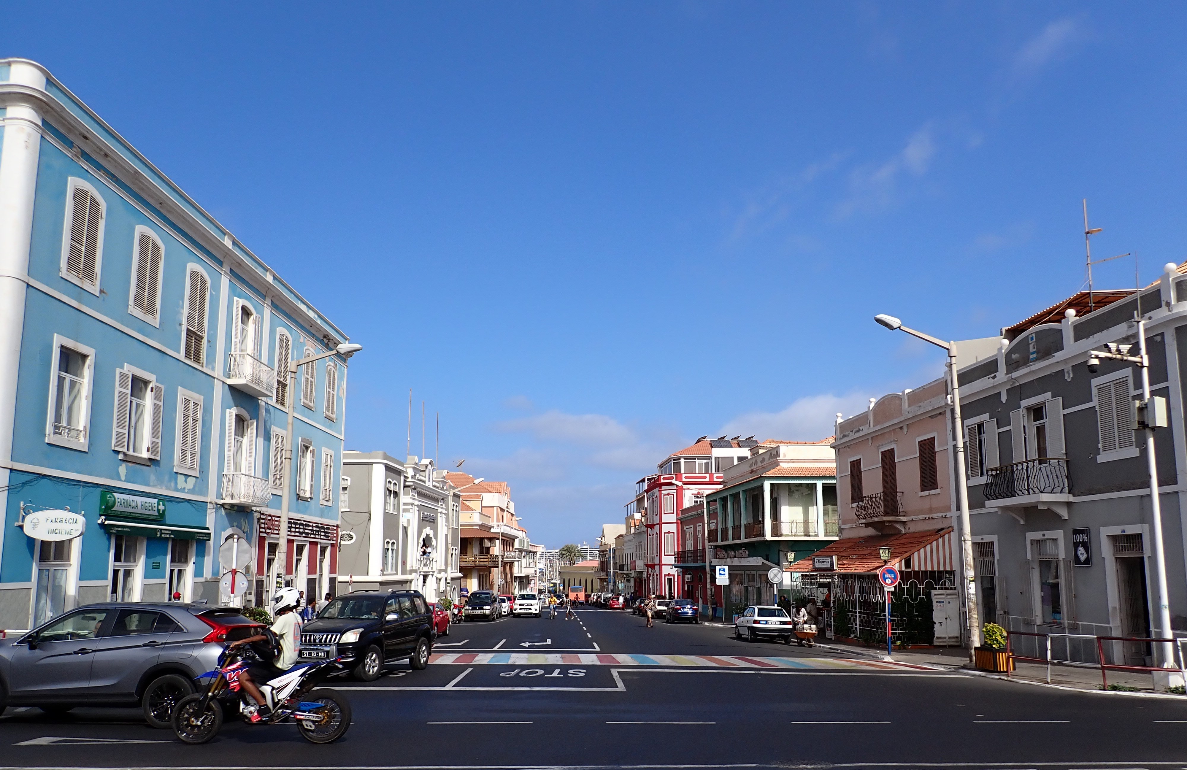
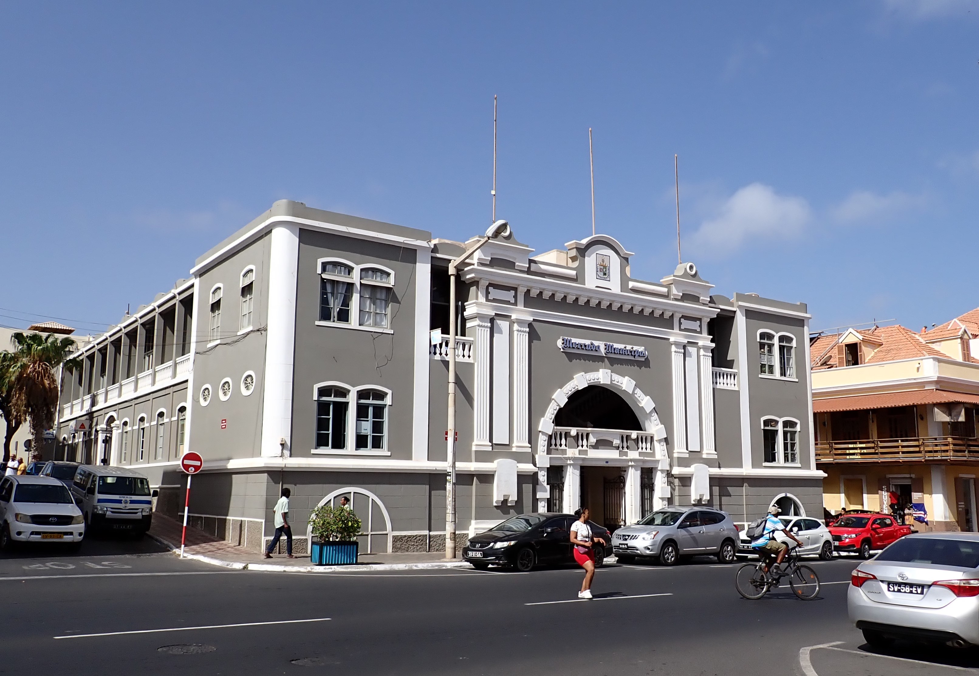
Mindelo is a clean, artful and colorful town with Portuguese influence. 

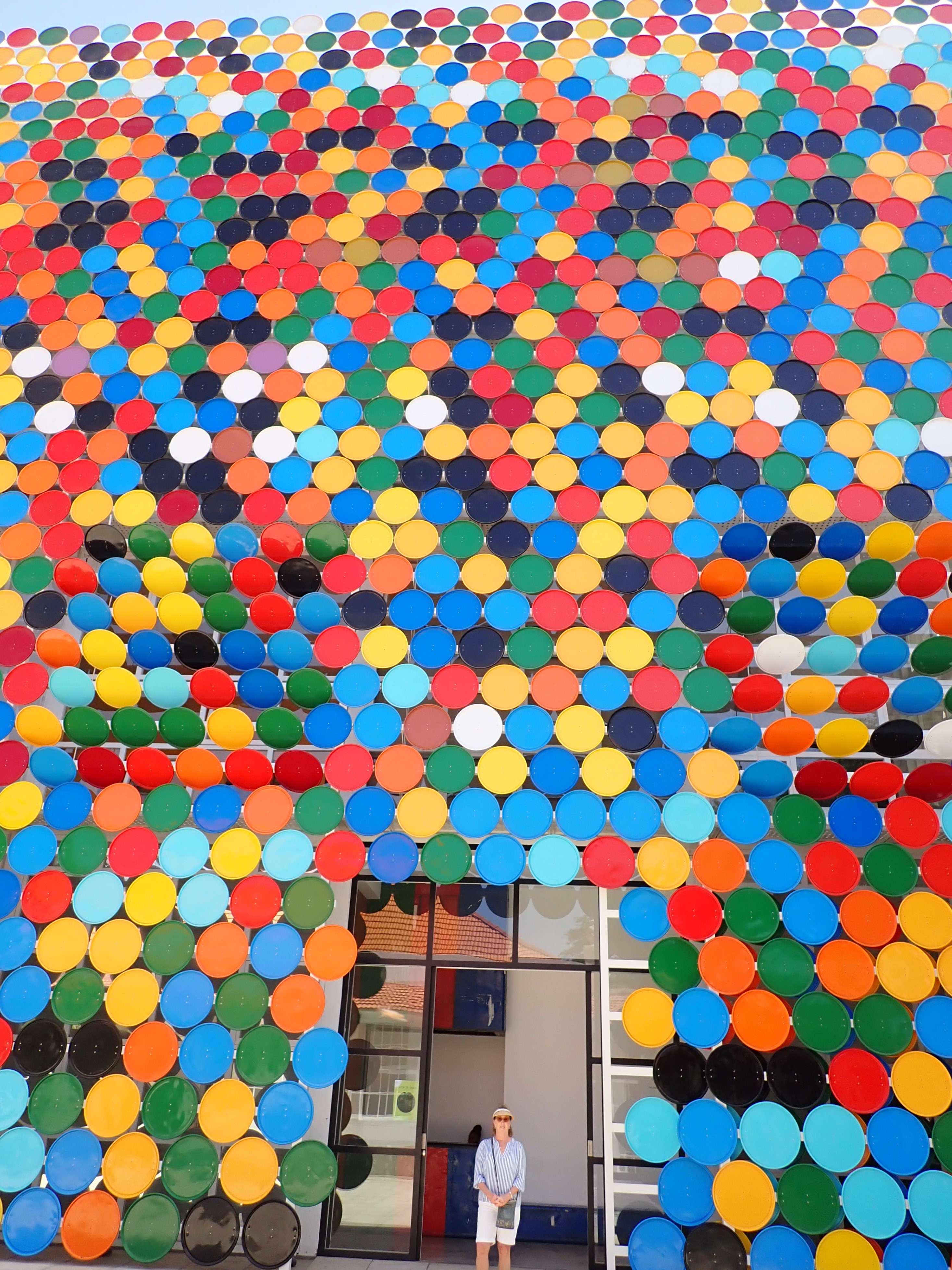
The exterior of the Art Gallery is vibrant with its painted 55-gallon drum lids (all 2,532 of them)!

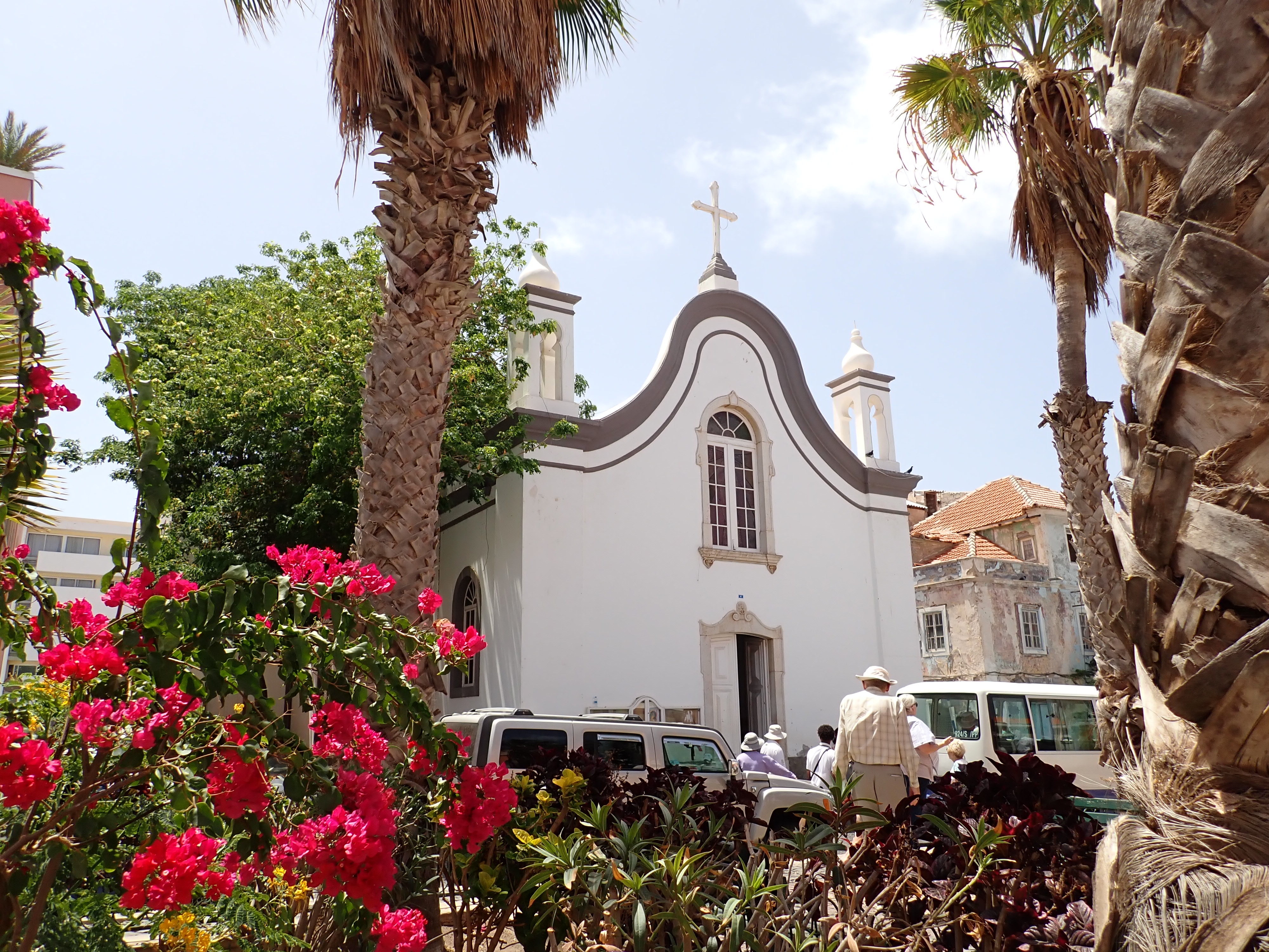
Cobblestone streets lead past the University, Peoples Palace and the Nossa Senhora da Luz Church built in 1862.

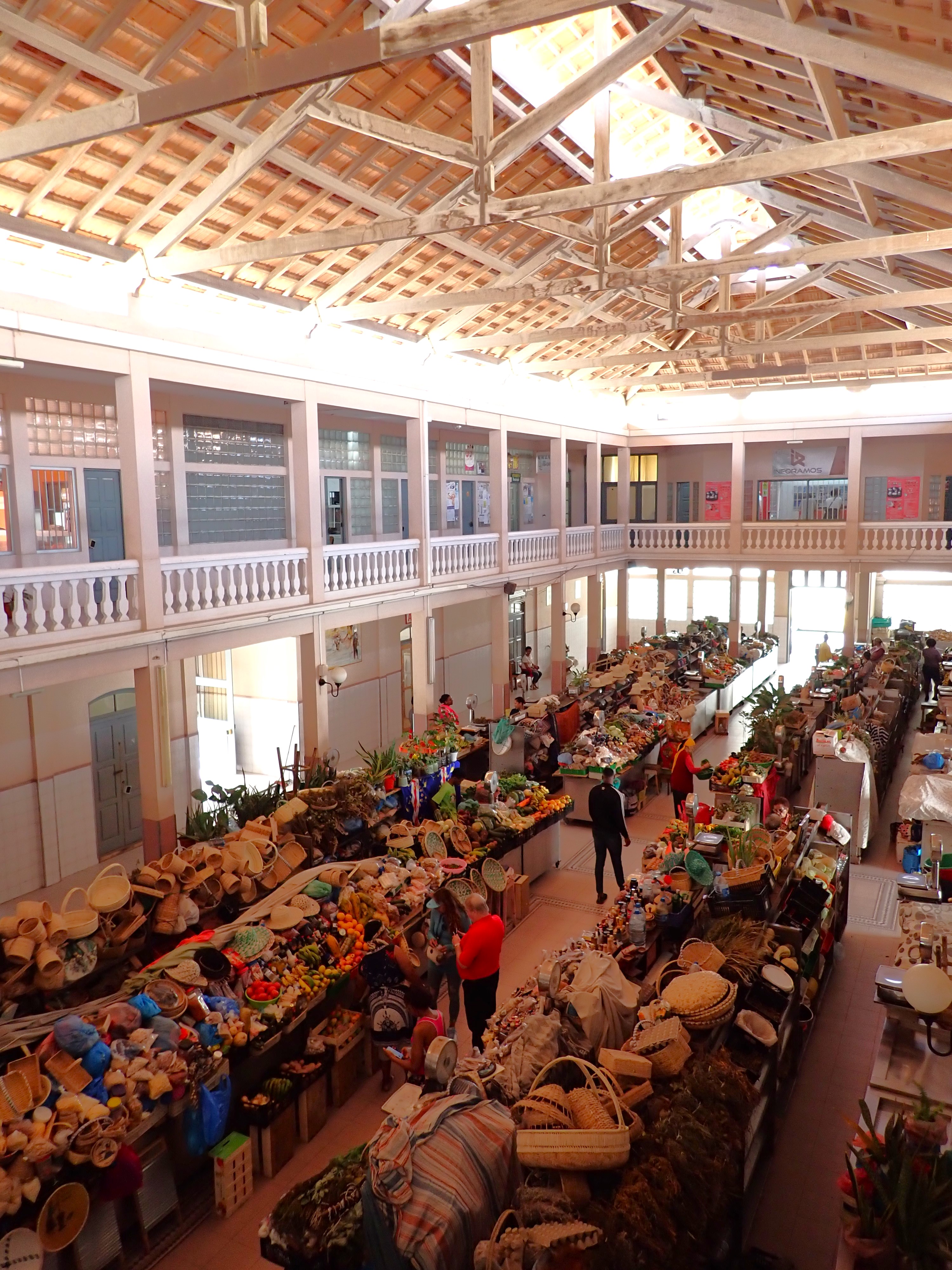
The handsome and well-preserved colonial building houses the Municipal Market. 

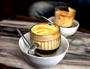
Not only were the sights a delight, but so was the “café cremoso”, a soft-serve coffee gelato served in a champagne flute. To this, the Portuguese say, “Muito Bom” (very good)!

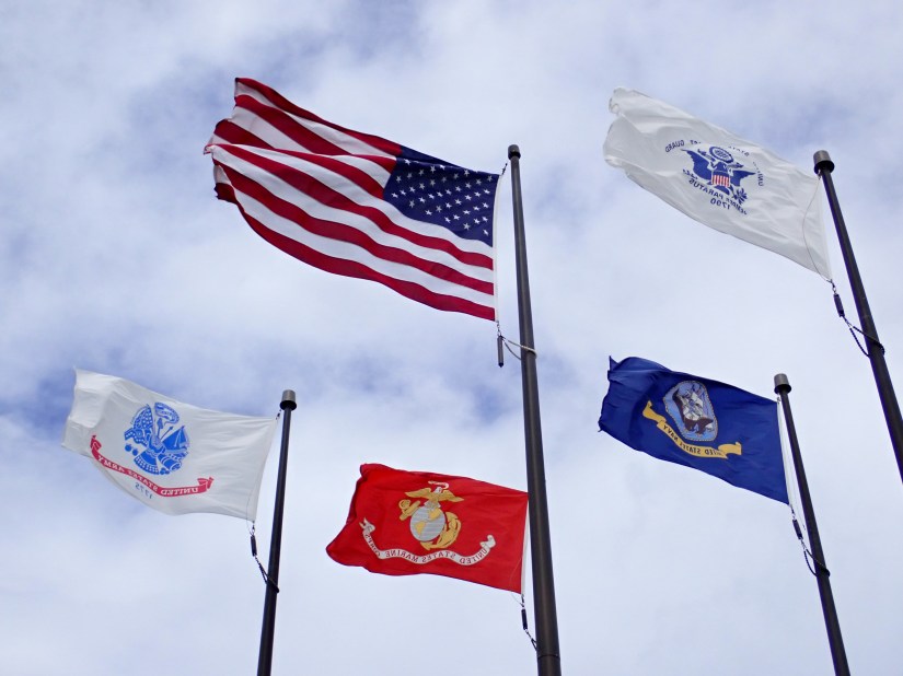
A four-day passage on calm seas brings us to some familiar ‘ground’ … Puerto Rico. Zuiderdam docks in Old San Juan as we view the cityscape. There’s a powerful emotion that rises in your heart when you see an American flag flying proudly after being away for some time.

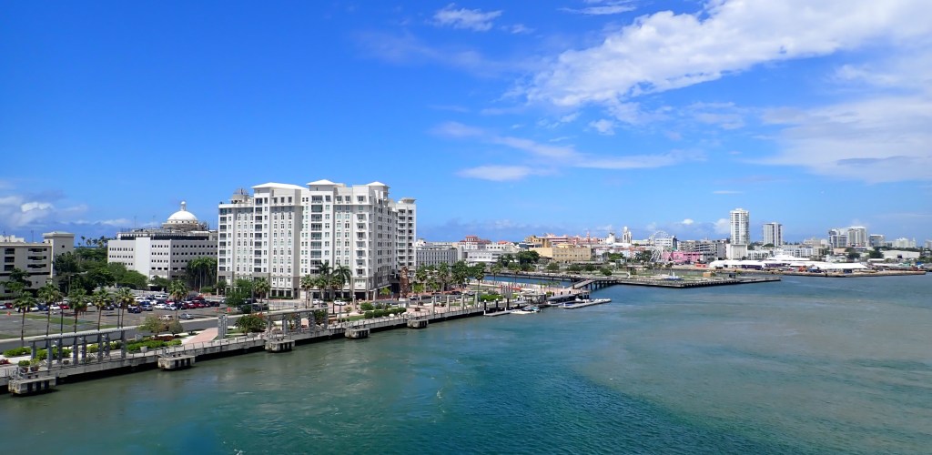
It’s our last stop, and a relatively short one.  Our 3pm arrival doesn’t leave room to be idle before our evening departure, so we disembark quickly and head up the hill into town. There’s nothing ‘old’ about Old San Juan…it’s always vibrant, boisterous and beautiful.   

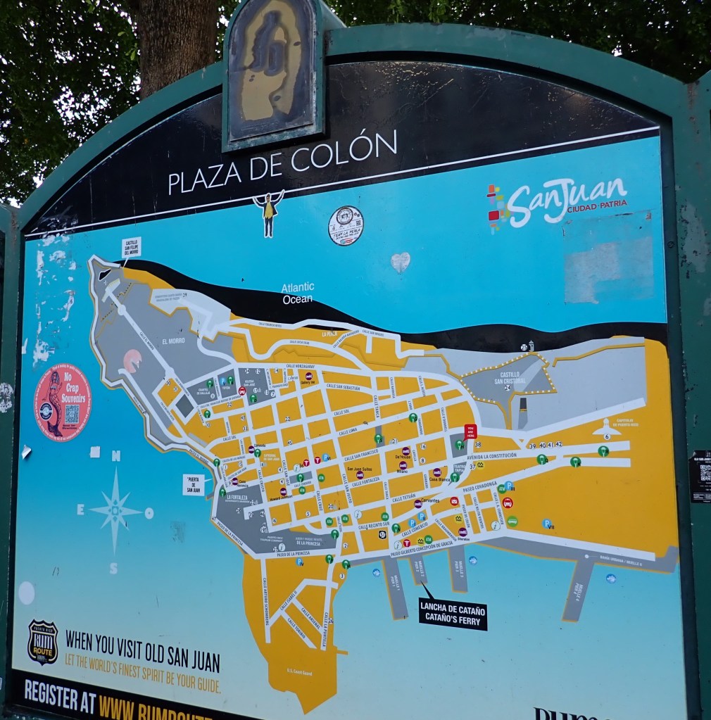
Celebrating over 500 years of history (relatively young compared to some of the places visited on this journey), San Juan displays an old-world charm, with many of its historic buildings lovingly preserved and maintained. 

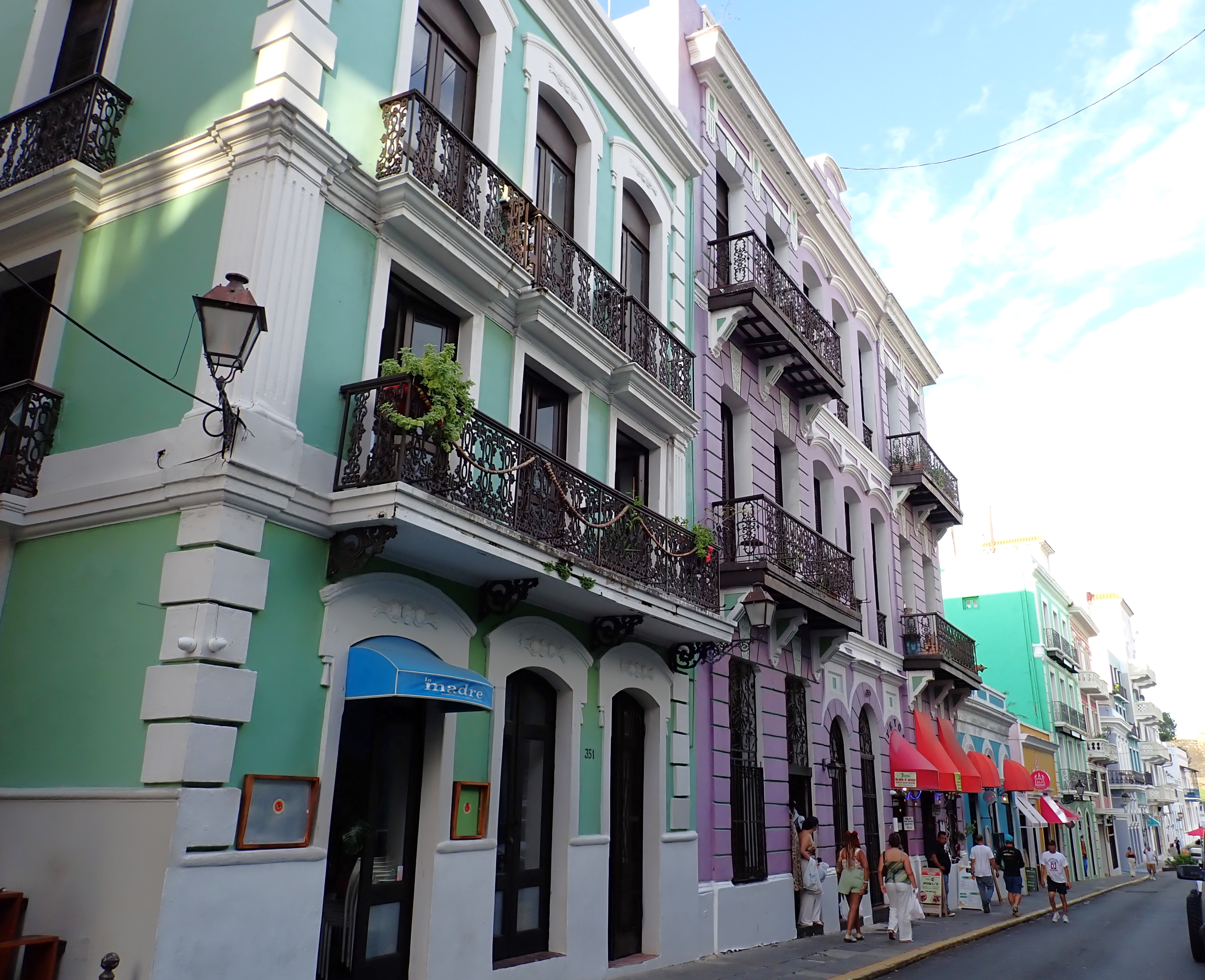
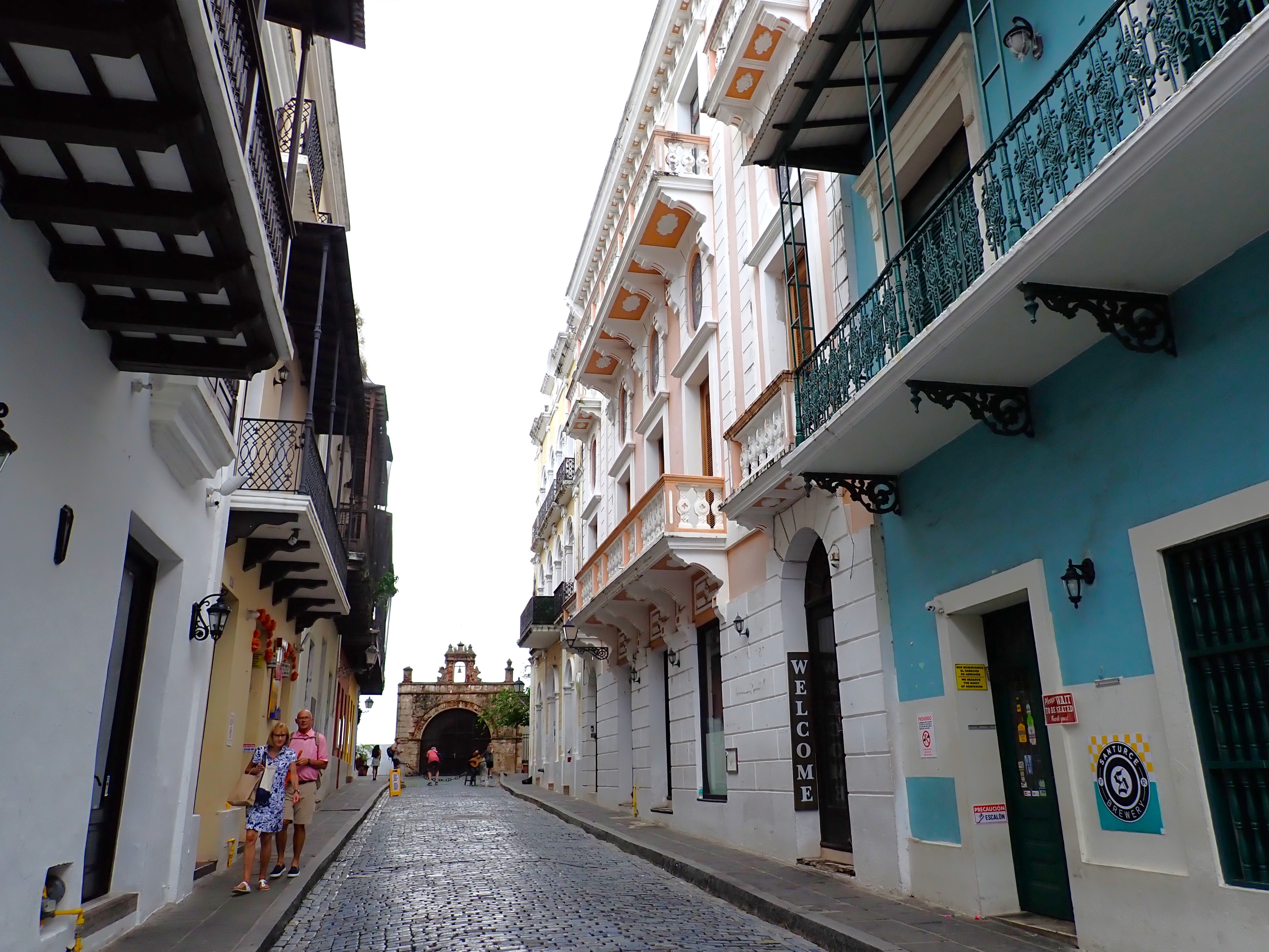
We meandered through the narrow streets, enjoying unique shops, cafes and restaurants, including the birthplace of the Pina Colada. 

The setting sun seemed to accentuate the aromas coming from eateries, like the local favorite, mofongo, prepared with green plantains.   As the city begins its transition to nightlife, we return to the ship for our departure and watch as the twinkling lights fade in our stern.  We have two sea days in which to pack, say goodbyes, and participate in many end-of-cruise celebrations. 

Homecoming:  Fort Lauderdale, Florida, The U.S.A.   After her final 979 nautical mile run from San Juan, Zuiderdam finds her way back to her familiar Fort Lauderdale pier in the pre-dawn darkness.  It may be early and quiet ashore, but aboard, the entire ship is buzzing like a beehive. Throughout, it’s a barrage of luggage, announcements, hugs and tears, last Lido breakfasts, burdened elevators, and a general sense of bittersweet:  sad goodbyes, as well as the excitement of going home to friends and family.

We take with us the memories of 37,809 nautical miles traveled in 128 days, visiting 24 countries and 44 ports.  And we can’t say enough about the wonderful friendships we’ve made along the way (both aboard and ashore) with whom we will always be connected through shared experiences. 

Goodbye, Zuiderdam….Until next time!

We return home feeling humble and small on this big, blue, beautiful planet we live on. It’s an extraordinary privilege to travel to distant shores, each place a learning experience on so many levels. It’s true what they say: the more borders you cross, the more your mind opens.

But it can also be said: There’s no place like home. And so, until next time, we’re content to enjoy the peaceful and scenic surroundings of Wisconsin and explore the magnificent Mississippi River in the Driftless Region. Home Sweet Home:

“One’s destination is never a place, but a new way of seeing things.” – Henry Miller

2024 World Cruise, Cruising, Travelogues

Leg 7: Maldives, Seychelles & Zanzibar

Located southwest of Sri Lanka, near the equator in the Indian Ocean, we find The Maldives, consisting of 1,192 low-lying coral islands grouped in a double chain of 26 atolls.  It spans a territory of roughly 35,000 square miles, but a land area of only 115 square miles.  Malé, is the Maldives largest island and its capitol, where we will anchor for two days.

Tourism is the largest industry here, but tuna fishing also contributes, with 100,000 tons caught annually. Hence the tuna canning facility in port…which you can smell before you see it. Beyond that, the sprawling city takes over.

Malé cityscape

When you think of idyllic island chains, population usually doesn’t come to mind.  So, it was a big surprise to learn that the density in Malé is greater than 60,000 people per square mile! 

This is an aerial view of Malé

Vertical construction of apartments continues to keep up with demand. The highest natural point in the Maldives is only 7’10” above sea level.  But based on studies, it is feared that 80% of the present land mass may not be inhabitable in future due to climate change and rising sea levels.  With that in mind, there have been plans and completion of some artificial islands and land reclamation.

Most visitors fly into Malé airport, but rarely stay on the main island.  Rather, they seek the solitude of its neighboring island resorts rimmed with white powdery sand and warm turquoise waters.  And, as we are visiting during Ramadan on this Islamic nation where no other religion is legally practiced, few places are open.  Therefore, a group of us from the ship obtained a day pass at the Club Med Kani for the first of our two-day port call here.

A 40-minute water taxi ride brings us alongside their long dock, and their beautifully manicured and lush grounds. 

The shallow crystal-clear lagoon beckoned us to escape the heat and humidity.   We anticipated refreshingly cool water but found the top six inches to be the warmest open water we’ve ever encountered.  It was gorgeous at any temperature!  

After a spectacular buffet lunch on the beach, four of our group opted for the Club Med 2pm daily snorkel tour. But first, each of the 36 participants had to swim a 50-yard distance to a buoy and back to demonstrate our capabilities in the water. Having passed the test, we were loaded into two boats and headed north towards what we hoped would be a good reef. But once everyone was in the water, we merely swam hard against current, some chop, no coral and few fish in poor visibility. Then reboarded and returned.  It was an odd 1.5-hour exercise of futility.  Perhaps not the best snorkel, but hey, we’re in the beautiful waters of paradise…no worries!

Back ashore, we rejoined our group in the pool, which was almost as warm as a hot tub.  We held court for another hour before taking the Club Med water taxi back to the main harbor, and then tendered back to Zuiderdam for the night.

For our second day, our aim was to vindicate yesterday’s snorkel.  A few of us set out again, this time aboard a dedicated snorkel boat to renowned locations, including a spectacular sand bar.  The sight was as surreal as a screen-saver image.

The crew launched a small plastic boat with would float those who didn’t want to wade or swim, as well as our umbrellas or any other gear out to the sand bar.  In any direction, white sand and aquamarine water mingled in depths 2 feet or less.  What a sight!

Reboarding the boat, we head for the first of two snorkel sites.  The first was against a quay wall, shouldering an unremarkable narrow rock shelf, but home to a large eel.  

But the real show were the schools of fish and 7 large sting rays that swam with us the entire time.  It was incredible! 

So many fish, they were practically bumping into us

Our next snorkel stop was equally good, but an entirely different profile.  The shallow water of the atoll’s rim sheltered colorful, tropical fish.  

Beyond the rim, the wall fell sharply and plummeted down into deep blue depths.  Sharks came and went, giving a thrill to those who had never had the experience of swimming with them. 

Leaving the Maldives, we will cruise 1,264 nautical miles over 3 days to arrive in the Seychelles for another overnight stay. 

Goodnight and goodbye, Maldives!

The Republic of the Seychelles consist of 115 islands; some granite and some are atolls.  Zuiderdam pulls into the Port of Victoria, the capital and largest city on the island of Mahé .

Our approach to the island of Mahe in the Seychelles

Victoria’s population is about 27,000.  Tourism is an important factor in their economy, and the principal exports of Victoria are vanilla, coconuts, coconut oil, fish and guano (used for fertilizers).    

City highlights include Immaculate Conception Cathedral (Roman Catholic), “Little Ben” clocktower and the Botanical Gardens where you’ll find the rare male and female palm trees of the endemic Coco de Mer, the largest seed in the plant kingdom.  This suggestively shaped coconut can weigh up to 65 pounds! To learn more: https://en.wikipedia.org/wiki/Legends_of_the_coco_de_mer

Ten of us met with Derek, a well-spoken local who introduced us to his 15 x 3.5-mile island that abounds with forests, beaches, turquoise water, and golden sands.

Seychelle beaches are known for their iconic boulders, similar to those of The Baths on Virgin Gorda, BVI.

Gorgeous vistas met us at every turn.  The elevation of the Morne Seychelles National Park, the Mission Lodge and the Tea Factory, all offered breathtaking views of the western coast of Mahé.  Lush mountainsides sloped into the deep blue ocean. 

View from the top

Eventually, the distant rain caught up with us while we were having lunch at the beachside, Del Place Restaurant, in Beau Vallon Bay.  Perfectly timed, the rain poured while we enjoyed fresh red snapper and tuna on their open-air veranda.    

Once the rain had passed, we made our way to Takamaka on the southwest coast, finding a secluded little beach bar within the tangle of mangroves.  We also came across a few of the 6,000 giant tortoises that roam freely on the island.  Thanks to Derek, we got to know this lovely island above sea level.

Beach lovers paradise!

Exploring below sea level came with the help of Atoll Divers on Day 2.   Eight of us took a taxi to the east side of the island to meet Sebastian, Shrimp and Sam for a morning above and beneath the water.  Four of us went scuba diving, and four snorkeled. 

Divers ready! Photo credit: Cathy C.

The highlight of the dive was an entire herd of bump-head parrot fish that grazed past us like buffalo! 

Despite being herbivores, these fish are enormous, growing to lengths of almost 5 feet and weighing up to 165 pounds. They’re known to hang out in small groups (we saw 7) with personalities that can be quite curious and gregarious.

Transferring from shore to boat and back was this creative float! Photo credit: Jim C.

The Seychelles were absolutely spectacular and has been placed on our short list of places to revisit! From here, long swells push Zuiderdam westward over a two-day trek of 1,125 nautical miles to Zanzibar, Tanzania.

Welcome to Zanzibar!

Zanzibar deserves all the exotic images that your mind might conjure up when thinking of this Spice Island located off the east coast of Tanzania, Africa. 

It’s a gray and rainy morning as Zuiderdam sets her anchor for the next 2 days.  We tendered to the ferry dock already buzzing and crowded with people, luggage, chickens, and cargo.  

It feels like we’ve stepped back in time, especially in the historic Stone Town district with its narrow passageways, aromatic markets, and traditionally dressed locals; women wearing khanga dresses and men in their kofia hats.

Centuries of being on the dhow trading routes have evolved into a rich, blended culture.  A long and complicated history, as well as occupations by Portuguese, Swahili, Indian and Arab can be seen in the ancient and ornately carved doorways, each bearing its influence.

Once the center of slave trading, Zanzibar’s dark past is memorialized by a somber sculpture and heritage museum on the grounds of the Angelican Cathedral, built in 1879 to commemorate the abolition of the slave market that once occupied the site.

The Old Dispensary completed in 1894 used as a dispensary in the early 20th century.  Restored in 1990, it now serves as a symbol of the diverse architecture.

The Old Dispensary

As a side note of more modern history, Zanzibar was the birthplace of rock band Queen’s Freddie Mercury who, at the age of 17, fled with his family to the United Kingdom during the Zanzibar Revolution in 1964.  His childhood home serves as the Freddie Mercury Museum.

We followed labyrinths of passageways leading to the Darajani Bazaar and markets:  vegetables, spices, fish, meat and live poultry.  All colorful, even on this rainy day. 

Open-aired and aromatic, all the meat butchering and fish fileting happens on site in the markets.

Throughout the Bazaar, you can find everything from textiles to household goods. 

“Home Depot”

Taking a break and getting out of the drizzle, we sought refuge in the covered rooftop café of the Swahili House.  The 125-year-old, 5-story hotel was originally used as an Indian merchant house, as well as home to a Sultan family.  Restored to its original state, it provides a 360-degree view of Stone Town and the Indian Ocean in the distance. 

The light rain finally stopped while we strolled along the waterfront, back towards the ferry dock and our return to the ship for the night.

Another soggy day was in the forecast, so we thought we might as well fully immerse, and arranged for an impromptu scuba with One Ocean Dive Center.  We boarded their heavy, wooden planked dhow and headed out to the reef in the rain.

While ideal visibility came and went, it was a fascinating dive with mounded reef structures, bubble coral, and lots of clown fish scuttling within anemones.  So many different varieties of anemones, including neon pink, which we’ve never seen before. There was also an abundance of brightly colored nudibranchs. 

Clown fish
Bubble Coral

But the best surprise our first mantis shrimp!  These aggressive, carnivorous crustaceans really pack a punch…the same velocity as a gunshot, which stuns their prey. It was about 8” long, strolling along the front of some coral and was certainly not intimidated by our presence.  In fact, I’m pretty sure he was taunting us to challenge him in a fist fight, LOL!

Mantis Shrimp

Even with two days in Zanzibar, we only scratched the surface of this vibrant island!  Had we more time, we would have explored the spice farms, Persian Baths, the Jozani Forest and its monkeys, as well as the many beaches and neighboring islands.  There’s plenty more to see if we ever return!

Leaving Zanzibar, we will drift down the east coast of Africa for 1,400 nautical miles to Maputo, Mozambique.   More to come!

2024 World Cruise, Cruising, Travelogues

Leg 6: Vietnam, Singapore, Sri Lanka

Vietnam was next on our itinerary, and it seemed the newspaper headlines of the 1970’s still echoed in my mind as I tried to imagine what the country would be like.  But in the decades since, this country of 100 million people (and 50 million motorbikes/scooters!) has certainly evolved and holds many surprises. 

Tourist arrivals have briskly risen over the years, calling attention to its beautiful landscapes and 3,000 kilometers of coastline.  And did you know Vietnam is the largest producer of cashew nuts and black pepper?  It is also a major exporter of coffee and rice.  With a currency exchange of $1 USD equaling 24,806 Vietnamese Dong, our cash may go very far.

We are visiting two ports:  Da Nang in the central region, and Phu My, a southern port that will serve as access to Ho Chi Minh City.

We have left the cooler climates of our northern wake. Ambling down the gangway in Da Nang, we are engulfed in the thick, hot and humid air.   

Our shipmate friend, Lydia, has organized a day’s outing for 8 of us to go and see The Golden Bridge, a scenic overlook and tourist attraction.  Our driver, Mr. Ha, met us outside the commercial port gate and we got a glimpse of Da Nang’s center as we merged with the morning commuters riding scooters.  

The skyline of Da Nang in the distance

The city quickly fell away to lush tropical and rural farmland.  An hours’ drive WSW brought us to Ba Na Hills.

Opened in 2018, The Golden Bridge made TIME magazine’s list of “Top 10 best destinations in the world” and has been recognized by The Guardian as “The most impressive pedestrian bridge in the world”.   What we didn’t know, was that it was within the Sun World Park, an extraordinary and massive entertainment complex. 

We purchased tickets and began our ascent of 4,600 feet that included a series of long escalators and then perhaps the span of another mile by aerial cable car.  

Stepping out of the cable car, we stepped into another world!   Our mouths practically agape, we followed the stonework ‘street’ into the dream-like grandeur of a medieval French Village. 

Including hotels, cafés, floral courts, theaters and sculptures.  The attention to detail, craftsmanship and the assumed fortune spent to create all of this was mind boggling.   Turn after turn, we were amazed. 

After a lot of discovering of what we didn’t know we were in for (but were delighted), we finally came to The Golden Bridge, a 490-foot-long pedestrian bridge overlooking the dense green mountains and gorges, being held by a pair of hands.   It really was eye popping!

Returning off the mountaintop was just as exhilarating over the lengthy cable car ride back down, as we all chattered away in amazement of what we had just witnessed at Sun World.

A delicious beach-side restaurant for lunch, then dropped a few miles south to Hoi An.

As we approach the outskirts of Hoi An, new high-end resorts are popping up along its beach strand. But the real draw here is “Old Town”. 

Old Town Hoi An is a UNESCO World Heritage site and is said to be a well-preserved example of a Southeast Asian trading port dating from the 15th to the 19th century.

Old Town Hoi An

We found it to be a charming village with narrow streets lined with shops, restaurants, small temples, and colorful lanterns everywhere.  And lots of street vendors!

The riverfront, bridge and lantern boats offer a riot of color.

It is situated along the Thu Bon River, where tourists can hitch a ride aboard a lantern boat to view the town from the water, especially at night.  

Lantern boats are a popular way to view both sides of town at night
Hoi An has a lively night scene.

Zuiderdam heads south 500 miles overnight to our next port: Ho Chi Minh City (formerly known as Saigon) is known as Vietnam’s manufacturing hub and home to 9 million people.  Its gritty façade and busy roadways are packed with boisterous scooters stampeding forward at every green light.  And they load their scooters very creatively!

The guy at the end of the above video wins the prize for most cargo aboard!
Scooter Nation

A mix of big city wealth, tiny back-alley shops and farmers living in rice fields beneath thatched roofs along the Saigon River are all found within the city limits. 

Our local guide, Loc, was born here in the 80’s and learned English by listening to songs, saying that English and the internet changed his life.  He is well-traveled in the U.S. and a few years ago, began his tour company in Ho Chi Minh City.   We enjoyed his enthusiasm, humor and knowledgeable about the history and culture of Saigon and Vietnam.  Today, he would guide us through the city highlights and introduce us to new foods along the way.   

We began in the old city, Chinatown in Saigon, and walked through the Thien Hau Temple. Passing through an iron gate, you cross into the small courtyard of this ancient Chinese-style temple, completed in 1760.  

Along the roof, there are small delicately fashioned porcelain figurines expressing themes from Chinese religion and legends.

Lanterns and wooden models of Chinese theaters hang over the entrance and the smell and smoke of incense was thick. 

The banks of the Saigon River are lined with traditional wood-planked keel boats serving as their home and transport for the Mekong Delta River dwellers and farmers.  Entire families, dogs, birds, and all they owned were aboard.  

The complex and extensive river system of the region are vital to the distribution of their fruits, vegetables, animals, and a wide variety of goods.  We stopped by this floating fruit market for a quick drink like the locals do:  a straw shoved into a coconut for its refreshing coconut water and some jack fruit, which tastes much like Juicy Fruit gum.   

Back on the street, a common snack bought from push-cart style vendors is called banh quai vat.  It’s sort of like an empanada…golden pastry stuffed with mushrooms, pork and potato and sweet potato.   Hot and filling!

Loc ordering our Banh Quai Vat’s

Pho (Vietnamese pronounce it “faaa”) is a traditional dish featuring broth, noodles and a protein, often eaten for breakfast and lunch. With over 3,400 Pho restaurants in town, Loc brought us to his favorite.  We ordered the lean beef, bean sprouts, fresh basil, lime which cost roughly USD $2.00.   Along with a cold Saigon Beer, it was a hearty meal.    

In Vietnamese, “ chuoi ” means banana, “ nep ” means sticky rice and “ nuong ” means grilling. Therefore, Chuoi Nep Nuong  perfectly describes the dish, which features ripe bananas wrapped in sticky rice. The banana sticky rice rolls are then wrapped in banana leaves and grilled until the outside is golden. Then unwrapped and served with coconut sauce, toasted sesame, and toasted coconut.  Sweet, chewy and tasty.

The shopping experience here is similar to other countries we’ve visited, where all like commodities are clustered on the same street or block.  This makes for some tough competition. And for the shopper, it’s like walking the gauntlet!  We walked through the fabric/sewing/button alley, which was next to the fish aquarium supply district, and adjacent to the decorations area where one would go to buy a dragon ‘float’, for instance.  Each shop owner sold their wares on the street level, while living in the apartment above.    

The colorful and exciting Vietnamese dragon dance is performed during Lunar New Year and other important holidays or occasions and is strongly believed to dispel evil and bring good luck, prosperity and wealth. An entire street is dedicated to these shops.

Dragon shop

We visited the “Secret Basement”, an underground storage arsenal for the Independence Palace attack by 19 soldiers of the Saigon Special Force during the Tet Mau Than in 1968.   Back then, there were 220km of underground tunnels containing more than two tons of various weapons such as B40, AK, carbines, pistols, grenades, gun powder, TNT, C4 and other war equipment devices.  It also had a system of compartments in the ceiling with locks, ropes, and hooks to close when entering inside, lock the door and move to the neighboring houses or to the floor, then withdraw safely.   

We had to lower ourselves through a 24” x 24” secret hatch through the tiled floor to find the only room still accessible for viewing.  The rest of the tunnels and rooms have been sealed off.

We also passed The Rex Hotel, which served as a residence for U.S. officers and a bustling hub for war correspondents. The daily U.S. briefings on its infamous rooftop garden became known as “The 5 O’clock Follies”.

And finally, our last stop was for Egg Coffee.   It is a Vietnamese drink traditionally prepared with egg yolks, sugar, condensed milk and robusta coffee. The drink is made by beating egg yolks with sugar and condensed milk, then extracting the coffee into the cup, followed by a similar amount of egg cream, or egg yolks which are heated and beaten, or whisked.  It was incredibly rich and delicious!

Vietnam surprised us in many ways, and we would enjoy visiting again to explore more of this fascinating country. 

Spectacular Singapore!   Yes, it has the second highest population density of any country in the world, yet due to their innovative urban planning, it doesn’t feel as crowded as some of the enormous cities we’ve visited recently.   Modern and clean, Singapore boasts some of the world’s most iconic architecture.  It’s a diverse mix of Chinese, Malay and Indian influences along with the tropical climate that 1 degree of latitude brings.  We were anxious to revisit this dynamic city for an entire weekend!  

Singapore at sunrise, where we will join the Queen Elizabeth II, already in her berth.

One of the best things about Singapore is their subway system, or MRT, which is spotless, and quite easy to navigate!  

Over the two days, we made it to all the interesting neighborhoods like Ann Siang Hill, Little India, Clarke Cay, Chinatown and Dhoby Ghaut, each with their own vibe, foods, music and ethnic apparel. 

There are also tons of interesting sites to visit, many along the vibrant waterfront. The MerLion, Singapore Flyer Ferris wheel, and the architectural spectacle of the Marina Bay Sands Hotel.  

Its surrounding complex is impressive by itself, which includes museums, shopping, eateries, and entertainment all rolled into a vibrant cityscape. 

Speaking of the Marina Bay Sands Hotel, we had the privilege to join shipmate friends for lunch at Spago’s on the 57th Floor.   Many thanks go to Jo for making reservations a month ago!  It was a gastro-phenomenal, prix fix lunch with great conversation and magnificent views!   

Situated next to the Marina Bay Sands complex are the Gardens by the Bay.  This 250-acre park features domed conservatories which are home to rare and exotic flora and fauna, as well as their iconic Supertree Grove.   There are 18 man-made “trees” that showcase a vertical garden by day, and are a spectacular light show by night.  The tallest is sixteen stories tall, providing a shady grove to wander.    

That evening, we found bustling nightlife in the Clarke Quay area, where we dined alongside the river at an Indian restaurant and watched the constant parade of people, riverboats and the twinkling lights of this beautiful city. 

Our 2 days in Singapore flew by!

Goodbye, Singapore!

Zuiderdam has now carried us 22,977 nautical miles on this journey.   Our next passage takes us through the Malacca Strait onwards to Sri Lanka, some 1500 miles away. 

After three days at sea, we reached the Port of Colombo in Sri Lanka. This island country of 268 miles long and 139 miles wide, has a population of 22 million people.   Its Indian Ocean location is a crossroads of many cultures, languages, and ethnicities. 

Cultural dancers welcoming the Zuiderdam’s arrival in Sri Lanka

Tom’s Birthday begins with the breakfast crew singing and presenting a special cupcake.  The celebration would continue throughout the day with our shipmate friends!

Happy Birthday, Tom!

Today, eleven of us including tour guide, Buddhi, board our private 25 passenger bus for the town of Kandy, located in the interior.  Some scenes from along the way:

A 3-hour drive brings us to an Elephant Orphanage & Sanctuary, where these sacred, gentle giants are raised, cared for and/or rehabilitated.  The daily trek of dozens of elephants through the village to the river is a sight to see!

As you can imagine, it takes a small army, LOTS of food, and even more funding to provide continuing care for these incredible animals.   That’s where Poo Paper comes in.  (Caution: The following image may be disturbing!)

If the sign in the store window doesn’t grab your attention, this graphic statue will!

Yep, the elephant dung is processed, pasteurized, bleached or colored, and placed into molds to make thick, pulpy paper that is made into a variety of goods.  Bookmarks, stationary, calendars, etc.  All the proceeds go back into the Orphanage to help offset operating costs. 

Several of our group chose to ride and bathe an elephant in the adjacent river. 

Having ridden an elephant in Thailand years ago, Tom and I passed.  But we all enjoyed feeding fruit to the elephants who were eager to receive our offerings.

Sri Lanka’s trademark national export is Ceylon tea.  The Kadugannawa Tea Factory is where we watched as tea was separated, sifted, and fermented into various blends and types.  

Sampling a nice hot cup of Ceylon tea afterwards was a treat.  For sweetener, this part of the world uses a natural brown coconut sugar instead of the refined white table sugar we are accustomed to.  The coconut sugar is said to have a lower glycemic index, a few more nutrients and less processing.

The Kadugannawa Tea Room

Our late lunch was buffet-style at a resort restaurant, offering curries, coconut fish, rice, salads and desserts.  Some of it quite spicy!

Our tour included an end-of-the-day, 60-minute massage for only $15.  After 7 hours in a small bus, it was the perfect remedy to get our kinks out.  We all disappeared into various rooms; Tom and I sharing the same.   Without much English spoken by our masseuses, it was too late to object to the liberal amount of oil they used on each of us, beginning with a scalp massage and working south.   When our entire group rendezvoused in the lobby afterwards, we all laughed as we looked at each other’s slick hair and greasy body shine! 

Oily massages being given behind closed doors..

It was dark when we returned to Colombo, giving us spectacular views of the Lotus Building and its oscillating colors.  We enjoyed Sri Lanka and all it had to offer!

Leaving Sri Lanka, we cut through the placid Laccadive Sea on our way to Maldives, a 24-hour sail.  The sea was so calm that it appeared we were sailing on deep blue satin.

Stay tuned…

2024 World Cruise, Cruising, Travelogues

Leg 5: China

Welcome to China:   Where multiple drones orbit our ship as we dock.  Access to in-room viewing of BBC, FOX, MSNBC and other channels are mysteriously and temporarily unavailable.  We’re told that the government monitors the internet, as well as has impeded our access to Google, Facebook, WhatsApp and other communications of the free world. Curfew begins at 11pm until 5am.   Passports are scrutinized, and cameras are everywhere.   All Women’s public restroom toilets are now porcelain floor troughs, and you must remember to bring your own toilet paper. And sanitizer, as there’s never any soap.  (We sure do miss the Japanese bathroom engineering now!)

They must also have been worried about what we may be bringing ashore from our cruise ship, as evidenced by their “Welcome Mat”!

But on the bright side, we are here to discover the Chinese cities of Shanghai (2 days), Dalian and Beijing (2 days). 

Shanghai Financial District

Shanghai, a vibrant city of 24 million people with an electric nighttime skyline.  What better way to get a fast overview of this big city, than to take the Maglev train? This astonishing magnetic levitation train reached a speed of almost 200 mph as we took its 8-minute ride to the airport, 18.6 miles each way.  It was fast, smooth, clean and quiet! https://en.wikipedia.org/wiki/Shanghai_maglev_train 

After that, it only took us 44 seconds to go up 88 stories in the Jin Mao Tower for breathtaking views of the city.  Jin Mao is part of the Big 3 towers, all adjacent to each other.  

Looking up at the Big 3 in Shanghai

The Shanghai Tower has highest post office at 2,073 ft and its elevator goes 47mph. And not to be left out of the notoriety, the Shanghai World Financial Center building is known as bottle cap opener. 

The “Bottle Cap Opener”

A couple of views from the top:

Another unique mode of transportation was taking the Sightseeing Tunnel beneath the Huangpu River to get to The Bund on the other side.   A light and sound show plays during the 80-foot deep tunnel transit in a cable-car style train which takes about 5 minutes.  

To sum it all up, we traveled the fastest, highest and deepest all withing a 2-mile space in Shanghai!!  We were truly “Shanghai’d”!

The Bund is a waterfront area along the Huangpu River and popular destination for visitors, offering shopping, dining, entertainment, and luxury hotels, including the Peace Hotel and Waldorf Astoria.  We strolled it for blocks, finding lots of unique sights. 

Remaining in town after sunset was a quite a sight for the eyes, as all the buildings came alive!

Our second day, we set out for Shanghai’s Old Street to see how things were before high-speed trains and skyscrapers. 

We found a slower way of life:  artisans, craftsmen, rickshaws, incense, cooking vats on the street corners with various local delicacies. 

Our only disappointing surprise was that the batter-fried prawns we ordered were not shelled, beheaded or deveined.  We opted for the fried dumplings as a snack instead…. very tasty!

Dalian lies 500 miles north of Shanghai, giving us one sea day to rest.    Located on the southern tip of the Liaodong peninsula, it is not a typical cruise ship port, but we found it has a lot to offer. 

Our warm and musical welcome to Dalian

Sometimes visiting a city on a Sunday can be a benefit.  While many places may be closed, the advantage is that you get a clearer picture of resident lifestyles.   

Today, we found a very joyous atmosphere in Laodong Park (aka Labor Park), where families and friends gathered to socialize and be in touch with nature. 

Groups of people were performing traditional dances, some in full costume, others practicing Tai Chi, martial arts, playing instruments, enjoying card games, walking dogs… all enjoying life.  The entire 252-acre park seemed colorful with all the activities. 

We stumbled upon a ski lift style cable car that took us up to the rim of the city for a magnificent view.  From the top, folks could also take a “land sled” on a metal track back down the hillside.  We thought it would be a little more like a luge, so didn’t purchase that method, but in hindsight, it looked tame enough and we would have tried it.  Next time! 

The view from the rim of the city

Leaving the Labor Park area, we meandered some local streets and the hardware area of town before coming to Russian Street.  The architecture here is from former Russian rule, and shops pander to the tourists with Russian goods of nesting dolls, fur hats and shawls. 

We found a small café to rest and have lunch.  As we were the only ones there, the owners invited us, via broken English, to share red tea with them.  Sure!   They demonstrated placing the loose red tea leaves into a porcelain pot, poured in hot water, steeped for 1 minute before swirling and poured through a strainer into another porcelain tea pot.  Then poured into very small round mini cups and sipped hot.  It was a wonderfully friendly gesture!   Sometimes a language barrier is best served by friendly actions.  It seemed the four of us understood each other perfectly, with few words and many smiles.

We bid Dalian an evening farewell.

Dalian in our wake

An overnight passage takes us the short distance from Dalian to Tianjin, the northernmost point of our circumnavigation.  Unfortunately, the commercial port lies 50 km from the city of Tianjin.  And further still, is the city of Beijing, another 100 miles beyond.  Therefore, over the next 2 days of our visit here, passengers will utilize LOTS of buses to visit the attractions:  The Great Wall, Tiananmen Square, Forbidden City, Temple of Heaven, and others. 

Beijing Day 1:  We set off aboard a comfortable coach bus on a hazy morning for a 12-hour day of touring The Great Wall of China and Ming Tombs.   Be it haze or smog, we’re not quite sure.  It will take 3.5 hours to our first stop. The highway from the port going inland was empty.  Sporadic clusters of high-rise apartments were interspersed with large tree farms.  

We were making good time.  Until we reached the Beijing city limits and its mandatory Police Check.  

Here, all 17 of Holland America’s excursion buses carrying approximately 700 people, were instructed to pull into a side lot for further scrutiny.  Apparently, the officials were declaring that we all require our actual passports, and not just the photocopies that were vetted and stamped by Chinese officials when we arrived in Shanghai.   An hour and a half later, we are released and allowed to proceed. 

Nearing the majestic mountains, we were awed as we came upon the sight of The Great Wall. 

Climbing the worn, uneven and often steep stone steps, we ascended to heights and breathtaking views of the Juyongguan section of The Wall.  Everyone wore a smile; delighted, despite the physical effort.   After all, we were experiencing one of the wonders of the world!

After taking in every step, view, photo, angle, and memory we could absorb, we reluctantly returned to our buses.  It was now well past 1pm and we all had worked up an appetite.  Our restaurant for lunch could handle hundreds of people in its large hall.  And was no surprise that we were all first paraded through their “conveniently located” jade and jewelry store before reaching the restaurant.  But growling stomachs were no match for their earnest store clerks, and we stampeded past the dozens of glass counters!

Each large round table featured an equally large lazy Susan, where a family style lunch was served.  Copious bowls of sticky rice, vegetables, saucy stir fry, kebobs and soup were circulated until emptied. With the mornings 1.5-hour police delay to make up, we hurried through lunch and continued our way onto the Ming Tombs Changling about 45 minutes away.  

Changling is the joint tomb for the 3rd Ming Emperor Chengzu (1360-1424) and his Empress Xu. It is regarded as the largest, earliest and best preserved one of the 13 Ming Tombs.

The structures glowed in the afternoon sun, as we walked through the peaceful, park-like setting.  The most ancient trees were tagged green if they were over 100 years old, and tagged red if they were over 300 years old. 

Dog-tired and happy to be back aboard again at 9:30pm after an exhausting 13-hour day of magnificent touring!   But another excursion is planned for the morning, so a good night’s sleep is needed.

Beijing Day 2:  It’s still dark when our 4:50am alarm wakes us.  A quick breakfast before meeting in the Excursion Staging area by 5:30am.  Several hundred of us are off the gangway by 6:00am for our days trek back into Beijing to tour Tiananmen Square, Forbidden City and Temple of Heaven; a 10-hour excursion.  We are blessed with a gorgeous blue-sky day without smog, which locals say is a rarity. 

Upon entering Tiananmen Square, you are immediately taken aback by its vast space. Through the Jin Shui Qiao Gate on the north end, its 109 acres easily accommodates the massive structures of the Great Hall of the People, Monument to People’s Heros, National Museum of China, Chairman Mao Memorial Hall and the Zhengyangmen Gate Tower, marking the south end of Tiananmen Square.  It was challenging to capture the scope of it into a camera frame.

Jin Shui Qiao
The Monument to People’s Heros and National Museum of China
Great Hall of the People

Stoic guards dressed in green military uniforms stand watch.  And there is a liberal police presence also. And cameras, lots of cameras.

Hours passed quickly as we ambled the entire length of the square and all its iconic views.  It was a memorable visit, indeed.

The sprawling 247-acre Forbidden City (Palace Museum) holds many treasures within, including thousands of buildings that are amongst the largest collection of preserved ancient wooden structures in the world.   

The tour was proceeding easily until we approached the security area for scanning of bags and passports.  There were already thousands of tourists here, and yet our guides claimed that today’s volume was not unusual.  Per Wikipedia, this UNESCO World Heritage site received 19 million visitors in 2019.

The lines were quite long and growing quickly.  Very vocal guards, police and security personnel herded people to file into the roped ques that zig zagged to eternity.  After 1 hour of the exceedingly slow moving que, the lines became even more congested and compressed until finally, there was literally a human crush surging forward around the last choke point.  The larger men of our tour took position to safeguard our groups place in line while going around the last turn.  This was much to the rebuke of the other tour guides trying to shove their way in.  It was getting a little sketchy.  For the last 30 minutes in line, we were all compacted as sardines and it was quite uncomfortable physically and mostly, mentally.  I’m glad neither of us is claustrophobic, as it would have been impossible for anyone who was.

However, once we were through, we were rewarded with the beauty and tranquility of the Palace and the Imperial Gardens on the other side.  The scope of the opulent architecture was extraordinary.

Lunch finally commenced at 2pm, and we still hadn’t visited the Temple of Heaven.  Not to mention a 3-hour anticipated commute back to the ship.  All aboard time is 5:30pm today.   But, as many other excursions were also running late, communications between ship and tour operators advised that the ships departure would be delayed until all buses were back.

Temple of Heaven was built in 1420 and is really something to behold.  Maybe the biggest space yet, at 675 acres, it commands an enormous space within the city of Beijing.  It was the site on which emperors of the Ming and Qing dynasties offered sacrifices to Heaven, prayed for rain and a good harvest. 

A glimpse into the Temple of Heaven interior

Two very long days in Beijing, but worth every step of the 13 miles we strolled through incredible sights and history.

Zuiderdam makes her way 1400 miles south through the East China Sea and the Taiwan Strait towards Hong Kong.  This passage will give us three days to recover from a marathon tour of China this past week, as well as download hundreds of amazing photos.

Our arrival into Hong Kong is shrouded in fog:

Hong Kong may be the most frenetic city I’ve ever been to.  The dizzying vertical sprawl, compressed population, clamor, aromas, neon, the zooming pace of people, vehicles, scooters, bikes; everything in motion all the time.   With 7.4 million residents of various nationalities in a 426 square mile territory, Hong Kong is one of the most densely populated territories in the world.

You would need more than a week to see it all; we have 2 days.  We begin with taking a tram up to Victoria Peak, 1811 feet above sea level. 

Unfortunately, the forecast is for 2 days of fog, not uncommon in the Spring.  At least we are back in temperatures of high 70’s/low 80’s. 

This sign shows the view we should be seeing in the distance, LOL!

We have better luck at sea level in the Stanley Market area, where a strand of beautiful beach hosts quaint cafes and a renowned shopping district. 

The original fishing village of Aberdeen showed us how ‘it used to be’, complete with a sampan ride around the harbor. 

To get a taste of the colorful nightlife of Hong Kong, we taxi’d to Temple Street to witness the melting pot of people, bright lights and lanterns, every kind of street food, performers, and music. We snacked on Asian Cucumber Salad and Dumplings before taking a taxi back to the ship. 

Hong Kong Day 2:   We begin at the Peninsula Hotel and awe at its finery, including fleet of Rolls Royce cars.   From there, our walking route took us by the Starr Ferry terminal and up the Tsim Sha Tsui (TST) promenade, then uptown, through Kowloon Park.   We found ourselves back at Temple Street for lunch….more dumplings!  

Back to ship, we walked the vast upper park above the Kai Tak Cruise Terminal in Kowloon that interestingly used to be Runway 13 of the old airport.  The short runway was famous for very exciting landings in its day! 

Kai Tak Cruise Ship Terminal and Rooftop Park

Next Stop:  Da Nang, Vietnam, 527 nautical miles further south.   More to come on this exciting journey!

2024 World Cruise, Cruising, Travelogues

Leg 4: Japan

The 3-day, 1,500-mile passage from Saipan to the southern islands of Japan was a rolly one.  A high-pressure system piped gale-force winds across our bow and whipped the sea state into a lumpy mess.  Zuiderdam’s stabilizers (see below) were working hard to keep us comfortable and did a pretty good job.  Still, there seemed to be a reduced number of passengers wandering about, and especially in the Lido for meals.  Likely, there were a few in their cabins feeling a bit green. 

Zuiderdam’s stabilizers are ’20-foot “pectoral fins” that project from the hull that ease motion of the ship. Photo from Powerpoint presentation given aboard the Zuiderdam.

Nevertheless, spirits are high because we are closing in on Japan!!   Certainly, one of the highlights of this voyage, where we will visit 5 ports over the next 12 days.

Our Japanese ports in order of visitation: Ishigaki, Okinawa, Tokyo, Kobe and Fukuoka.

We will leave behind the Western way of life and enter The East, where hieroglyphic-like symbols replace a recognizable alphabet, and chopsticks replace forks.  Lots of words now end in “i”;  saki, sushi, sashimi, samurai… and Ishigaki… our first island port of call in Japan. 

No more recognizable alphabet!

Located about 200 miles east of Taiwan, Ishigaki is the southernmost outer island of Japan, home to 55,000 people.

During the summer months, mainland Japanese flock to its beaches and laid-back vibe. The surrounding waters are said to hold a mesmerizing 8 different colors of blue and green.  But on this cloudy, late February day it’s just cool enough that we opt for an inland walkabout instead.  

This compact, coastal town was quiet on a Friday morning, and beyond the few commerce blocks, we quickly found ourselves among narrow residential streets.  Their typical houses are modest wooden structures with clay tile roofs.  

What is immediately apparent, is their love of gardening; flowers, bonsai, water features, etc.  Even in the tiniest spaces.

Beyond town, lay their agricultural fields, growing sugar cane, cabbage, and other vegetables.   

A slight elevation of another mile brought us to one of the islands attractions: the Stalactite Caves. In ancient times, this was actually the sea floor.  The movement of the earth’s crust over many years resulted in this vast cave featuring 4 kilometers of paths, though only 600 meters were open to visitors at this time. 

Our timing was lucky; there were no tour buses and we practically had the place to ourselves.   These magnificent stalactites grow 1 millimeter every 3 years.

Walking back downhill, we came upon the Noodle Place and enjoyed a traditional lunch of pork and noodles. Very delicious and satisfying!  

Returning to town, we explored the Toriji Buddhist Zen Temple (along with its mean-looking Guardian!) and also the Gongen-do Shinto Shrine.

And it’s always a bit of an adventure as to what you may find in the local stores.

The clouds and drizzle (as well as our tired feet) convinced us to go back to ship after almost 8 miles. 

An overnight, northward passage of 237 miles brings us alongside the Naha Cruise Terminal on the main island of Okinawa.  There are 160 islands that make up the prefecture of Okinawa, with a population of 300,000, including 30,000 US soldiers.  With an abundance of WWII history, it’s no wonder that 6 million people visit here annually.  We are looking forward to our 2-day visit.

It’s also the birthplace of Karate.  And Okinawan’s have the longest lifespan in the world. And it’s a place where Shisa Lions are protective guardians, said to be found only on Okinawa and its islands.  The open-mouthed lion wards off evil, and the closed mouth lion keeps good within.

Our first day to explore the town of Naha on Okinawa is partly cloudy with temps in the high 50’s.  We are just a few weeks away from the greatly anticipated cherry blossoms of Japan, but we find an occasional early bloomer in this southern region.

The peaceful Fukusyuen Gardens were a delight to wander.  The Japanese are so skilled at creating Zen-like spaces.  This walled garden was a sanctuary amidst an urban area.

Kokusai-dori Street or “International Street”  is the main destination for shops, food, nightlife, and street musicians.  It even becomes strictly a pedestrian street on Sundays.  Hidden corridors that branched from the main street held inner markets and more treasures.

Does anyone remember Lawson’s convenient stores? They are alive and well in Japan!

We found a small restaurant with 2 tables adjacent to the sidewalk for morning tea. A great spot to people watch! Then revisited it in the afternoon for lunch (Taco Rice, Agu Dumplings and chicken stir fry) and the local Orion Beer.   

Another specialty of Okinawa is snake sake called habushu (https://en.wikipedia.org/wiki/Habushu). And yes, those are real snakes soaking in this liquor!

Zuiderdam remains overnight in Naha. Nine of us, including the ship’s Captain and his wife, went to a traditional Okinawan restaurant ashore for dinner.  

Our evening at a local favorite restaurant.

Upon arrival, we removed our shoes and entered the dining area of rice-mat flooring where we were led to Japanese-style, low-rise table and sat on floor cushions. 

We ordered food while listening to two kimono’d musicians who performed on traditional instruments.  A shamisen, is a 3-stringed instrument and the Taiko, a Japanese drum.  

Japanese Shamisens

They sang Japanese folk songs, as all the patrons participated by signing and clapping to the music.  Our group were the only Westerners and we fumbled along as best we could, gaining favorable looks and smiles from the locals.  

Interesting and sometimes unrecognizable food was delivered to our table, which we also fumbled with!  It was all great fun and quite an educational experience.  Afterwards, we walked a block to an Irish Pub for Guiness, stories and left a US dollar signed by all of us to add to their dollar-plastered interior walls. 

Okinawa (Naha) Day 2  –  Or second day in Naha, we awoke to a colder and windier day with drizzle.   Yesterday, we had noticed a bunch of massage spas along the main street and decided today’s cooler and rainy day would be best spent on some pampering.   We taxi back into town, enjoyed a Starbucks coffee, then walked to our massage for our appointments.   It was a fantastic 60-minute massage for only $27!

Locals are wild about Spam, their Orion Beer and Blue Seal Ice Cream

For a ‘working souvenir’, we returned to knife store to purchase a Tokuzo chef’s knife with Tosa blade for our kitchen.   We love to cook and look forward to using this superior knife for years to come.   Our ship will store it until we disembark. 

Departing Okinawa, Zuiderdam sets a northeasterly course for Tokyo, 871 nautical miles away. Two days at sea to rest up!

As the moon was setting, the early morning sun shone on Mt Fuji as we slowly cruised into the Port of Tokyo.  We have journeyed far enough north now, that the mornings are brisk in the 40’s; afternoons in the 50’s. 

Downtown is a sprawling forest of skyscrapers, brick, glass, concrete and steel, yet each vertical rectangle boasts its own design characteristic.  Very orderly and spotless.  We are fortunate to have two days here to explore.

Given the vastness of Tokyo, we thought taking a “Best of Tokyo” excursion would provide a good first-day overview of this metropolis of 37 million.  Consider not only the necessity of infrastructure needed to support this dense population, but also the unique need of the melting pot of ethnic groups.  Incredible engineering is everywhere you look.  And moving armies of people each day, is a brilliant mass transit system.  Intuitive signage guides you through everything from vending machines to bathrooms. 

Train and subway systems may be complex, but well organized

Speaking of which, the Japanese have taken bathrooms and toilets to a level of engineering that is worthy of sharing.  Here is a typical control panel of your options.

Seats automatically raise and lower, are heated and self-cleaning.  Several options are available for the bidet feature.  And maybe the most important to the Japanese is the “privacy” feature that provides the background sounds of either soft running water or birds chirping.  Aroma therapy may also be available in your choice of scents.

As today’s tour would take us to a shrine and a temple, our guide provided some basic education of the differences, as well as Shinto and Buddhism, the two of the most popular religions in Japan.  Buddhism originated in India and was introduced to Japan in the 6th century, while Shinto is a religion that is indigenous to Japan.  They are both unique and have their own distinctive features and belief system.  In very simple terms, Shinto is an animistic religion that believes that every living and non-living thing possesses a spirit. Whereas Buddhism is a religion that focuses on the teachings of Buddha and the path to enlightenment.

Our first stop is the Meiji Jingu Shrine (Shinto).  

We are welcomed by its twin 40-foot-tall Torii gates that are the tallest in Japan and made of cypress.  

The densely wooded grounds resulted from the 100 trees planted in 1920, such as cypress, oak, orange. Including two “Marriage Trees” of camphor. Votive tablets are available for those who wish to write prayers and gratitude toward the deities enshrined in Meiji Jingu.

We traveled through the Asakusa entertainment and shopping district where Kimonos were everywhere. Including places where you could rent them.

The beautiful Senso-ji Temple (Buddhist) was a colorful and busy place on this sunny day. This is Tokyo’s oldest temple.

In central Tokyo, we viewed the home of Japan’s Emperor, the Imperial Palace Plaza and surrounding park filled with black pines. 

Our second day in Tokyo is cloudy with a morning temperature of 45 degrees.  A group of 8 of us are venturing out today for a Secret Food tour https://www.secretfoodtours.com/tokyo/food-tours-tokyo/. We navigated the monorail system, and then transferred to a train that took us to the city district of Ueno, known for its restaurants and nightlife.

We met Karol, who guided us to seven food stops, giving us cultural and cuisine descriptions along the way.  She said that most Japanese eat out most of the time, as it is cheaper and convenient with more choices given their tiny kitchens, mini stoves, and fridges. 

A wide variety of local favorite foods were tasted today:  Sushi, Goyza (pork dumplings), Yakitori (skewered chicken), Negima (chicken’s thigh with green onion), Torikawa (chicken skin),  Tsukune (minced chicken), Edamame and tempura shrimp, scallops, pumpkin and eggplant.  A local beer and a glass of cold saki.   Desserts included Miyako Manju (sweet bun with white beans) and Macha (green tea) ice cream. 

The tour exceeded our expectations.  We thought the day would be spent grazing on “nibblers”.  Rather, the day was rich with not only hearty portions but also a slice of what makes Japanese bellies happy.

Back aboard the ship, as she prepares for departure.  The Rainbow Bridge and Tokyo skyline twinkled as we departed into the night. 

We are notified that the Port of Omaezaki is closed due a low-pressure system producing gale-force winds.  

Tom’s video going up the outside elevators.

As a consolation prize, Captain Frank guides Zuiderdam around the point into a choppy bay, to at least try to give us another angle and photo opportunities of Mt Fuji before heading south.   

Photo credit: Martha Sullivan

From there, we slowly proceed to our next scheduled port of Kobe which offers much more protection from the weather.   Underway, we experienced 53 knot winds with higher gusts.  

Zuiderdam cuts through dark, lumpy seas overnight and after 435 miles from leaving Tokyo, we arrive at the Port of Kobe.  And what a welcome we receive!   Their coast guard cutter provides us a noble escort, while a fire boat parades in front of us, jetting water skyward in colors of yellow, green, pink and purple. 

Once at the pier, a crowd greets us waving flags.  Officials and locals alike are very excited to see us.  And we learn why:  we are the first cruise ship to visit here in four years!

Here is a time-lapse video that the Port of Kobe recorded, capturing our arrival.

Kobe is the 3rd largest seaport in Japan and a city of 1.5 million people.  It’s known as the birthplace of Karaoke, and home to sake breweries with locally grown rice.  But of course, Kobe is probably best known for their beef; small herds, heavily marbled and very expensive.  It can range anywhere from $70-250 per person in a restaurant. 

Japanese sake barrels, also known as taru

As we have 2 days here, we will use our first day to explore the neighboring “Ancient City” of Kyoto.  Only 43 miles away Kyoto is Japan’s cultural center, rich in history, tradition, and architecture, including some of the best known temples, shrines and gardens.

Bright sunshine but brisk temps, we first visit the Kinkaku-ji Temple, a UNESCO World Heritage Site originally built in 1397 for Shogun Yoshimitsu and then rebuilt in 1955, using gold leaf giving its nickname of “The Golden Pavilion”. 

Stunning yet serene

Next was the Nijo-jo Castle and its surrounding gardens, another UNESCO site, built in 1603.  Complete with “nightingale floors” designed to squeak to warn inhabitants of intruders. Unfortunately, photography was not permitted in its spacious yet spartan interior of painted panels.

And lastly, Kyoto celebrated its 1,100 birthday with the construction of the Heian Shrine. 

Surrounded by gardens, this a 2/3 scale model of the Heian Imperial Palace features a Chinese-style covered bridge.   Once the afternoon clouds rolled in, we even saw a few small snowflakes!

 Our fantastic tour guide Sumiko educated us on kimonos, origami, the art of bowing and other interesting Japanese customs.  At a local hotel, a traditional lunch was served bento-box style, with sashimi, miso soup, rice and veggies.

Back to the port and aboard the ship for dinner, as well as fireworks provided by the City of Kobe.

Kobe Day 2:     We quickly figured out the port tram, bought tickets and rode it into town.  As the downtown was still very deserted on a Sunday morning, we ambled down a few streets that brought us to the base of the cable car that would bring us up to the Kobe Herb Gardens. 

Its understated name does not convey the scope of this 40-acre botanical garden.  Even though we were weeks too early for the cherry blossoms, there were a surprising amount of early blooming perennials. 

We enjoyed a hot coffee in the upper courtyard on this chilly morning, watching local families gather for photos.   Then following the well-manicured paver paths downward, we found waterfalls, hammocks and fabulous views of the harbor, Kobe and adjacent Osaka in the distance.

Our goal today was to find some Kobe beef for lunch somewhere along our walkabout. 

The amazing marbling of Kobe Beef!

After poking our heads into many places that either required reservations or wanted a fortune for a 3-course dinner, we finally found a place that fit our budget and our hope to have just a snack instead of a gorging meal.  It was a bento box style lunch with Kobe beef, some rice and vegetables…perfect and delicious. 

Several blocks from there, we found Chinatown…yes, Chinatown in Japan.  And what a happening place!  Masses of locals EATING. Long lines for steamed buns (manju) and lots of dumplings; dimsum and goyza.  There must have been thousands of people packed into this six-block area. 

We fell victim to FOMO (fear of missing out) and had to try a popular sesame coated ball on a stick, called Jian dui.  It was rather dough-y with a slightly sweet bean paste filling.  

Satisfied stomachs and tired feet, we boarded the shuttle bus back to ship in time for the 4:30pm Sail-Away celebration.   Just as the locals had welcomed our arrival yesterday, they also planned some big fanfare for our departure:  hundreds of balloons launched, while a concert band played enthusiastically, and the locals and officials waved a vigorous goodbye. 

Zuiderdam threads her way through the narrow Kanmon Strait that separates Honshu and Kyushu, two of Japan’s four main islands.    700 ships a day pass through this narrow passage. 

Hardly ever visited by cruise ships is the port of Fukuoka and Hakata. 

It’s a 50-degree, overcast day with forecasted afternoon rain.  We are almost completely alone to walk through our first of several Zen temples today.  

The dew hung like pearls on the delicate, bare stems of young trees.  It was peaceful walking along the moss carpeted paths that led us through the gardens.

Midday found us in the Canal City vicinity, and we had been told about the renowned, local favorite: Ramen Stadium…perfect for lunch.  

We shopped several ramen restaurant kiosks where (thankfully) each entrée was fully pictured.  We confidently ordered a soup dish with pork, seasoned egg, mushrooms and ramen. It was delicious and filling.  And as the afternoon rain began to fall, we made our way back to the ship. Fukuoka was a beautiful town to discover!

We absolutely LOVED Japan!!  Its gracious people, stunning scenery and their lifestyle. We must return someday.

Departing Japan, we steam about 500 miles across the East China Sea for Shanghai.  As we near the Chinese coastline, the government has blocked us from Google, WhatsApp, Facebook and other communication accesses of the free world.  We’ve elected to turn off Wi-Fi on all our devices while in Chinese ports.  A week without internet is good for the soul!    Stay tuned…..

2024 World Cruise, Cruising, Travelogues

Leg 3: U.S. Pacific Islands

Kona coastline at dawn

A small group had gathered on the aft deck in the early dawn, as the mountainous coastline of Kona came into view.   We watched as our onboard Hawaiian culture ambassador blew their large conch shell; a resounding and haunting call to shore.  This ancestral ritual pays respect to the spirit of the land and observes the protocol in asking permission to come ashore.  Joined by another 3 ambassadors, they commenced with the prayer, blessings, and specific hula for this ancient ceremony.  

It may have been sheer coincidence, but upon the last note of their song and hula, the cloudy skies began to part, and the sun shone on our hull as we made our approach to The Big Island of Hawaii.

After six days at sea, the entire ship seemed buzzing with the excitement of finally going ashore in Kona.  Ourselves included, as we reserved a ‘street buggy’ to drive around in.  A 15-minute walk brought us to Big Island Buggy’s, where we received a quick orientation and then were off to explore Kona and the surrounding areas. 

We began by driving south on the coastal Alii Drive, through Keauhou, Honalo and a few beaches. Naturally, we had to stop for some great Kona coffee along the way too!

Eventually, we wound our way down Napoopoo Road taking us to Honaunau Bay, its National Historical Park and the sacred Place of Refuge.  

Puuhonua O Honaunau National Historical Park (Place of Refuge)

We also discovered nearby Mokuakae Bay and Kealakekua Bay, where the Captain Cook Monument is located. 

The scenery during our drive included black beaches, outrigger canoes, macadamia nuts, avocado and fruit trees, the occasional black lava field and plenty of coffee farms.

We visited St. Benedict’s Catholic Church, better known as the Painted Church, built in 1899.  It’s interior features frescoes painted using ‘ordinary’ early 1900’s house paint by one of the priests.  https://thepaintedchurchhawaii.org/

In Manago, the sign for fresh Kona Chips caught our eye (and our cravings).   They are made on-site and said to be “spun” for extra crispiness.   We also ordered a Veggie & Avocado Wrap with peanut sauce at a nearby takeout window. 

With lunch satisfied, we started our trek back north, taking the Mamalahoa Highway up to a 1,500-foot elevation that gave us some nice views of coffee farms and our ship at anchor in the distance.   

In Holualoa, we stopped at the lovely Dove Tail Gallery & Design (https://dovetailgallery.net/) which offers extraordinary woodworking and art.   Next door was the Holualoa Ukulele Shop, which formerly had been the US Post Office between 1937-1961.  It still displays its old post boxes. 

The air was decidedly cooler at this elevation, and the light rain shower that we drove through gave us a bit of a chill in the open-air vehicle.   So, we descended down to the coast and north past the airport to find the Kekaha Kai State Park with black lava fields contrasting against its beautiful blue waters.   

The beach at Kekaha Kai State Park.

Just offshore, we watched as several whales were breaking the surface while making their migration past the island.   

It took only 3 gallons to refill our tank before returning the buggy.  We thoroughly enjoyed our 65-mile open-air tour and even got pretty good at climbing in/out of the molded body.  The manual 4-speed Volkswagen engine rode relatively well up to about 50 mph, at which time the canopy roof would flap violently.  Fortunately, that strip of 50 mph highway was only a short distance near the airport.    

A block away, we joined some friends at the Kona Brewery for a pint of stout and everyone exchanged their Kona travel discoveries.   Disbanding, we headed back to Kona’s waterfront to look over the harbor before boarding a tender back to the ship.

Hilo, Hawaii   Zuiderdam enters the wide harbor protected by a 2-mile breakwater and comes along the pier by 7am. 

Distant rainbow at dawn
Making our approach into Hilo

After riding around in yesterday’s “rattle trap”, today we took an Uber to the airport for a “proper” rental car. 

The tiny white dots at the top of the volcano are the Observatories.

Our route today took us up Saddle Road, a stunning drive that winds us between two great volcanos: Mauna Loa (active) on our left and Mauna Kea (dormant) on our right.  Photos simply do not adequately capture the vast expanse in front of us.   The scene is both breathtaking and awe-inspiring!   

We continued our ascent all the way to the Visitor Center at 9,045 feet elevation.  Our view is above the cloud line. 

It’s windy and chilly at elevation 9,045 feet!

It is the farthest and highest point we are permitted to go in a two-wheel drive car, as the road conditions beyond deteriorate.   

We are very lucky to have a perfectly clear, blue-sky morning to witness the panoramic view!

Heading back down to sea level

Returning back down, we turned north towards Waimea.  Some locals told us about an art exhibition at the community center, and the Wednesday Farmers Market at the Parker Ranch came in handy for lunch.  

A few food trucks provided plenty of delicious choices.  We shared an incredible rustic-bread toasted cheese sandwich with black forest ham and orange marmalade along with taro chips, while listening to live music.  There were also vendors hawking their handicrafts, coffee and macadamia nuts.  We even got a chance to crack a few macadamias, which by the way, require 300 lbs of pressure to crack! 

The road eastward from Waimea became more wooded, strewn with farms, cattle and horses. 

And miles of eucalyptus trees, which are actually an invasive species here.  Stick-straight and tall, swaying in the wind. 

Eucalyptus Trees

Continuing down the scenic Hamakua Coast, we came upon single lane bridges cutting through lush foliage, stunning coves and waterfalls. 

If we had more time, we may have visited the Botanical Gardens instead of pushing on. Wish we could have lingered longer.  But today’s 148-mile drive gave us a glimpse into the many beautiful facets of The Big Island!

Maybe the most colorful experience today was our Uber ride back to the airport to return our rental car.  We stepped into the back seat to find a wild array of pipe cleaner art in every direction, hanging from anything.  The driver invited us to help ourselves to an ample supply of virgin pipe cleaners and add our own creations to the ongoing collection.  What a fun idea!

Uber interior….this photo doesn’t do it justice! LOL

The Big Island….did you know?

  • It boasts 10 climate zones, from tropical rainforest to subarctic tundra. 
  • It’s the size of Connecticut.  Taking a coastal drive, you’ll cover about 300 miles.
  • Mauna Kea is the tallest mountain in the world, when measured from its base at the sea floor.
Welcome to Honolulu!

Honolulu, Oahu   Since we toured the last two Hawaiian ports by car, we were itching to strike out by foot to Waikiki Beach to rendezvous with shipboard friends (three sisters) at Duke’s for lunch.  

Along the way, we passed high-rises, marinas, the Waikiki Yacht Club and gorgeous beaches. 

Nothing says Hawaii more than surf boards!
Thanks to Jo for the invitation and forethought of making reservations at Duke’s months ago!   

 Afterwards, we strolled streets lined the high-end stores.  As well as the charming International Market Place, an open-air mall with  “Don’s Treehouse”, featuring a historic banyan tree planted in the mid 1800’s still striving amidst the urban shopping.

The iconic Royal Hawaiian Hotel beckoned.  We wandered throughout her impeccably manicured grounds, taking pictures of this grand beauty on the beach. 

Remarkably, we found the perfect beach-side table on the back patio to people watch.  The sun shone on Diamond Head in the distance, as surfers, swimmers, sunbathers, and day-charter catamarans provided the cast for a scene right out of a 1960’s beach-party genre movie.  Frankie…Annette… surf’s up!

The hours passed quickly and when the sun began to set, it was time to get back to the ship via a Tesla Uber (no pipe cleaners this time).    

Leaving Honolulu, the Zuiderdam and her merry crew have logged 11,682 nautical miles in the 37 days since leaving Fort Lauderdale. 

During our 8-day passage from the Hawaiian Islands to Guam, we passed the International Dateline and lost a day.  Thankfully it was neither Valentines Day nor Mardi Gras which were both celebrated aboard in fine fashion!  We also enjoyed watching the Super Bowl on the giant screen on the ships Main Stage.   Our chefs made it special by serving all the tail-gating favorites, as well as the best brisket we’ve ever tasted! 

Our first view of Guam

Guam is a U.S. Island Territory with a population of 174,000 people.  Of that, about 22,000 soldiers call this island home.   With visits from only 5 cruise ships a year, locals here were excited to welcome us.  Including a small group from the Coast Guard who came aboard to aid with the required face-to-passport Immigration Clearance.  They were quite friendly and marveled at the Zuiderdam’s itinerary.

Once the ship was cleared, we walked beyond the port gates to meet with the owner of Ocean Encounters, for a morning shore dive.   Not far from where the Zuiderdam is moored, we slipped into the calm waters to find a beautiful underwater neighborhood.   Residents included two turtles, clown fish amidst their host anemones, haute Moorish idols and other colorful tropical fish and the biggest sea cucumber we’ve ever seen!   The reef structure was interesting as well, as were the green and purple elephant ear sponges. 

Returning to the ship to shower, we had a quick lunch and then boarded a shuttle bus to the Dusit Thani Guam Resort. 

This upscale area of Tumon Bay offers gorgeous beaches as well as high-end luxury shopping including Prada, Tiffany, Cartier, Coach, etc.   

It was fun to gawk at the astonishing prices of these luxury goods, but since we are not shoppers, we opted for the adjacent Aquarium of Guam. We walked through their 319-foot long tunnel (one of the longest in the world) and saw sharks, stingrays, a green sea turtle and giant grouper swimming all around us. 

Approximately 800,000 gallons of sea water are held back by 2.5 inches of acrylic.   As if this morning’s scuba dive wasn’t enough, this was like diving the Pacific Ocean and Philippine Sea without getting wet. 

The hot and humid climate here certainly supports prolific topical vegetation and an island vibe.  But generally, the overall architecture of this island is quite unremarkable due to wartime bombing and immediate need to rebuild, resulting in understandably utilitarian structures. 

As we cruised out of Apra Harbor, the sun shone on the cliffs of Orote Point.  It was a lively Sail-Away celebration with plenty of participation and scenery, including a U.S. Coast Guard escort.

We will sleep through our overnight passage of 135 miles to Saipan. 

Saipan is a U.S. Commonwealth since 1986,  with a population of 48,000.  It is located north of Guam and is the largest island in the Mariana Islands archipelago. 

Zuiderdam with Manahaga Island in the distance

Our intention was to ferry to the adjacent Manahaga Island and snorkel its marine conservation preserve,  but high winds and coastal current on this cloudy day convinced us to choose otherwise.  Instead, we did as good tourists do and hopped on the shuttle that took us to downtown Garapan.  

The village of Garapan

This village of 3,600 people was quiet and appears to be recovering and rebuilding from a devastating typhoon last year, as many businesses were closed and the resort hotels along the oceanfront were sparsely populated.   However, this boutique was open and interesting!

Micro Beach was picture-perfect with its powdery-fine white sands gently sloping into intensely turquoise water! 

The most intriguing building is the incredibly opulent but defunct Imperial Palace International Casino building.  Mired in scandal, construction ceased in April 2020.  Sadly, salt air and typhoons have further aided in the corrosion of this once polished casino and hotel. 

But most importantly, Garpan is home to a national park that honors the American and Marianas people who gave their lives during WWII. 

The American Memorial Park in Saipan

Respectful but sobering exhibits portray the very brutal battles that were fought here.  

There was plenty more that Saipan has to offer that we did not have time to see, leaving something for our next visit someday.  

Lastly, as we had all anticipated, it has been announced that the Zuiderdam will not be transiting the Red Sea due to instability in the region.  Rather after Sri Lanka, her revised itinerary will take us to the Maldives and Seychelles, then African ports before and beyond the Cape of Good Hope.  Attached revision below:

“One recognizes one’s course by discovering the paths that stray from it.”

— Albert Camus

Next stop: Japan! Stay tuned …

2024 World Cruise, Cruising, Travelogues

Leg 2: Grenada to Mexico

Tom and I last visited the island of Grenada in 1992, when we sailed our own humble 38-foot sailboat into St. George Harbor.  

We were pleased to see not much has changed and that the waterfront promenade called The Carenage, has retained its Caribbean charm. 

Some modest modernization has occurred, but the open-air Market Square was still full, colorful, and boisterous, with vendors hawking their spices and produce on a Saturday.    

But there was something new to see for us, and we jumped right in!   The Molinere Underwater Sculpture Park was established in 2004 as a means of promoting coral reestablishment and growth, after the devastation of Hurricane Ivan.  Sixty-five cement sculptures have been placed on the seabed within an area of 800 square meters and are doing a great job of bringing back coral, fish and tourists.  Snorkeling in and around these sculptures is somewhat an eerie experience, as they loomed into view.   

After snorkeling, we spent some time on beautiful Grand Anse beach before heading back into town.   

Grenada, known as the Island of Spice, will always hold a special place in our hearts. 

In this blog post, we will visit the islands of Grenada and Curacao, before transiting through the Panama Canal, up the Pacific coast with stops in Costa Rica and Mexico.

Willemstad, Curacao     The delightful pastel-colored buildings that line Willemstad’s iconic waterfront welcome the Zuiderdam in the early morning hours. 

We spent a few wonderful weeks scuba diving in Curacao back in 2011 and were anxious to get back in their beautiful waters.   Our shipmate friend Lydia joined us for a one-tank shore dive in the morning.   

This shore dive featured areas of coral restoration which was responding nicely.

The afternoon was spent with Derek, a local friend whom we met on last year’s cruise.  He hosted lunch for several of us at a beachside restaurant and afterwards, we visited his lovely home.  What a great day spent in Curacao!

Rainbow departure from Curacao
That evening, we sailed into the night towards the Panama Canal.
Size Comparison: our ship “Zuiderdam” is on the left, and typical-sized cruise ship “Britannia” on the right.

The moon was going down over the Pacific, as the sun was coming up over the Caribbean Sea.  Zuiderdam eased her way through the Limon Bay to begin her Panama Canal transit.

We were awake early and stationed ourselves in The Crows Nest observation deck by 6:30am for prime viewing of the day-long transit that would take us beneath bridges, through winding channels, locks and lakes of this 50-mile engineering marvel. 

To begin, we pass beneath the Atlantic Bridge (completed in 2019), which spans the Atlantic entrance to the canal. 

Then onto the Gatun Locks, three sets of double-lock chambers bring hulking ships almost 100 feet above the water, from the Caribbean Sea into the man-made Gatun Lake.   The lake encompasses 166 square miles, and the surface sits at an elevation around 85 feet above sea level. 

The Zuiderdam’s bow was open all day for exceptional viewing of the canal locks.

From there, it’s through the Culebra Cut, an excavated gorge stretching more than 8 miles across the Continental Divide. 

Tight fit with only a foot or so on each side of our hull!

We are then lowered about 30 feet in the Pedro Miguel Locks, transit the small body of Miraflores Lake before descending another 54 feet in the Miraflores Locks. 

And lastly, we pass beneath the enormous Bridge of the Americas, that was completed in 1962 at a cost of $20 million. At 5,425 feet long (almost a mile), the bridge is a key part of the Pan-American highway. 

After a long, hot day on the canal, the ship created a casual “Burgers & Beer” event with live music at the Lido Pool. 

Some of our group, celebrating a successful Panama Canal transit!

Exiting the Panama Canal, we are now in the Pacific Ocean, making our way northwest along the coast towards Quepos, Costa Rica.

With 800 miles of gorgeous coastline and 25% of the country’s land protected as national park, it’s no wonder why the local mantra is “Pura Vida” meaning Pure Life. Beaches, coral reefs, rainforests provide the good life, for sure!

At 7am we anchored just outside of Quepos, a small town (pop. 22,000) on the Pacific coast, known as the Gateway to Manuel Antonio National Park, only a few miles away.  

But Quepos is also famous for world-class sport fishing, like blue marlin and sailfish.  The Marina Pez Vela is home to an impressive fleet of sleek sport fish yachts, shops and restaurants, and where our tenders land us ashore. 

We had visited the national park several years ago and saw the incredible array of sloths, monkeys, and tropical birds.  But since our port call was relatively short today (3:30pm), we opted to explore Quepos. 

A short walk along the broad harbor brings us to the 6-block village center where locals are busy getting ready for the weekend.   We enjoyed milling the streets and popping into variety and souvenir shops.  Additionally, we made frequent stops at “Sodas” which are small casual eateries, to cool ourselves and rehydrate in the 90-degree heat and humidity. 

From Quepos, it would be a two-day run northwest towards Manzanillo, Mexico.  During the first overnight, Zuiderdam experienced anticipated 50- knot winds and higher gusts, and we felt the impact of 17-foot waves, as confirmed by Captain Frank the next morning.  This area is prone to the phenomena of “Tehuantepecer”, or Tehuano winds.  According to Wikipedia, it is described as a violent mountain-gap wind that travels through the Chivela Pass in southern Mexico, across the Isthmus of Tehuantepec. It originates from eastern Mexico and the Bay of Campeche as a post-frontal northerly wind, accelerated southward by cold air damming, that crosses the isthmus and blows through the gap between the Mexican and Guatemalan mountains.  With all that explanation aside, a picture is worth a thousand words. Here is the Ventusky.com capture of the conditions at 2am from Tom’s phone:

Captain Frank also shared that they filled the ships ballast tanks with water to counter the force of the wind heeling the ship to port, and she handled the conditions easily.

Manzanillo, Mexico

Manzanillo offers the coastal charm of old Mexico.  The seaside boardwalk and park welcome visitors with brightly painted metal sculptures, including their enormous swordfish sculpture boasting that Manzanillo is the sailfish capital of the world.

For perspective, that’s me in the green shirt standing at the base of the sculpture!

 Meandering the streets to El Centro and the Mercado we experienced all the sights, smells, and sounds of this bustling port city. 

Mercado or Central Market
Typical street corner in Manzanillo

Lots of colonial architecture, and a surprising number of old VW’s driving around. 

Lots of colonial architecture of the Spanish Empire
Colorful Shopping

There were numerous tortillerias, or “tortilla factories”, which were spartan open-air store front with a mechanized machine that would extrude, flatten and stack tortillas all day long.   

There were several of these automated tortilla making machines throughout town.
Manzanillo Waterfront

Further up the Mexican coast, Puerto Vallarta comes into view against the backdrop of the Sierra Madre mountains. 

The shoreline of Puerto Vallarta

It’s a city that blends old and new.  Where quiet cobblestone streets and family-owned businesses of Old Vallarta are not far from the lively beach strands of sleek resorts, high-rise living and luxury shopping.

What better way to experience a slice of life here, than cooking with a local?!   We rendezvoused with Manu at the traditional Mexican marketplace that included fruits and vegetables, a tortilleria for fresh tortillas, a carnicería (butcher), and a pescadería (fish market).  

After completing culinary school in his hometown of Guadalajara, he traveled abroad and lived in Canada, Spain, and Norway where he worked in a series of professional kitchens. After being away for 6 years, Manu returned to Mexico where he could indulge in his love of the food from home.

After shopping for all our fresh ingredients, he drove us to his home where we could create our authentic Mexican meal together.   

Fresh ceviche was made with the beautiful yellow-bellied snapper caught that morning.  His family salsa was the perfect accompaniment.  We watched as he showed us techniques how to handle (and tame!) habanero and jalapeño peppers.

The next dish was making Red Enchiladas using local panela cheese and beef shanks, made with his mother’s famous homemade sauce. 

The kitchen smelled fantastic, the conversations flowed, the food was dished out and the beer washed it all down.  We left with full bellies and a new friend!

Our thanks go out to fellow travelers Pete & Judy who got us linked up. Interested in finding cooking classes while traveling? Check out: https://www.travelingspoon.com/

The Zuiderdam pushes away from the pier in the late afternoon and heads west into the Pacific. For the next 6 days, we’ll be at sea heading for our next stops in the Hawaiin Islands. Stay tuned!

2024 World Cruise, Cruising, Travelogues

Leg 1: Florida, Tobago, French Guiana and Amazon

The baritone blast of Zuiderdam’s massive horn echoed in Port Everglades, declaring that she was about to get underway.  With 1,215 excited passengers aboard, she departed Pier 26 at sunset for her first of approximately 35,000 nautical mile journey around the world.  The circumnavigation will include 27 countries/territories, 51 ports and 69 sea days.

Note: This itinerary is subject to change due to world events. There is much conjecture aboard as I write this, as we are all watching the situation in the Red Sea. Holland America will alter our itinerary as needed, in due course.

The Sail-Away Celebration aboard was a lively reunion of friends and crew, as many aboard use this 4-month cruise as their annual winter home.  As this was the beginning of our 4th voyage, we reconnected with dozens of fellow travelers who share this love for exploration of the world by water.

Built in 2002, Zuiderdam is one of Holland America Line’s smaller ships of their fleet, at 954 feet.  She is more like an ocean liner than her more gaudy ‘big sister’ cruise ships that tower above her in port.  No, she doesn’t have rock climbing walls, skating rinks or carnival rides.  But she’s one tough yet elegant lady that can get into smaller ports and handle challenging seas in comfort.  And while she can accommodate about 2,200 passengers, she feels almost empty with only half that capacity aboard.

Our cozy 275 sq ft cabin includes a queen size bed, loveseat, mini-fridge, desk, tv, compact bathroom and small balcony with 2 chairs.  Storage is adequate if you’re a little creative and selective about how and where to store everything you need for 128 days.  As they say, a place for everything and everything in its place!

Leaving the lights of Florida fading into the distance, we set a course SE for a 4-day passage that will eventually bring us to the island of Tobago.  But in the meantime, these sea days will give everyone time to unpack, settle in and become familiar with shipboard life.   Daily routines begin to develop including morning fitness, midday naps, afternoon social gatherings dinner and evening entertainment.   The days seem to race by. 

At 7am, we dock in Tobago, the smaller, sister island located adjacent to Trinidad and about 100 miles off the northeastern coast of Venezuela.  The shoreside town of Scarborough is quiet on Sunday, except for the welcoming steelpan player, traditionally dressed dancers and the taxi’s awaiting our ships arrival.  Some passengers opt to tour the island and rainforest, while we decided to head for the crystal-clear waters for some snorkeling. 

Many locals enjoying their weekend shared the same glass-bottom boat that transported us to the reef at Pigeon Point.  Beautiful coral gardens and some very social French Angelfish greet us in the warm, shallow waters.  It’s an easy, first port of call.

One day’s passage brings us further south to Royal Island and adjacent Devil’s Island, off the coast of French Guiana.  It’s an idyllic, palm-rimmed island fringed with lovely beaches, but has a very dark and brutal past.  Between 1852 and 1953, it served as a penal colony for the French.  Prison life here was dire and depicted in the movie, Pappion.  Along with being fed rancid pork, the equatorial heat and humidity could have only added to the prisoner’s misery.  Shark infested waters made escape nearly impossible.

Visitors may explore the remnants of the hospital, church, lighthouse cell blocks and insane asylum. We visited here in 2020 and little has changed. We enjoyed stretching our legs on the shady, tropical path that encircles the small island. 

For those who want solitude, you may stay at the small hotel which was formerly the officer’s barracks. Otherwise, the only residents left are peacocks, agouti rodents and small brown capuchin monkeys, who roam freely.  

The Amazon River and Basin  The faint aroma of woodsmoke scents the humid air.  Zuiderdam’s bow cuts through the cappuccino-colored river, beginning her almost 2,000-mile journey on the Amazon River.   Squawking parrots and other bird life along the densely wooded shoreline provide the soundtrack in the otherwise still air.  We will make 5 stops in Brazil during our seven-day route; Alter do Chao, Boca Da Valeria, Manaus, Parintins and Santarem.

Brazilian cultural ambassadors have come aboard to share and educate us on the geography, history, Portuguese language, and the diverse wildlife.  Per Wikipedia, more than 90% of the animal species in the Amazon are insects.  To underscore this point, the ship dims the outside deck lights at sunset to dissuade this enormous population of Amazonian insects—some small, but most are very large–from being drawn to our floating home.  Moths are the size of your hand.  In addition, we are instructed that any wood carvings or souvenirs brought aboard will be collected at the gangway and kept in frozen storage for 24 hours to prevent unwanted pests from damaging your purchase and/or entering the vessel.  

Our first stop is Alter do Chao, a small riverside community, population 6,740.  We stroll along the riverbank pathway and adjacent town square, complete with church, small grocery store, various restaurants, and beachwear huts.  Beautiful murals were everywhere.

After exploring the town streets, we stopped for refreshments at an outdoor café, where we tasted a local snack called Dadinho de Tapioca, or Tapioca Dice.   Crunchy deep-fried crust with a chewy inside, these cubes are served with a pepper jelly for dipping.

Alter do Chao also features a broad beach making it popular among the local weekenders.  A wooden canoe takes us across the 30-yard waterway to the inviting white sand peninsula, lined with concession stands, umbrella tables and chairs. 

We joined eight of our shipmate friends already enjoying a favorite Brazilian cocktail, Caipirinha, made with the local sugarcane spirit called cashaca.  Vendors strolled by selling jewelry, sunglasses, bikinis and cover-ups.  And a few enterprising young men with mobile bbqs that grill cheese kabobs on the spot.

It was a delightful afternoon for our first stop on the Amazon River.   Our overnight passage will bring us to the tiny village of Boca da Valeria. 

Boca da Valeria   Stepping out onto the Portuguese Bridge on Deck 9 in the quiet early morning hours, where the port side of the ship was only 100 yards from the red soiled embankment.   While fisherman in their log canoes were plying the shoreline setting their nets, Zuiderdam was setting her anchor.

Tendering into shore, the small village of 75 indigenous people welcomed us.  Most holding parrots, baby sloths, small caimans or other local critters, hoping to exchange a photo for a dollar. 

Boys holding baby caimans

We followed the narrow, sandy path 1/4 mile towards the village passing their simple wooden homes; stilted and open-aired.  Some having electricity and we even saw one satellite dish. The Zuiderdam brought several bins ashore with donated items from passengers and the ship, including toiletries, books and school supplies. 

Village Center consists of their church, school, bar and community hut.

Continuing the path that follows the river tributary, we soon left behind the hubbub that our cruise ship presence created and found ourselves walking in the natural setting of the Amazon and shoreline villages.   

Boca da Valeria certainly gave us a glimpse into the hundreds of villages like it that call the Amazon tributaries home.

Thirty miles and in stark contrast to the tiny village of Boca da Valeria, our next port is Manaus.  The early morning rain lets up by the time we dock in the center of this large city, home to 2.2 million people.  It is the capital of Amazonas and was once referred to as “the Paris of Brazil”.   The rubber boom in the late 1800’s brought wealthy European families, their art and architecture.  For instance, architect Eifel designed several downtown structures, including the city mercado.  We toured the still-impressive Opera House built in 1896.   

But when rubber tree seeds were eventually smuggled to Asia, Brazil and Peru lost their monopoly on rubber and the boom abruptly ended. Manaus fell into poverty and today under the gray skies, a pallor of grime seems to have taken hold over the cityscape.  

We meandered along with the locals on their Sunday morning pedestrian street fair.  A mix of pop-up cafes, artisans, and farmers market, that rambled for 10 city blocks. 

Our walk continued through the Cidade da Crianca Park in a very local part of town, then through the mercado and waterfront where fisherman unloaded and sold their catch beneath a crude tarp village. 

Manaus is also where to find the “Meeting of the Waters”, where the black waters of the Negro River meet the brown waters of the Solimoes River, flowing side by side without mixing for about 6 miles, until Santarem, where we will see them finally meld together. But first, we will visit Parintins.

Leaving Manaus late afternoon, we will cruise 265 miles overnight to Parintins.

The 115,000 residents are extremely proud to be the site of one of Brazil’s most significant festivals, Boi Bumba.  Held each June, the festival features elaborate parade floats which they build year-round in preparation.  While the entire town is unified about the annual festival, they are divided into Red and Blue Teams which fiercely compete for who creates the biggest, best, most elaborate floats.  Both teams have their own huge warehouses where they work and store past and present creations; their size and scope are impressive!  We hired a tuk-tuk to see it all. 

This float towered over us by 60 feet!

Their waterfront is crowded with ferries and fishing boats.  Locals predominately travel via water; a ferry to Manaus takes 3 days at $20, versus an airline flight would cost hundreds.  Passengers bring their own hammocks and string them from racks in the ferry ceilings.  The ultimate ‘no frills’ travel. 

Santarem is one of the oldest cities in the Brazilian Amazon and where 2 rivers join, called “Wedding of the Waters”.  

Santarem cityscape

The deep blue Tapajos River and creamy Amazon Rivers mingle, making stark and stunning watery contrasts along the city shoreline and extending 62 miles of beaches. 

The “Wedding of the Waters”

Soybean farming is the main supporter of the 300,000 population, along with fishing.  And both gray and pink dolphins enjoy the good fishing here too. 

Photo credit: Nancy Grace

Speaking of fishing, we tried our luck at piranha fishing!   We boarded a local boat taking us to back water tributaries, where we passed farms, pastures, and fishing camps.

Beaching the boat and tying to a tree, we lowered handlines with hooks baited with meat into the murky water. 

Piranha handlines awaiting their meaty bait.

Unfortunately, the piranhas were not biting for our boat today, but the catfish certainly were.  I caught 2 catfish and received the boats ‘trophy’ for my efforts: a dehydrated piranha fish mounted on a wooden stand. 

My ‘mounted’ piranha trophy!

Fellow passengers on other boats nearby did catch a few piranhas, so we know they were in those waters.  No swimming!

Gift shop piranhas!

Leaving Santarem, Zuiderdam heads east and successfully negotiates the crossing a shallow sediment bank where we only register 4.5 feet of water beneath our keel!  We trade the cappuccino-colored river waters for the blue Atlantic Ocean once again.  So far, we’ve traveled 1,812.8 nautical miles on the Amazon River, experiencing its indigenous people, their culture, diverse wildlife and their habitats.    What a “wild” way to begin this worldwide journey!

Brazilian Phone Booth

Our next stops are Grenada, Curacao, Panama Canal and beyond.  More to come!

If you enjoyed reading this post, you can subscribe to our website to automatically receive every blog I publish. Just go to our “Contact” tab. On the right-hand side you’ll find a section that says – SUBSCRIBE VIA EMAIL. Just enter in your email address, and any future posts will appear in your Inbox!